


Date
|
Time
UCT
|
MAG
|
Depth km
|
location
|
Lat
|
Long
|
Map
|
PSN
|
AmaSeis
Event
|
Heli
corder
|
Sound
File
|
SCA
|
Notes
|
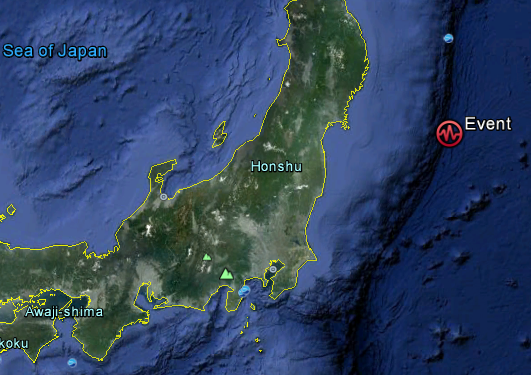
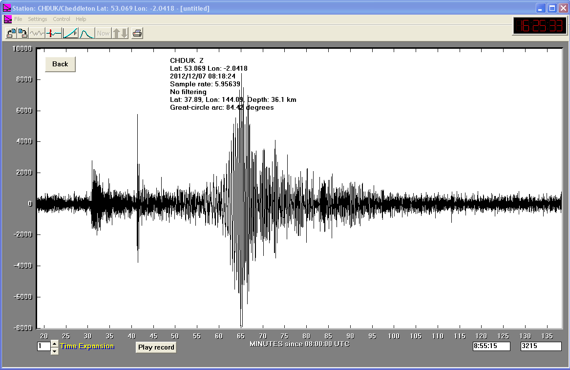
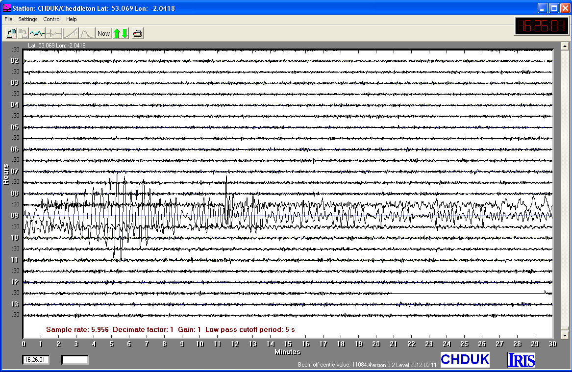
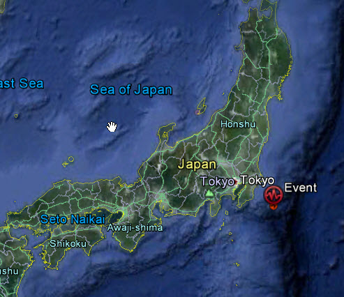
07/12/2012
|
08:18.24
|
7.3
|
36.1
|
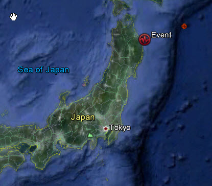
Off East Coast of Honshu, Japan
|
37°53'24.00"N
|
144° 5'24.00"E
|
|||||||
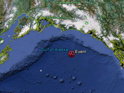
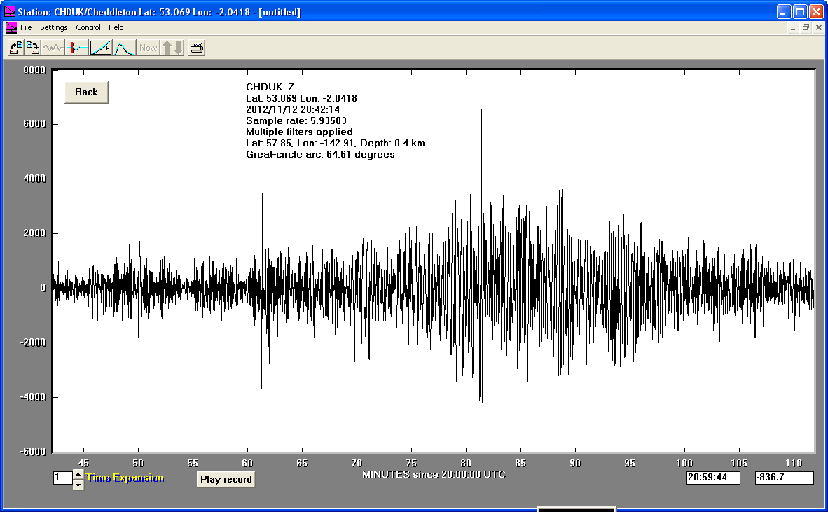
12/11/2012
|
20:42.14
|
6.2
|
0.4
|
Gulf of Alaska
|
57°51'0.00"N
|
142°54'36.00"W
|
|||||||
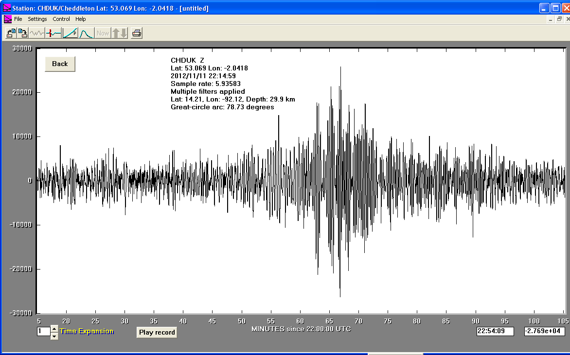
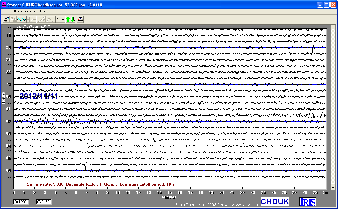
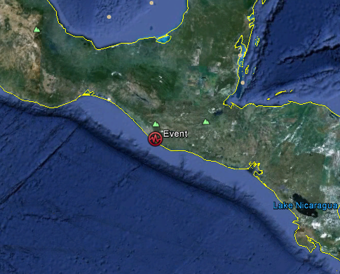
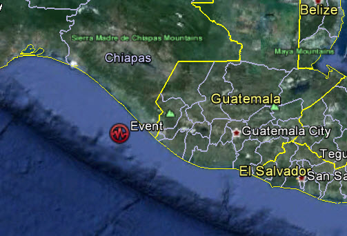
11/11/2012
|
22:15.01
|
6.2
|
29.9
|
Offshore Guatemala
|
14°12'36.00"N
|
92° 7'12.00"W
|
|||||||
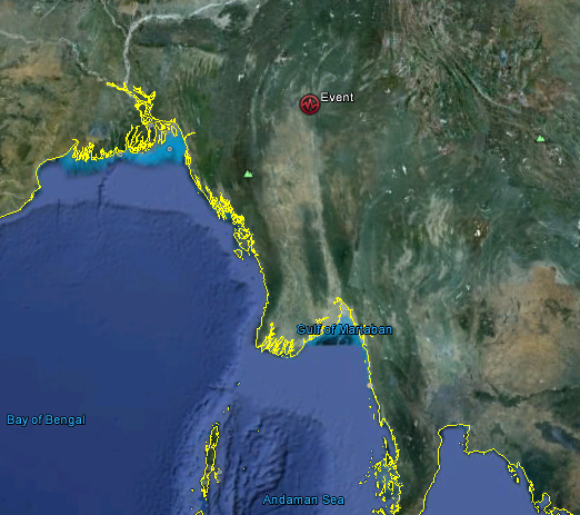
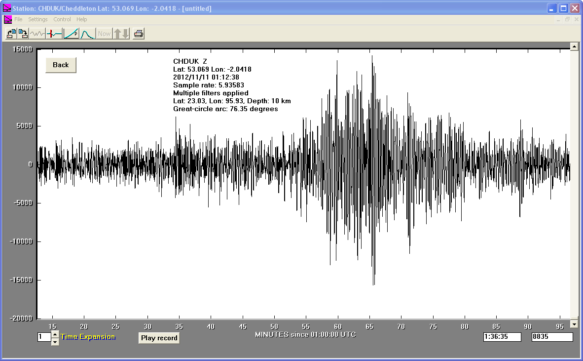
11/11/2012
|
01:12.38
|
6.6
|
10
|
Myanmar
|
23° 1'48.00"N
|
95°55'48.00"E
|
|||||||
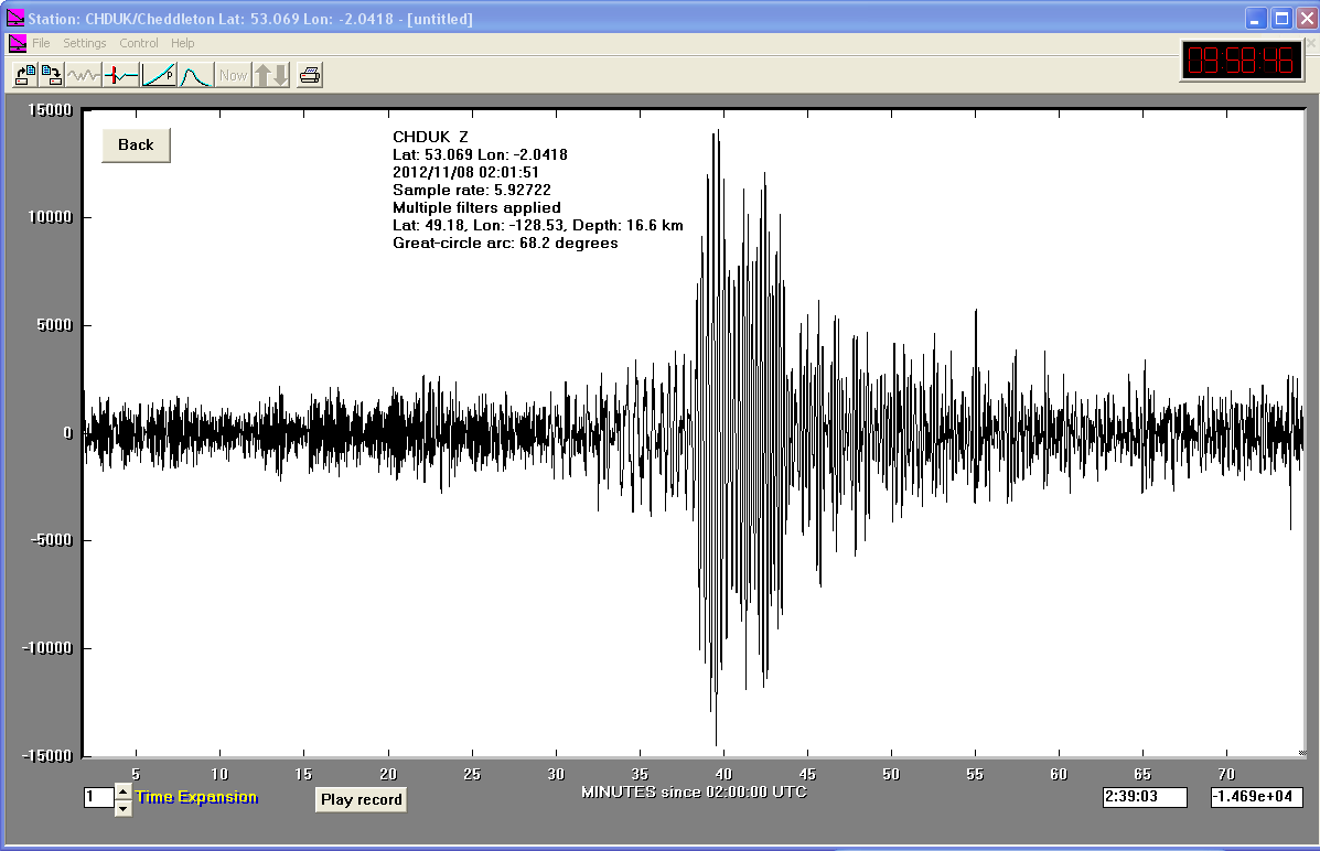
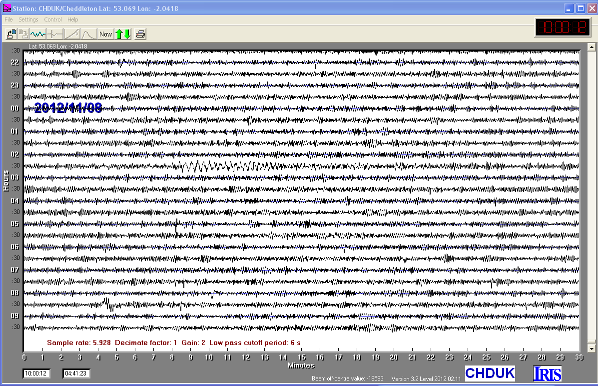
08/11/2012
|
02:01.51
|
6.3
|
16.6
|
Vancouver Island
|
49°10'48.00"N
|
128°31'48.00"W
|
|||||||
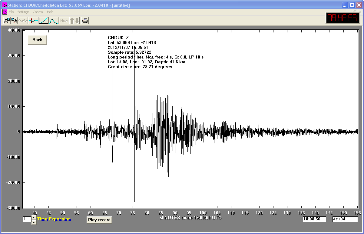
07/11/2012
|
16:35.50
|
7.4
|
14.08
|
Offshore Guatemala
|
14° 4'48.00"N
|
91°55'12.00"W
|
|||||||
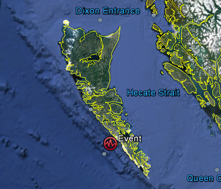
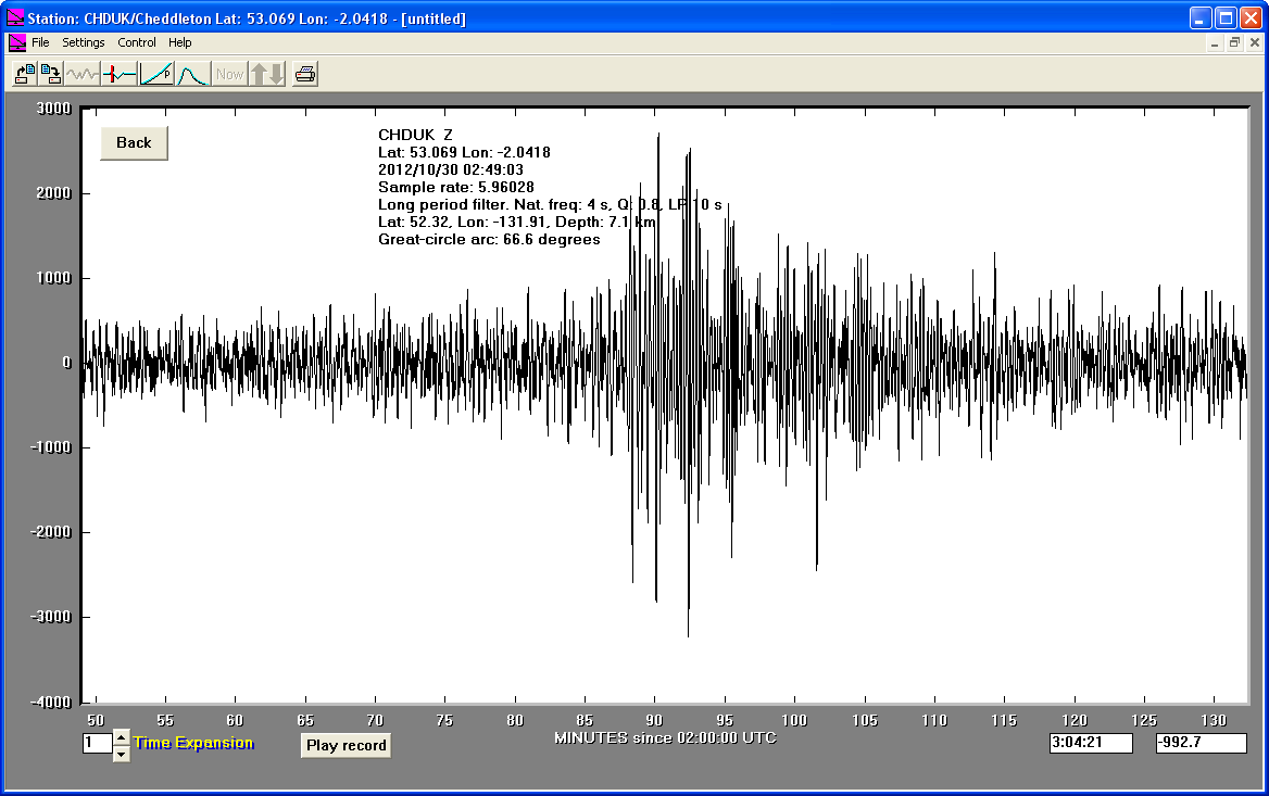
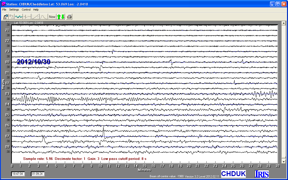
30/10/2012
|
02:49.02
|
6.2
|
9.7
|
Queen Charlotte Islands, Canada Region
|
52°19'12.00"N
|
131°54'36.00"W
|
|||||||
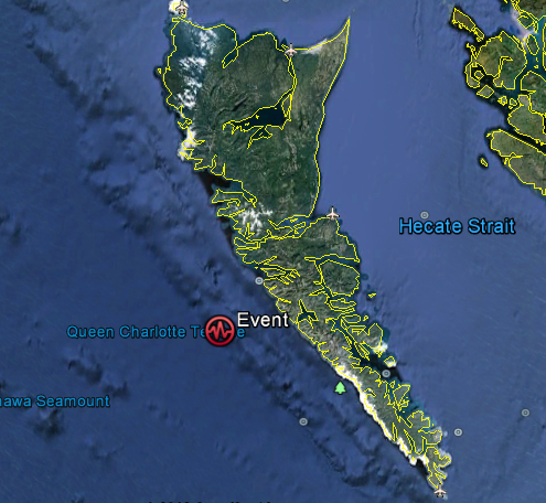
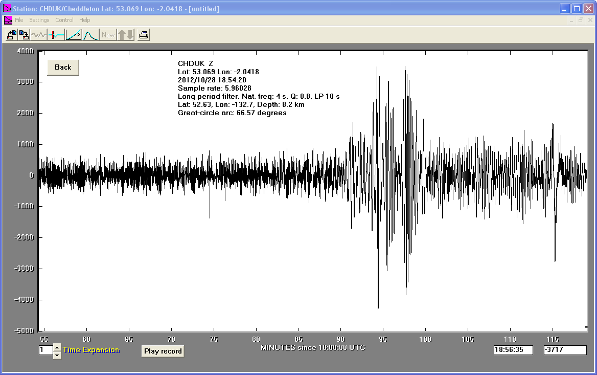
28/10/2012
|
18:54.21
|
6.3
|
8.2
|
Queen Charlotte Islands, Canada Region
|
52°37'48.00"N
|
132°41'60.00"W
|
|||||||
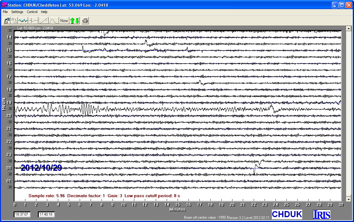
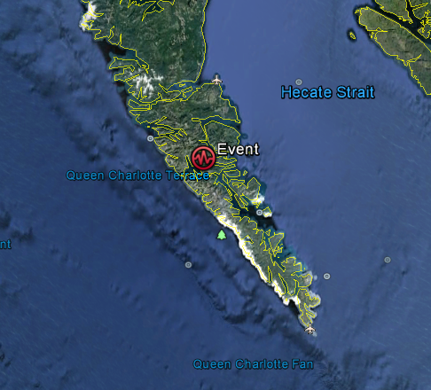
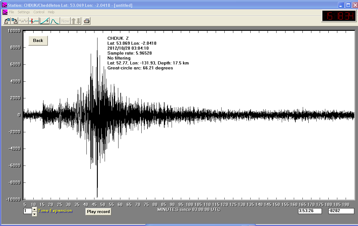
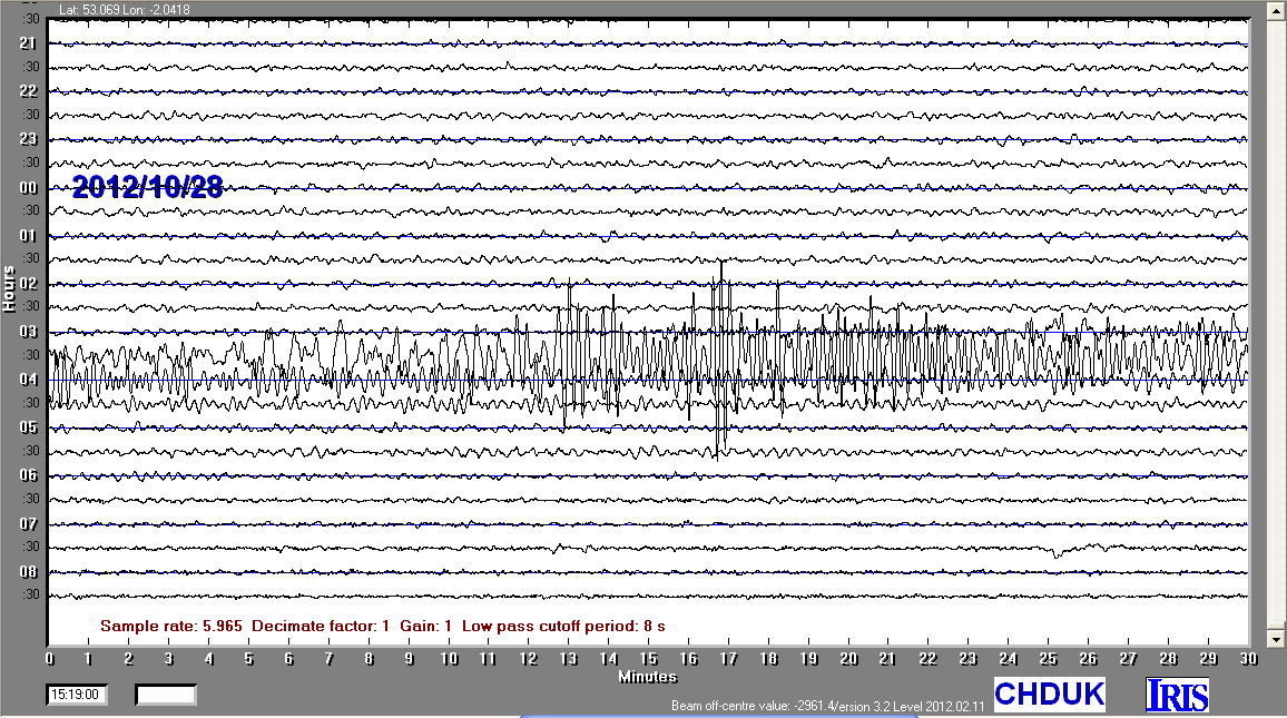
28/10/2012
|
03:04.10
|
7.7
|
17.5
|
Queen Charlotte Islands, Canada Region
|
52°46'12.00"N
|
131°55'48.00"W
|
|||||||
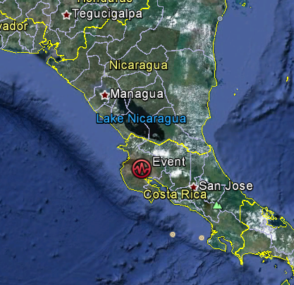
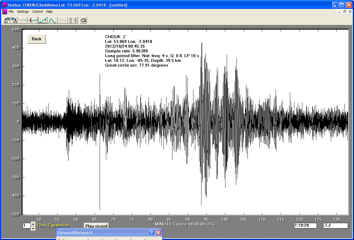
24/10/2012
|
00:45.36
|
6.6
|
10.12
|
Costa Rica
|
10° 7'12.00"N
|
85°20'60.00"W
|
|||||||
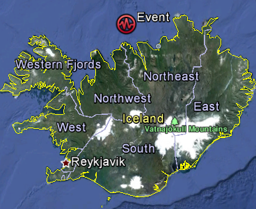
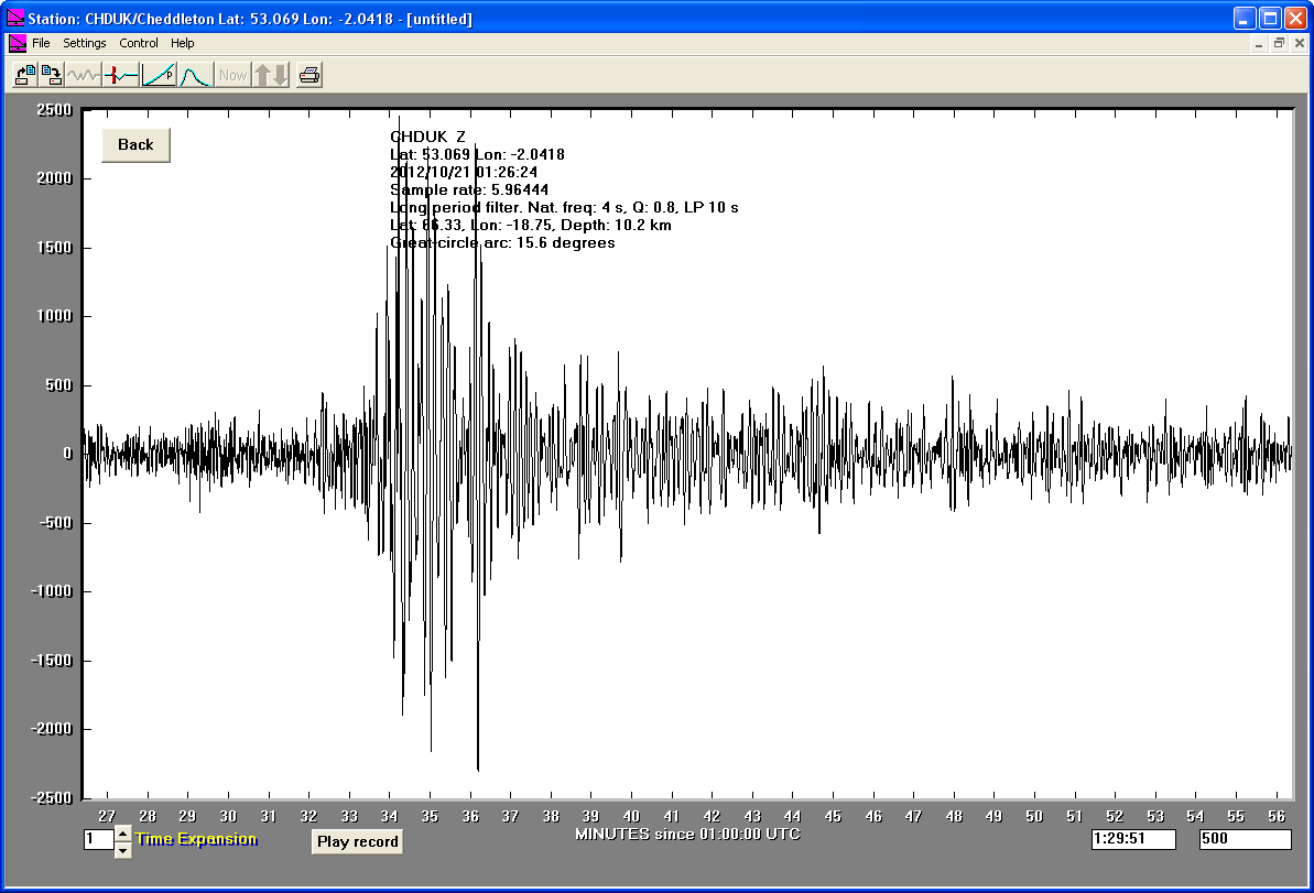
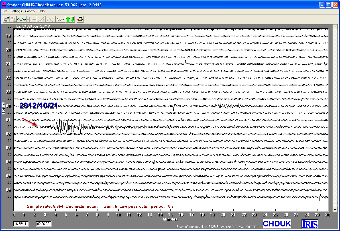
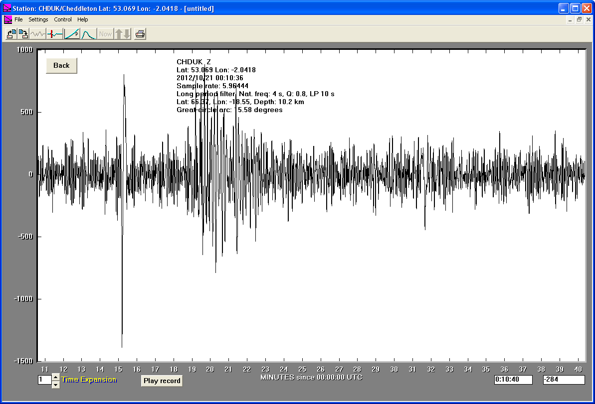
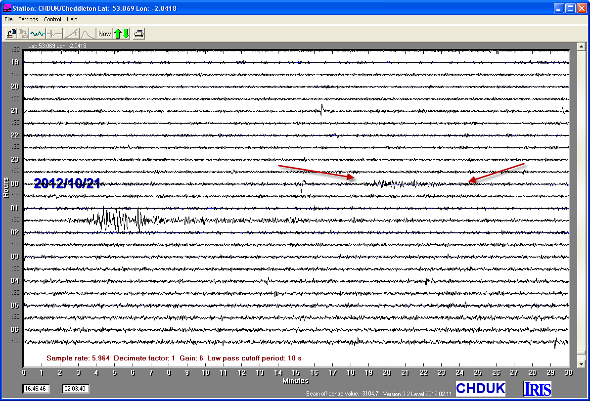
21/10/2012
|
01:25.23
|
5.6
|
10.2
|
Iceland Region
|
66°19'48.00"N
|
18°45'0.00"W
|
|||||||
21/10/2012
|
00:45.36
|
4.8
|
10.12
|
Iceland Region
|
66°22'12.00"N
|
18°33'0.00"W
|
|||||||
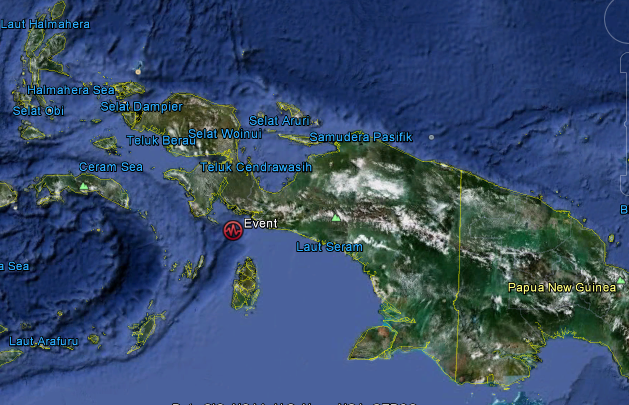
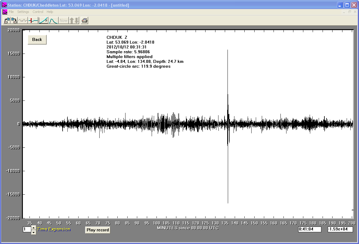
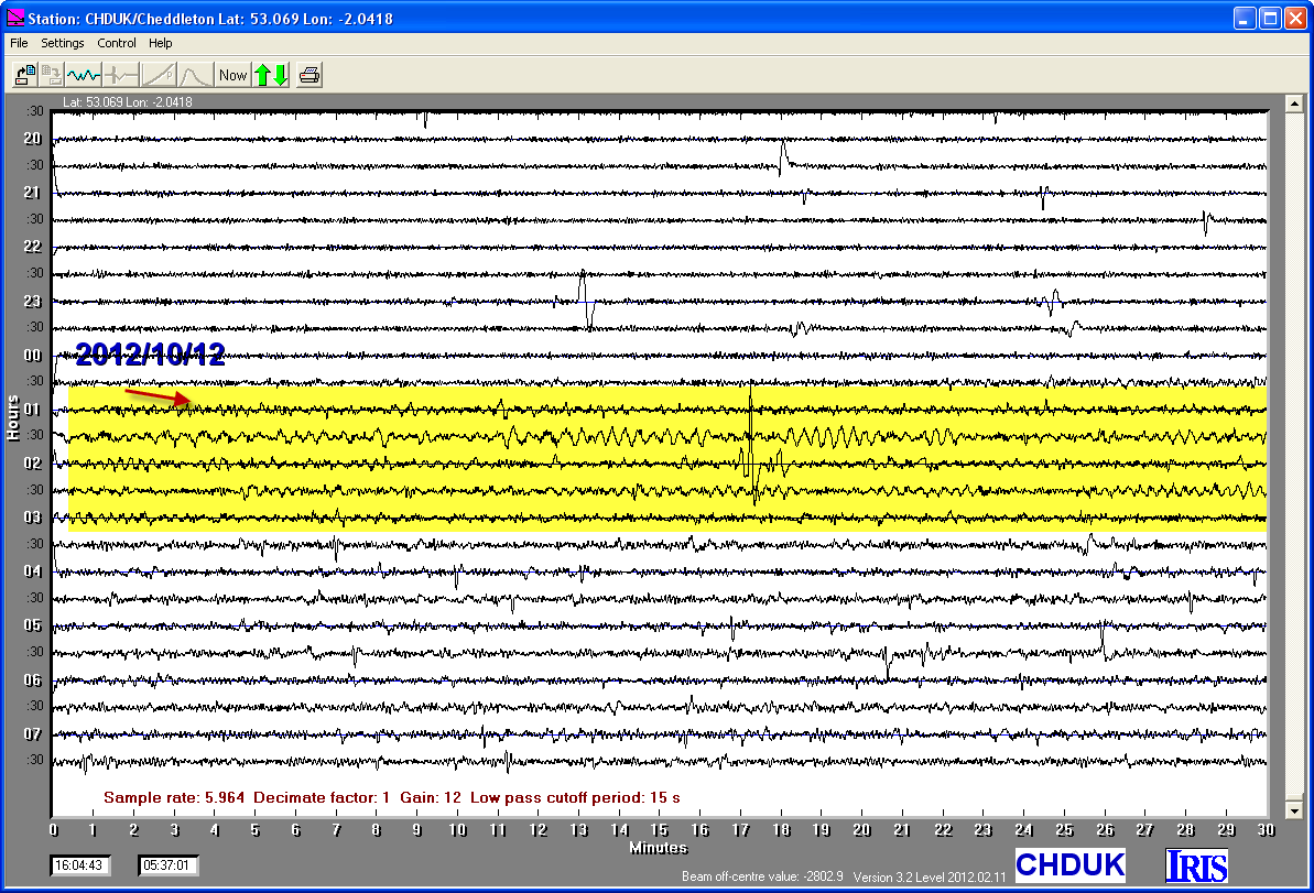
12/10/2012
|
00:31.30
|
6.7
|
24.7
|
South Coast of Papua, Indonesia
|
4°50'24.00"S
|
134° 4'48.00"E
|
|||||||
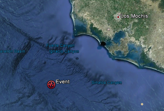
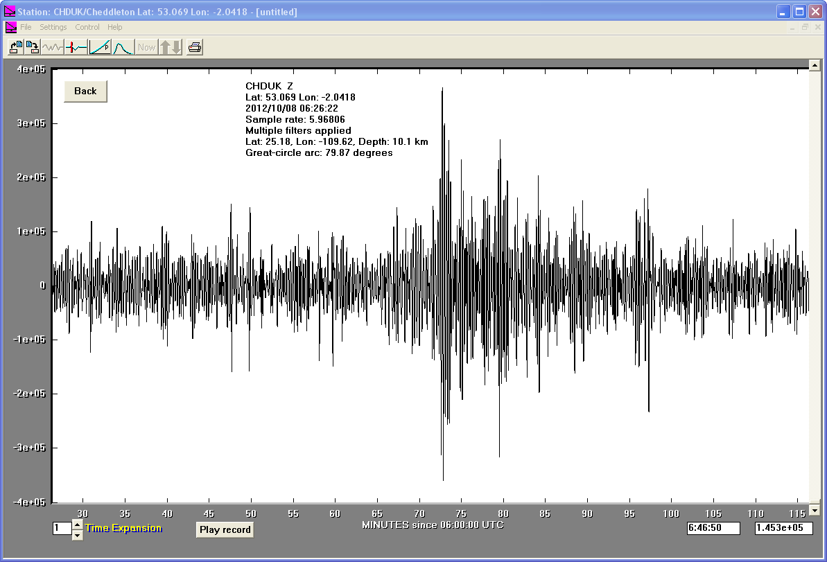
08/10/2012
|
06:26.22
|
6
|
10.1
|
Gulf of California, Mexico
|
25°10'48.00"N
|
109°37'12.00"W
|
|||||||
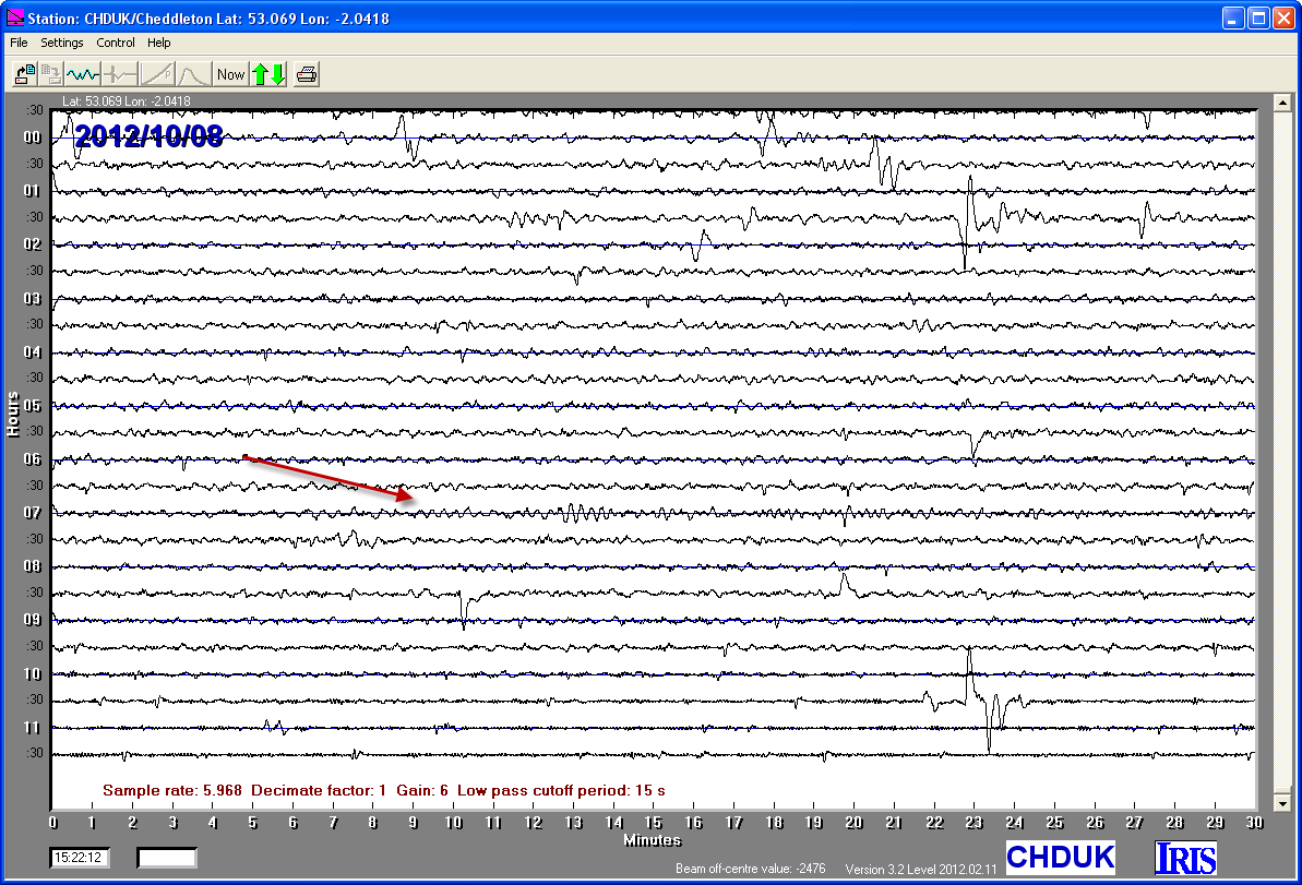
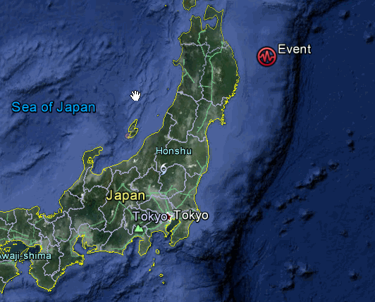
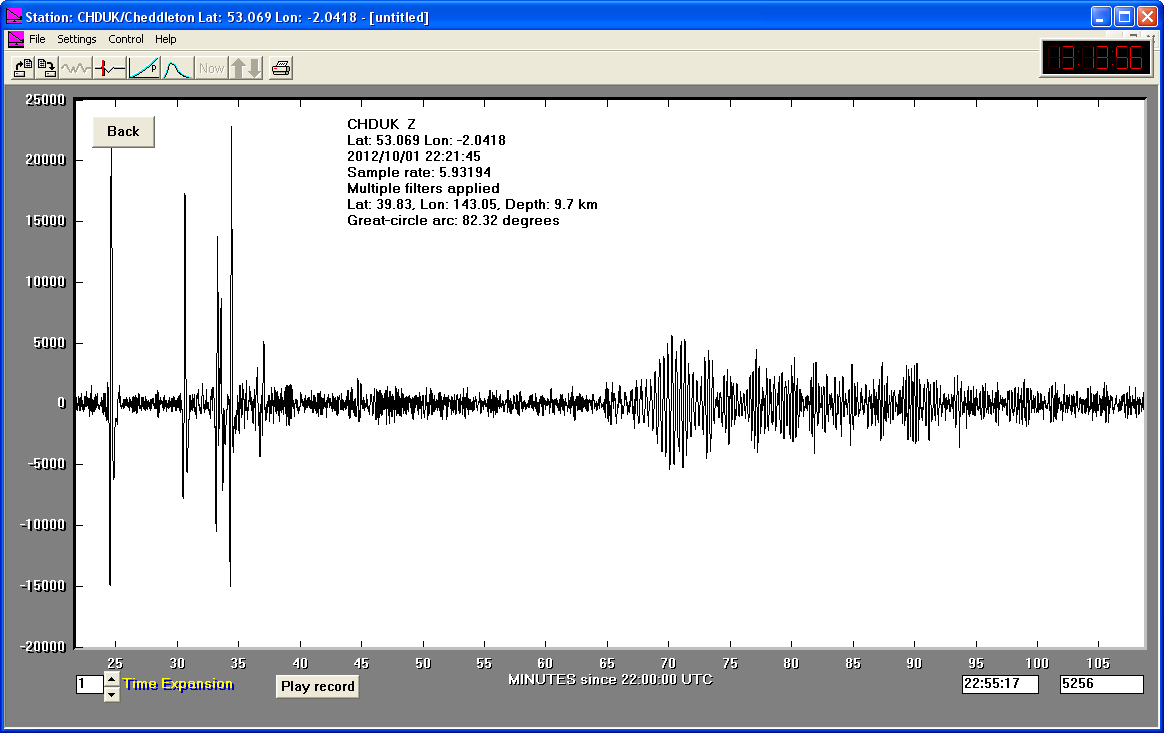
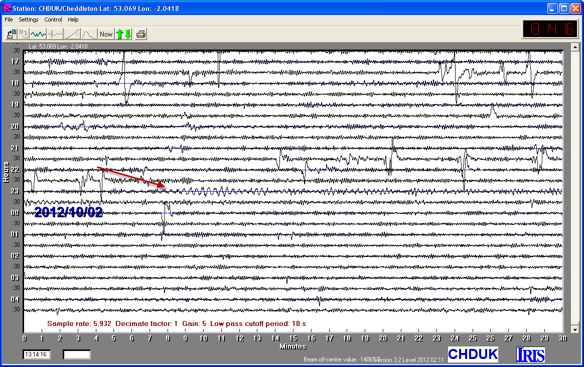
01/10/2012
|
22:21.45
|
6.2
|
9.7
|
East Coast of Honshu, Japan
|
39.830000°N
|
143.050000°E
|
|||||||
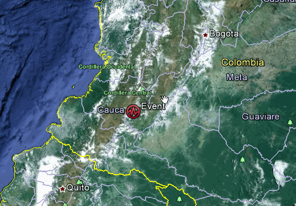
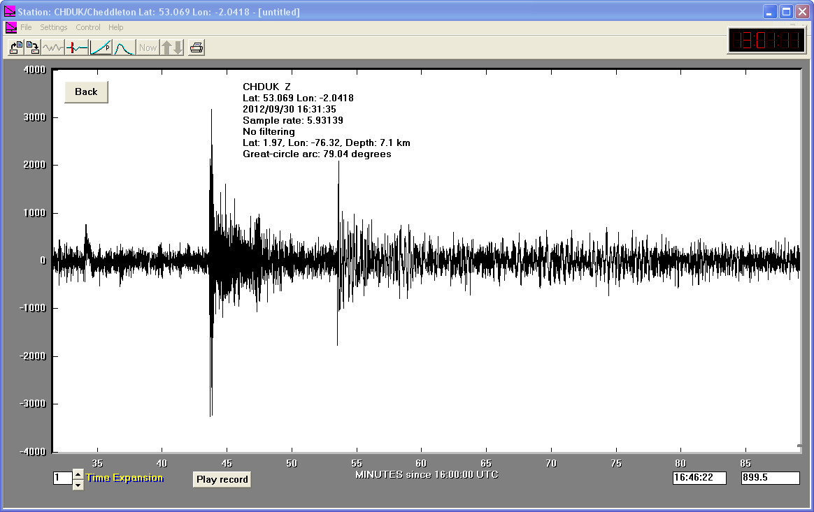
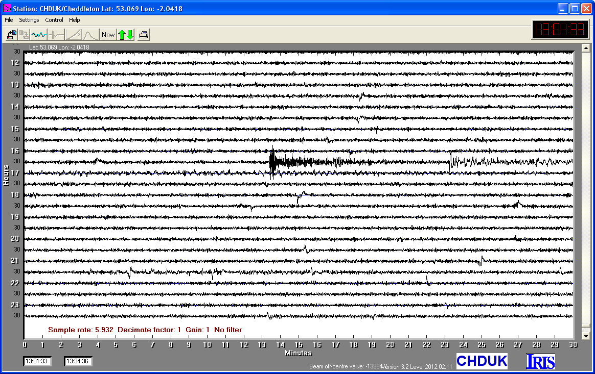
30/09/2012
|
16:31.34
|
7.1
|
150.4
|
Colombia
|
1.970000°N
|
-76.320000°W
|
|||||||
26/09/2012
|
23:39.58
|
6.9
|
40.5
|
Andreanof Islands, Aleutian Islands, Alaska
|
51.580000°N
|
-178.200000°W
|
|||||||
05/09/2012
|
14:42.10
|
7.6
|
40.8
|
Costa Rica
|
10.120000°N
|
-85.350000°W
|
|||||||
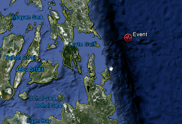
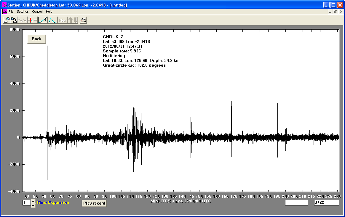
31/08/2012
|
12:47.34
|
7.9
|
34.9
|
Philippine Islands Region
|
10.830000°N
|
126.680000°E
|
|||||||
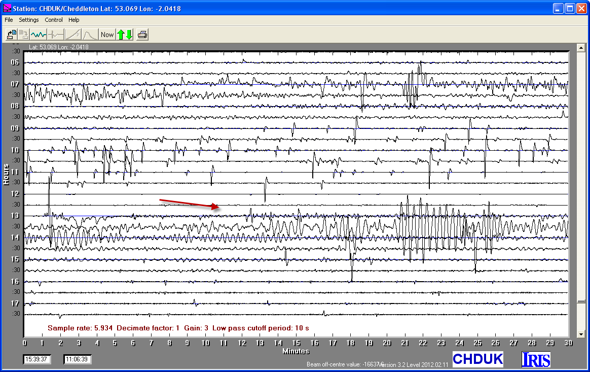
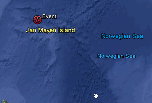
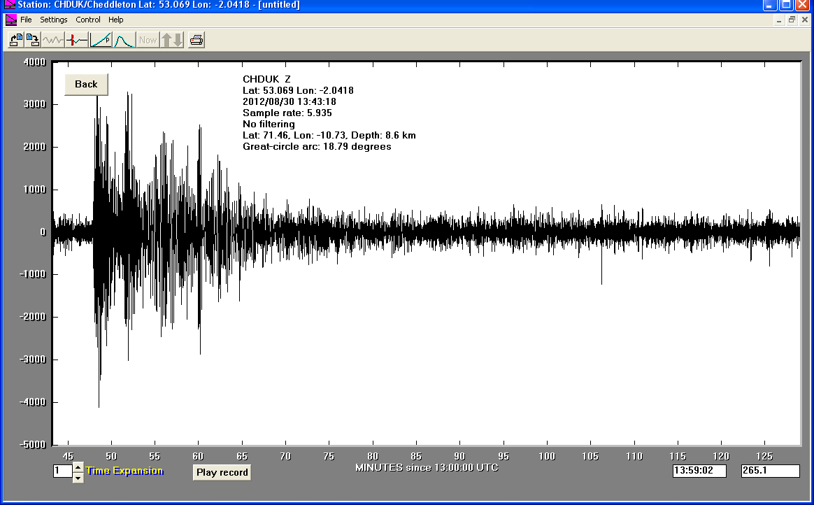
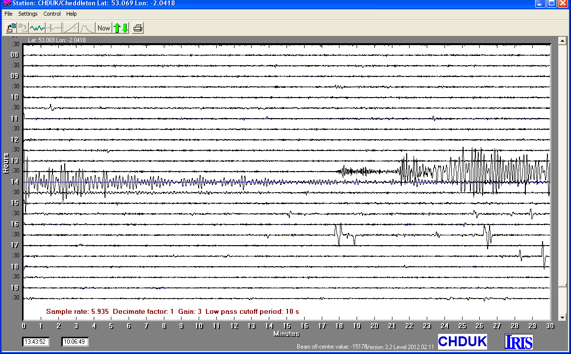
30/08/2012
|
13:43.24
|
6.6
|
8.6
|
Jan Mayen Island Region
|
71.460000°N
|
-10.730000°W
|
|||||||
27/08/2012
|
04:37.23
|
7.4
|
52.9
|
Offshore El Salvador,
|
12.280000°N
|
-88.530000°W
|
|||||||
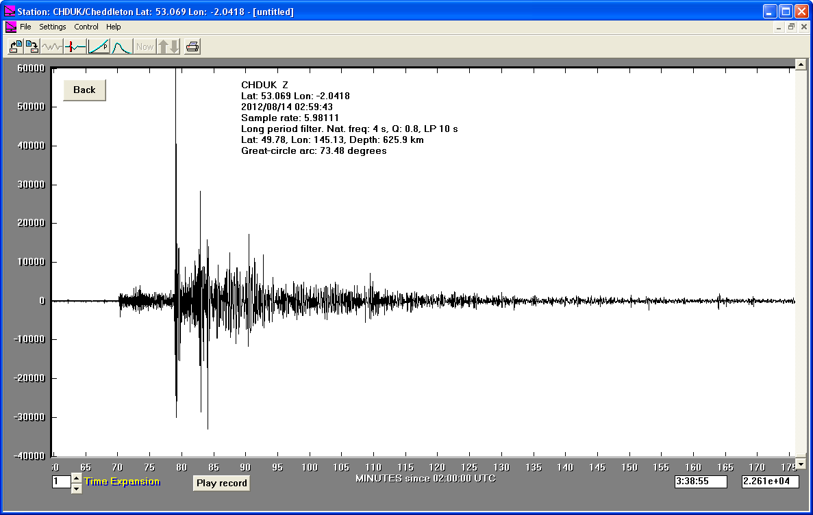
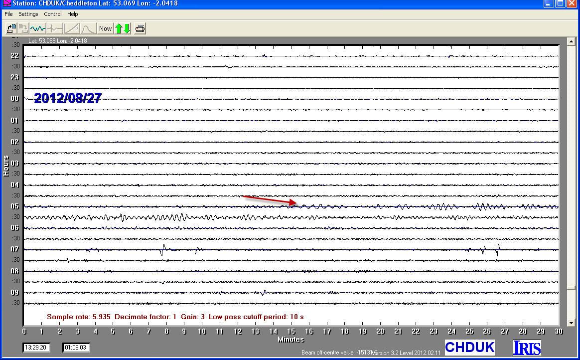
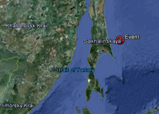
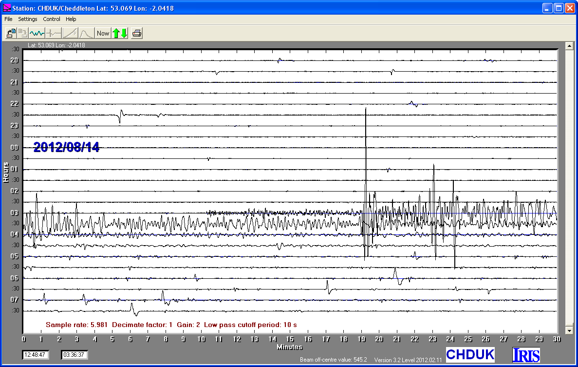
14/08/2012
|
02:59:42
|
7.7
|
625.9
|
Sea of Okhotsk
|
49.780000°N
|
145.130000°E
|
|||||||
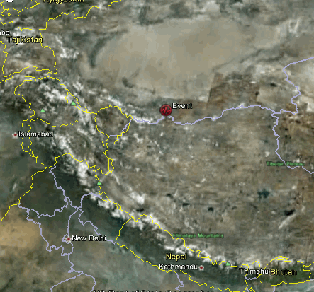
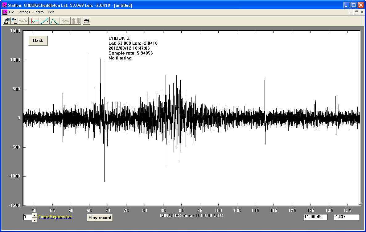
12/08/2012
|
10:47:06
|
6.3
|
11.0
|
XINJIANG-XIZANG BORDER
|
35.680000°N
|
82.520000°E
|
|||||||
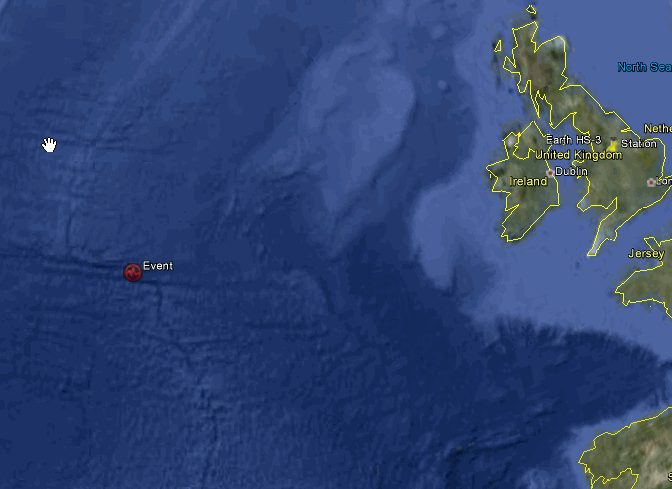
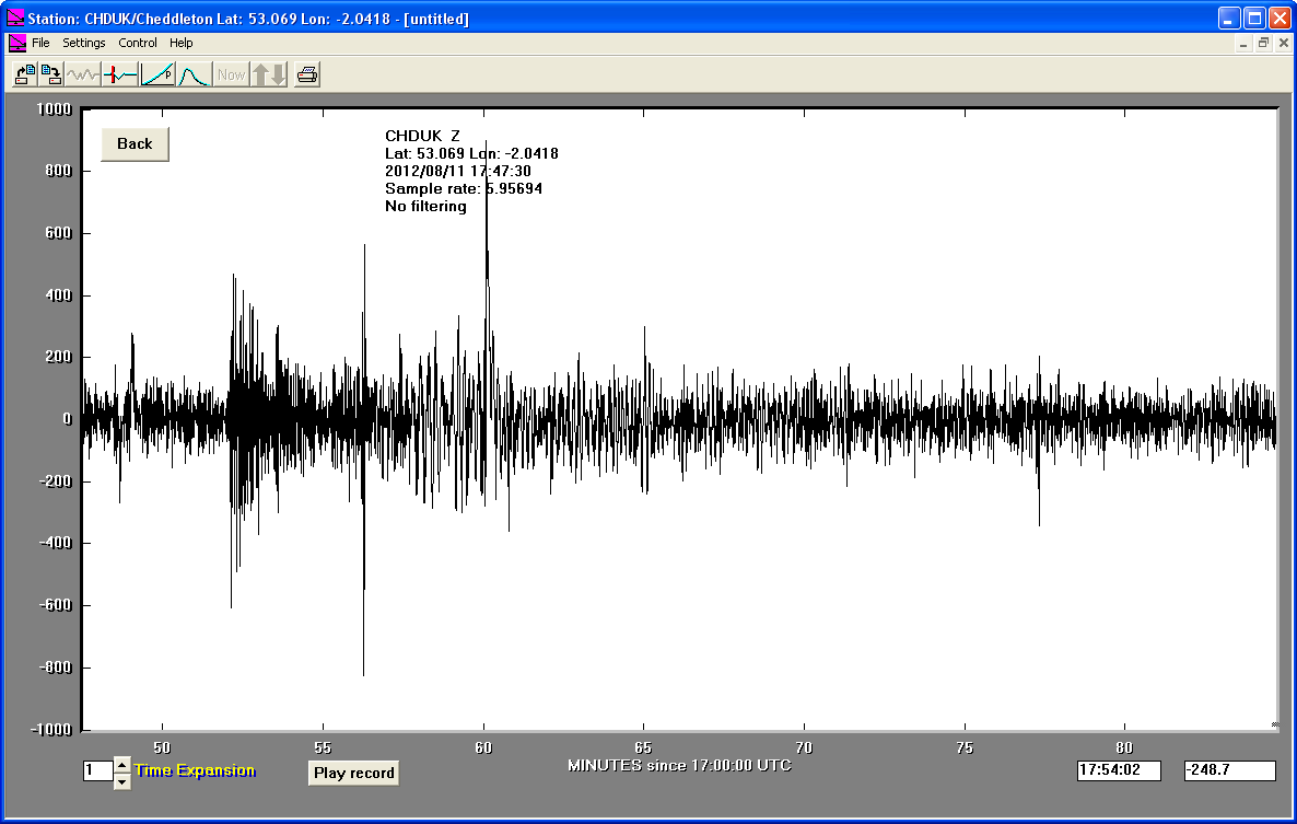
11/08/2012
|
17:47:31
|
5.3
|
10.3
|
Northern Mid-Atlantic Ridge
|
52.190000°N
|
-31.410000°W
|
|||||||
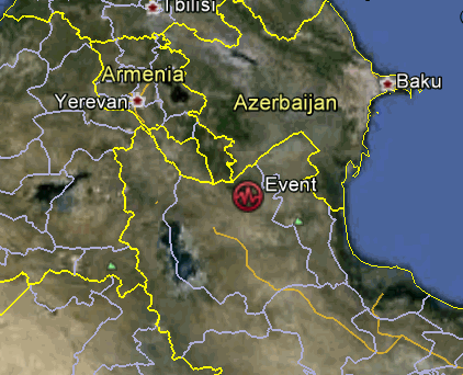
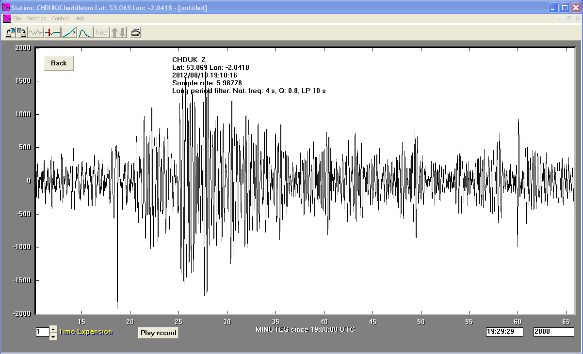
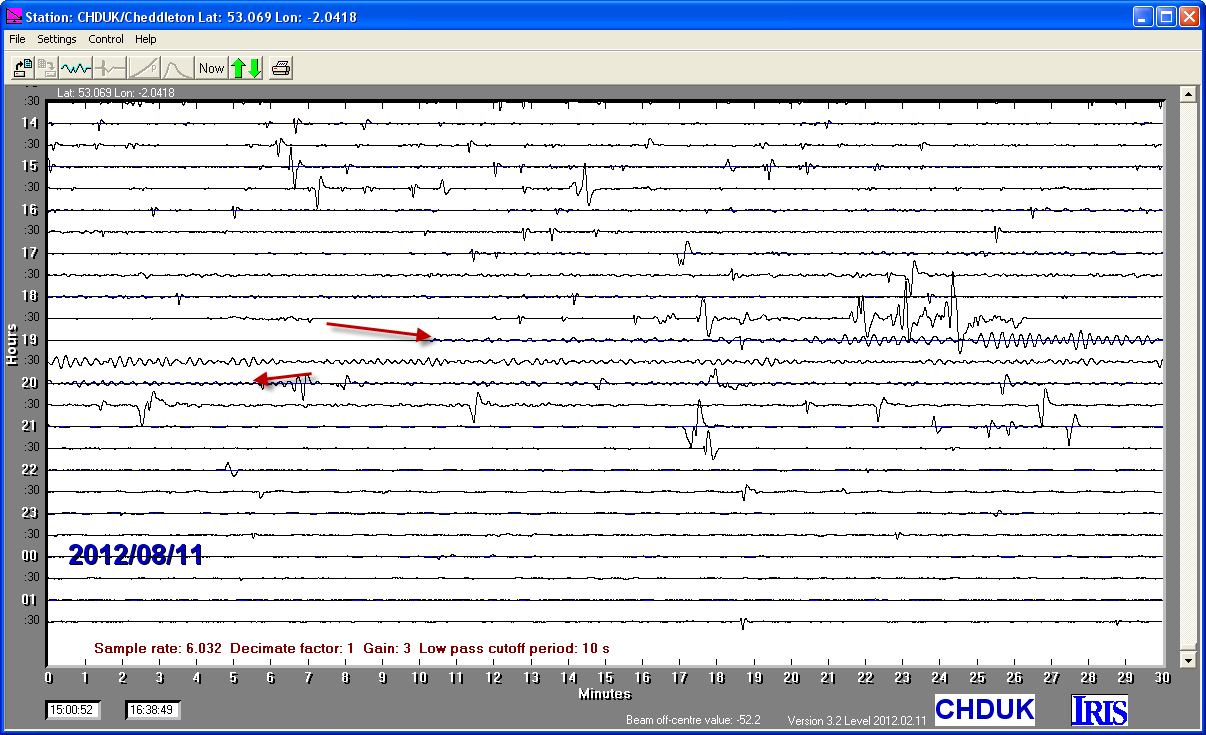
11/08/2012
|
12:34:35
|
6.3
|
9.8
|
Iran-Armenia-Azerbaijan Border Region
|
38.380000°N
|
46.760000°E
|
|||||||
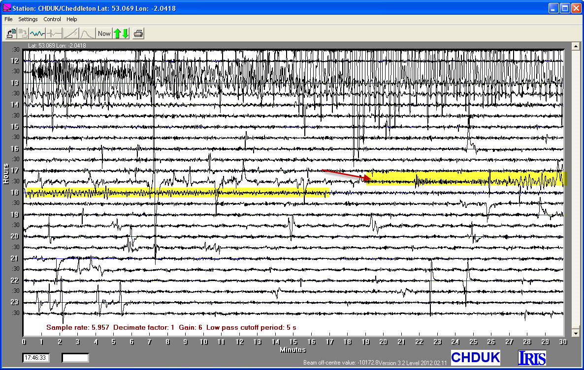
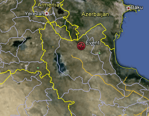
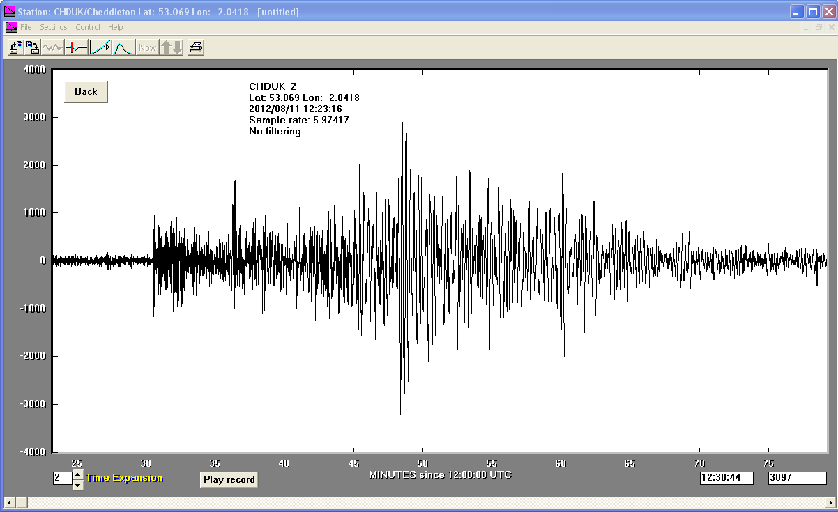
11/08/2012
|
12:23:17
|
6.4
|
9.9
|
Iran-Armenia-Azerbaijan Border Region
|
38.380000°N
|
46.870000°E
|
|||||||
10/08/2012
|
18:37:43
|
6.2
|
13.1
|
Fox Islands, Aleutian Islands
|
52.690000°N
|
-167.480000°W
|
|||||||
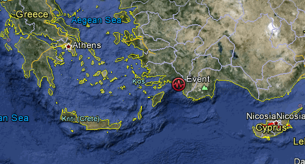
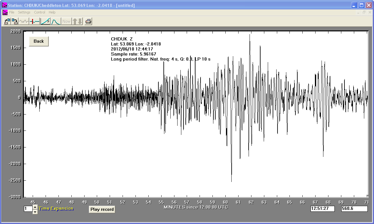
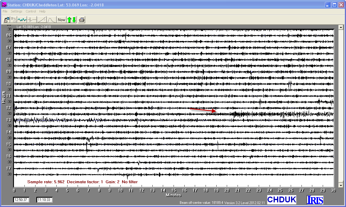
10/06/2012
|
12:44.15
|
5.7
|
20.4
|
Dodecanese Islands, Greece
|
36.440000°N
|
28.920000°E
|
|||||||
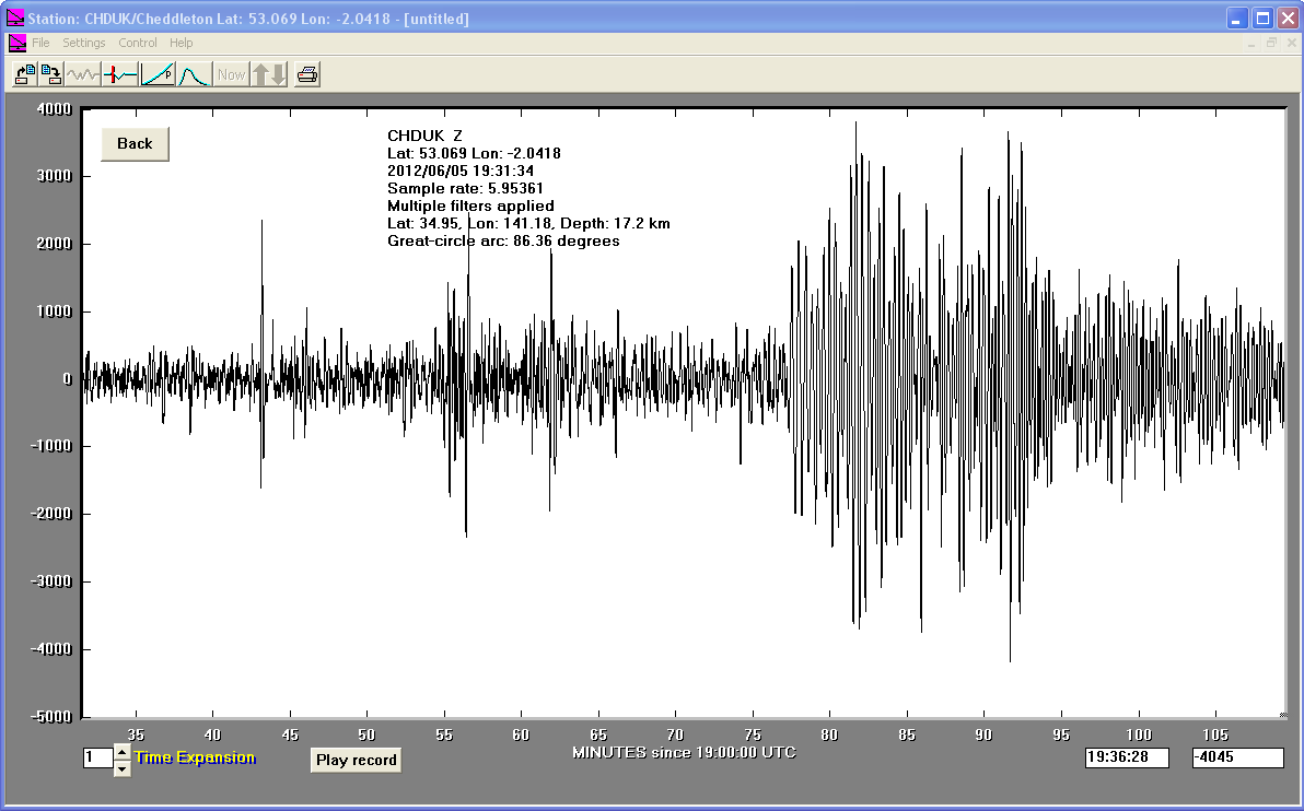
05/06/2012
|
19:31:34
|
5.8
|
17.2
|
Off East Coast of Honshu, Japan
|
34.950000°N
|
141.180000°E
|
|||||||
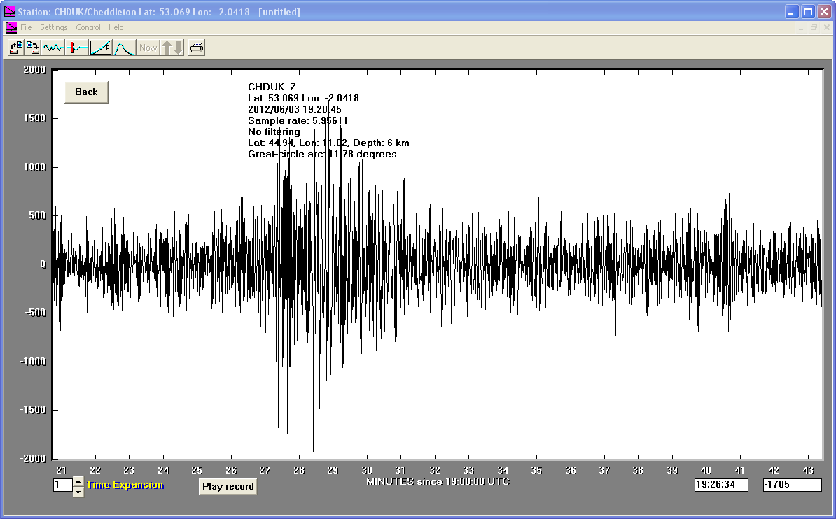
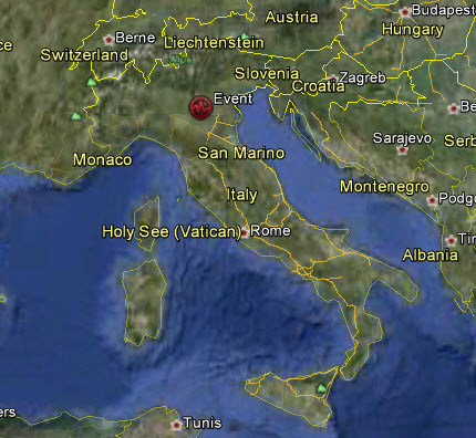
03/06/2012
|
19:20:43
|
4.8
|
6.0
|
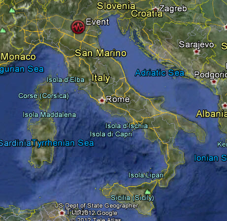
Northern Italy
|
44.940000°N
|
11.020000°E
|
|||||||
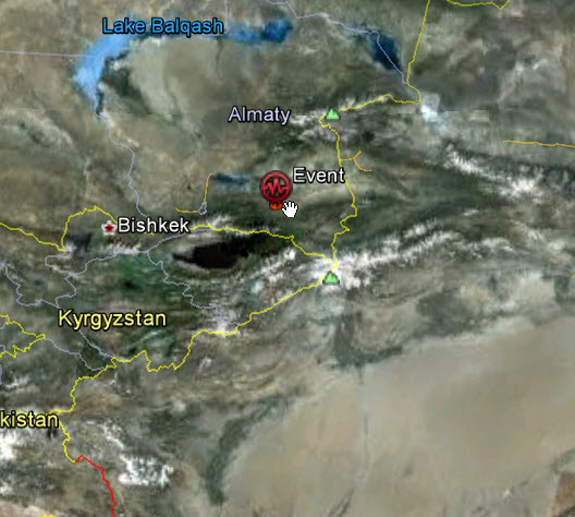
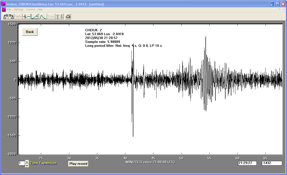
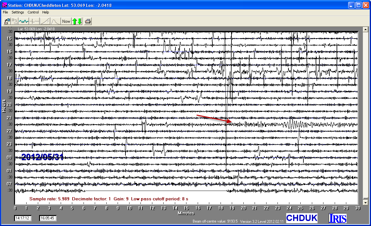
30/05/2012
|
21:20:57
|
5.4
|
23.1
|
Lake Issyk-Kul, Kyrgyzstan Region
|
43.390000°N
|
78.770000°E
|
|||||||
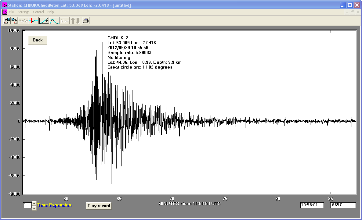
29/05/2012
|
10:55:57
|
5.4
|
9.9
|
Northern Italy
|
44.860000°N
|
10.990000°E
|
|||||||
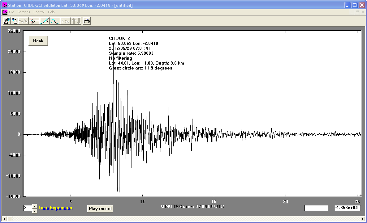
29/05/2012
|
07:00:03
|
5.8
|
9.6
|
Northern Italy
|
44.810000°N
|
11.080000°E
|
|||||||
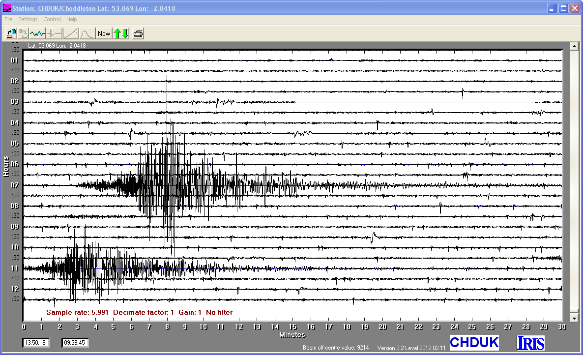
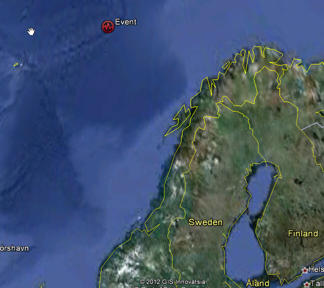
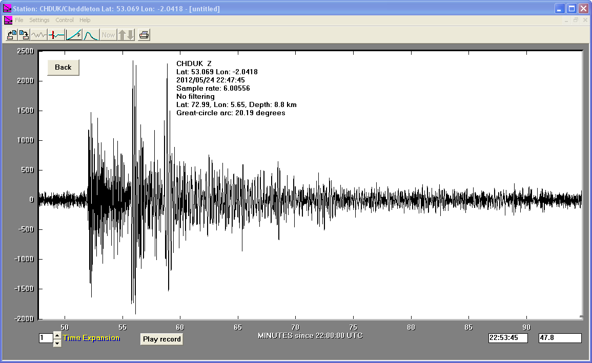
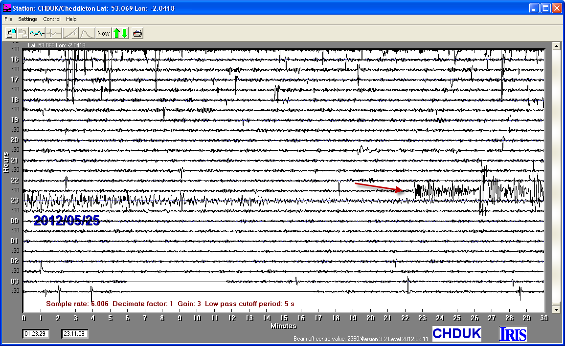
24/05/2012
|
22:47:46
|
6.2
|
8.8
|
Norwegian Sea
|
72.990000°N
|
5.650000°E
|
|||||||
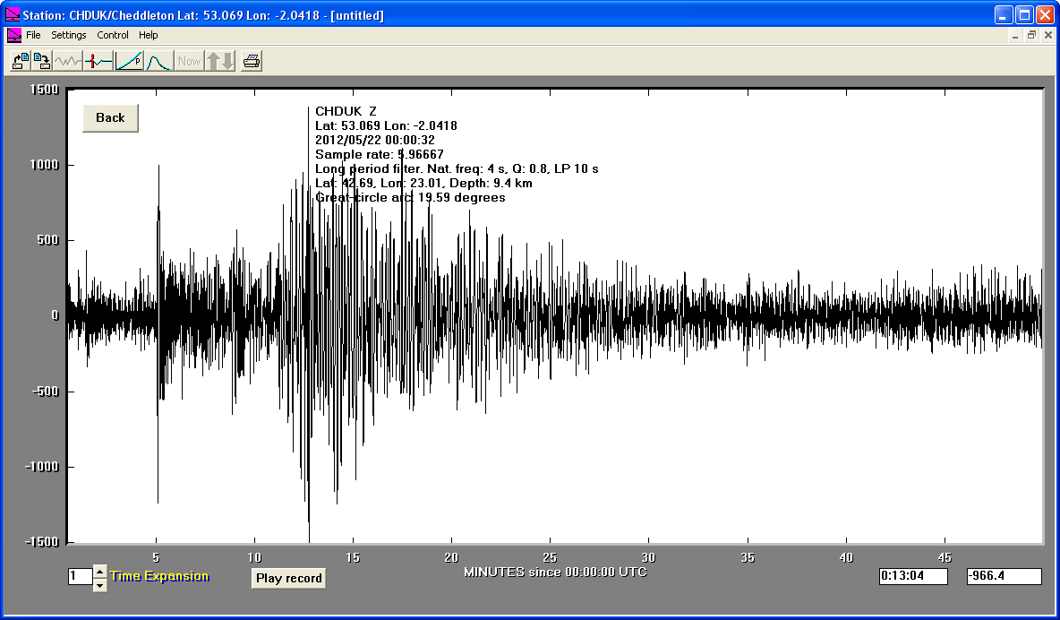
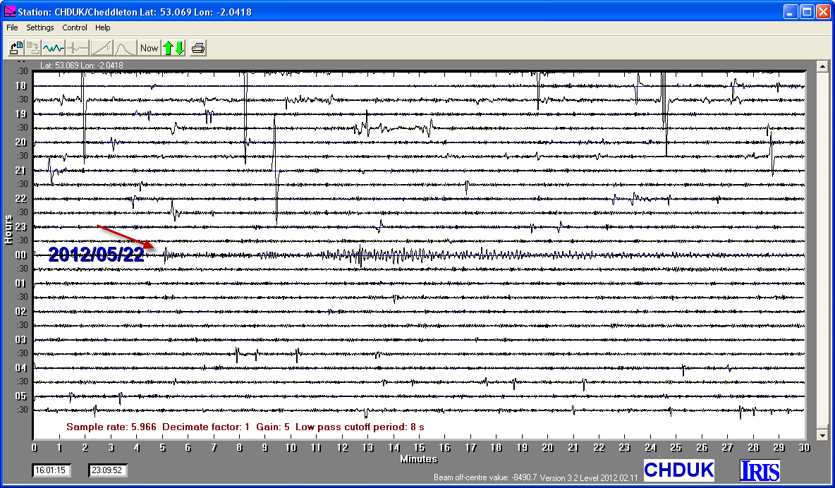
22/05/2012
|
00:00:33
|
5.6
|
9.4
|
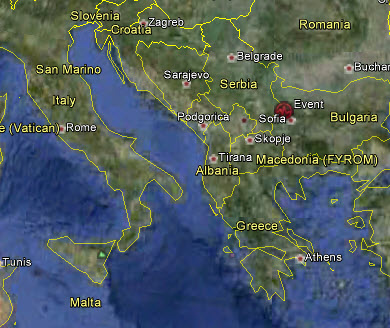
Bulgaria
|
42.689999°N
|
23.010000°E
|
|||||||
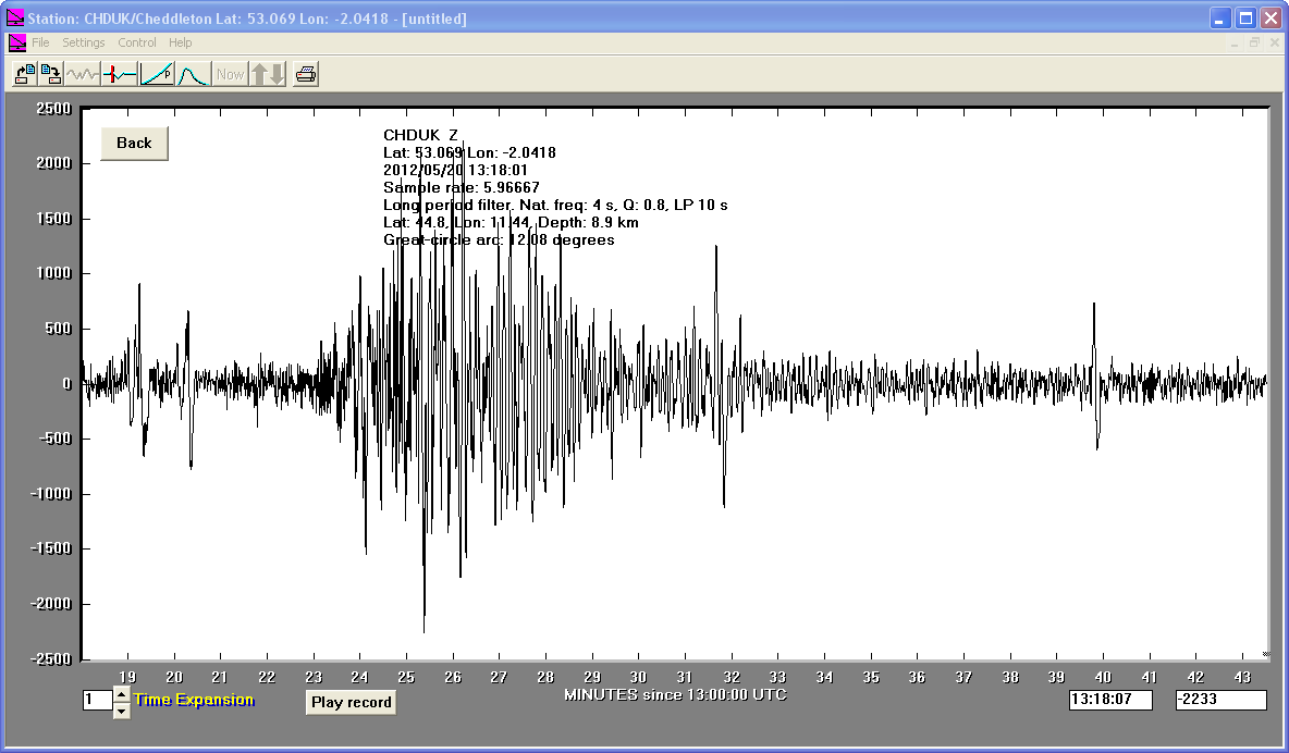
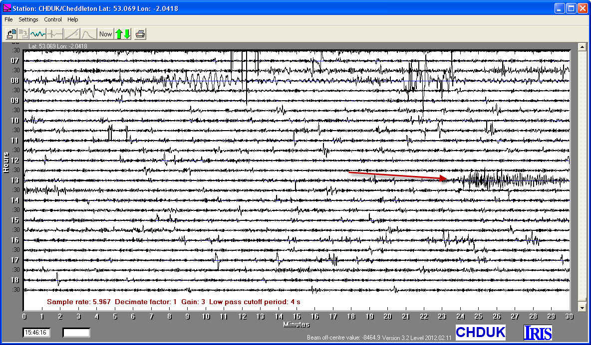
20/05/2012
|
13:18:02
|
5.1
|
8.9
|
Northern Italy
|
44.800000°N
|
11.440000°E
|
|||||||
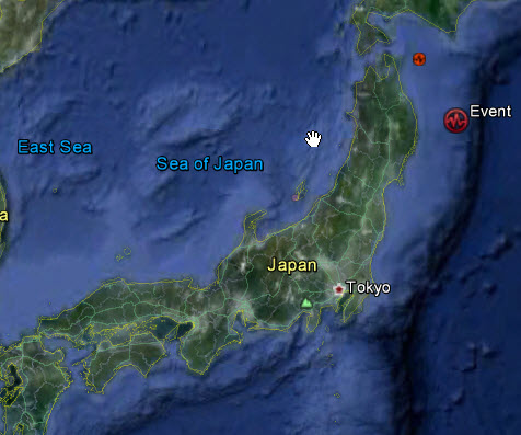
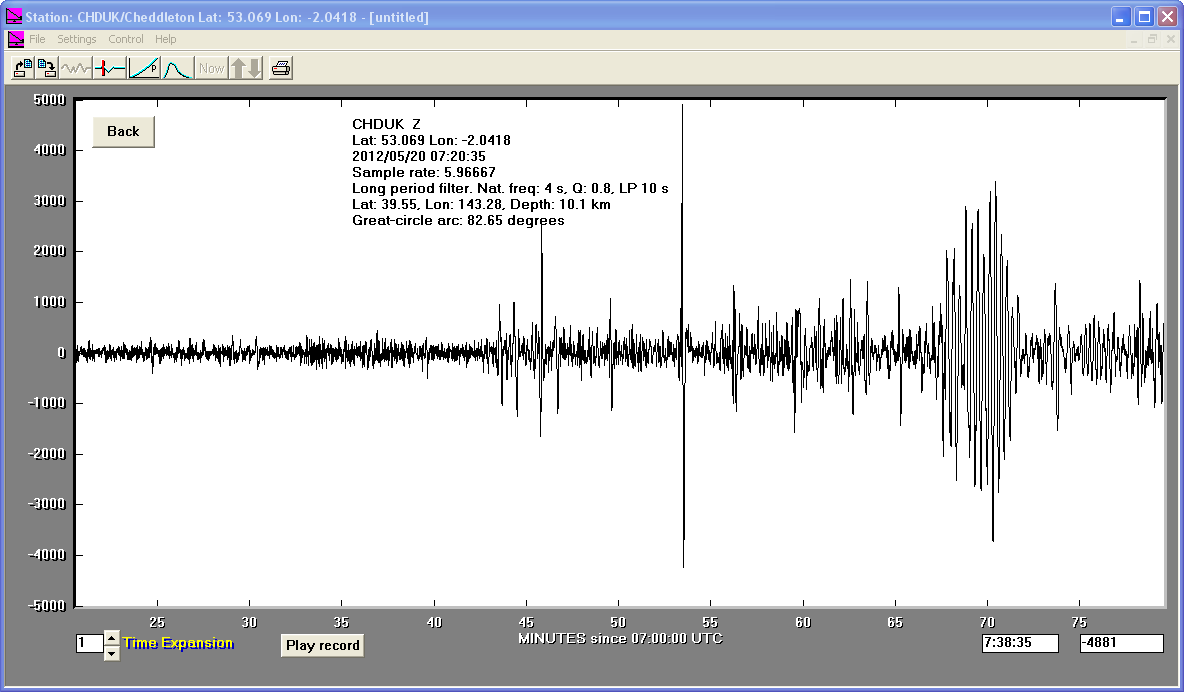
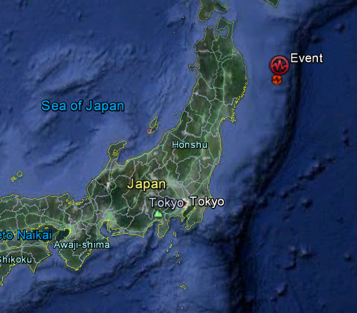
20/05/2012
|
07:19:54
|
5.9
|
10.1
|
Off East Coast of Honshu, Japan
|
39.550000°N
|
143.280000°E
|
|||||||
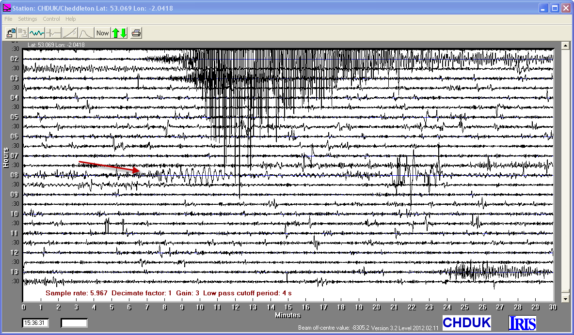
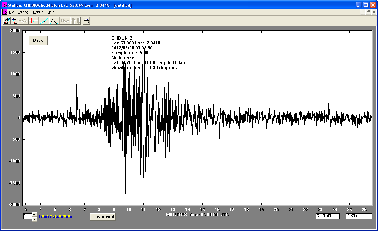
20/05/2012
|
03:02:50
|
5.1
|
10.0
|
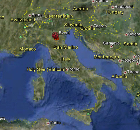
Northern Italy
|
44.780000°N
|
11.090000°E
|
|||||||
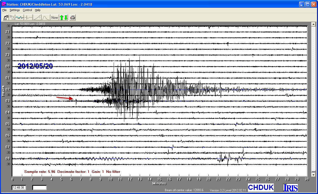
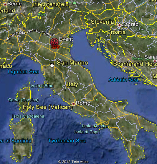
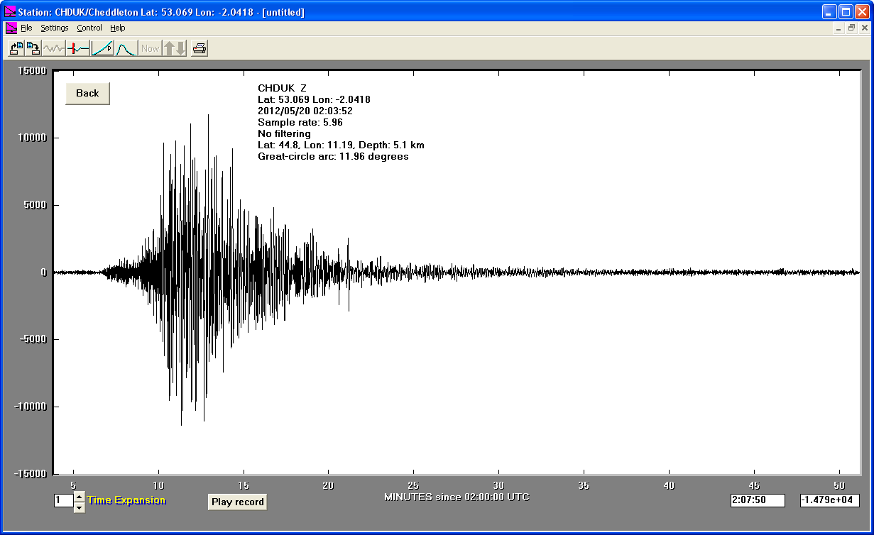
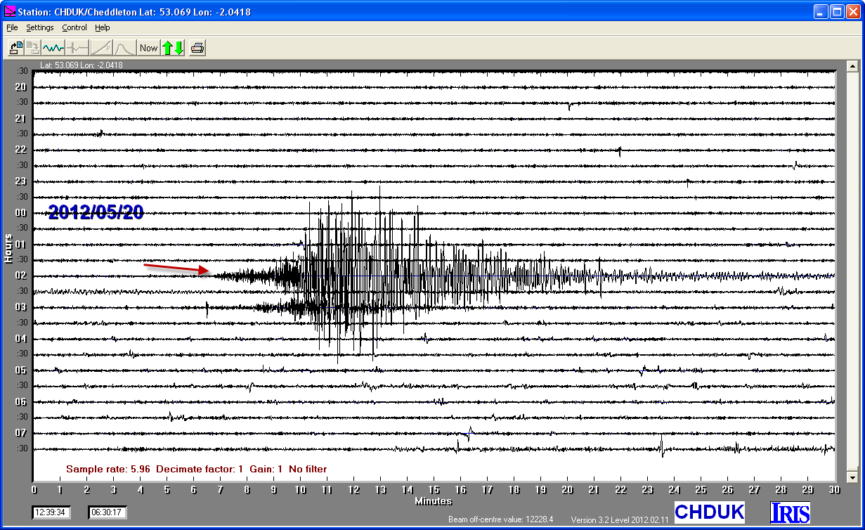
20/05/2012
|
02:03:52
|
6.0
|
5.1
|
Northern Italy
|
44.800000°N
|
11.190000°E
|
|||||||
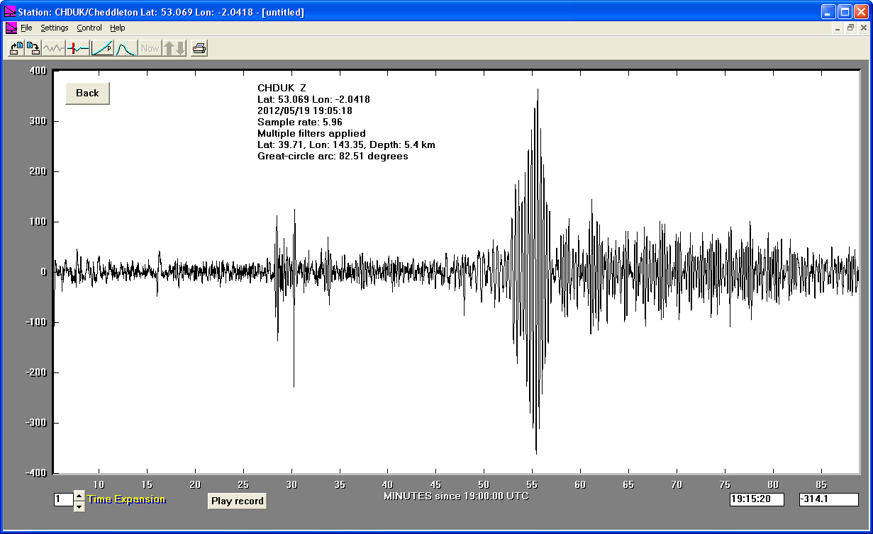
19/05/2012
|
19:05:19
|
5.9
|
5.4
|
Off East Coast of Honshu, Japan
|
39.710000°N
|
143.350000°E
|
|||||||
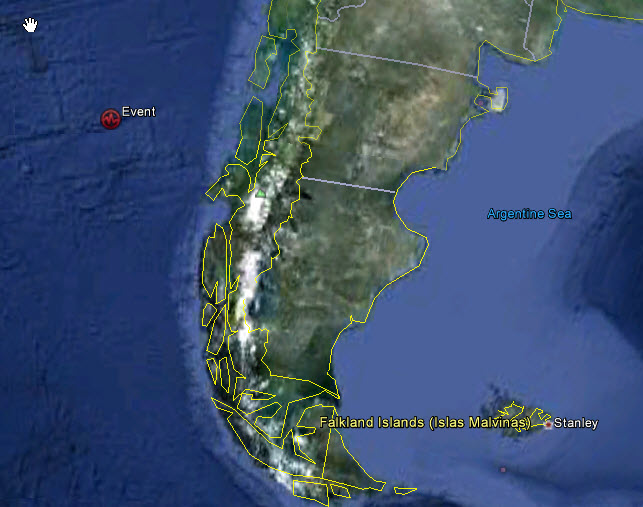
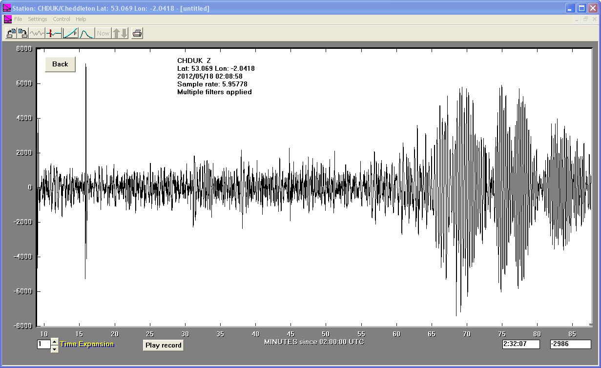
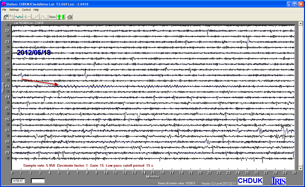
18/05/2012
|
02:00:41
|
6.2
|
10.0
|
Off Coast of Southern Chile
|
-44.950000°S
|
-80.070000°W
|
|||||||
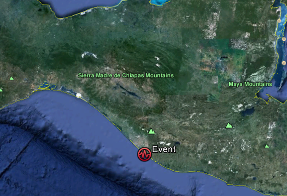
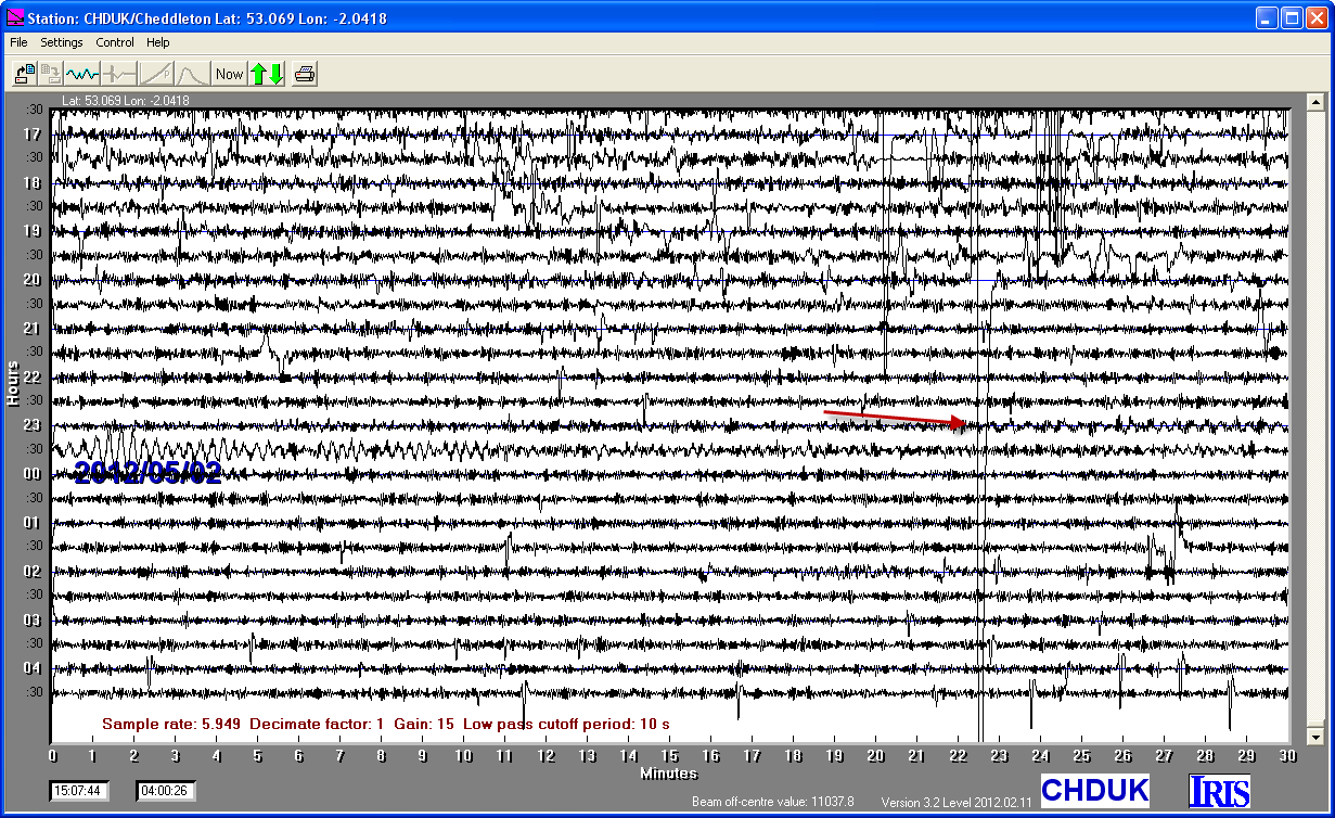
01/05/2012
|
22:43.38
|
6.3
|
44
|
Offshore Chiapas, Mexico
|
14.420000°N
|
-92.970000°W
|
|||||||
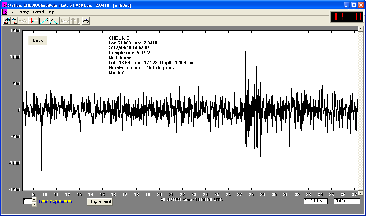
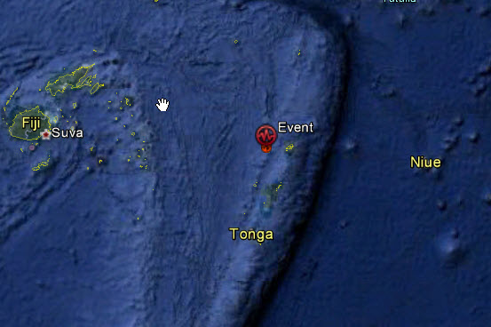
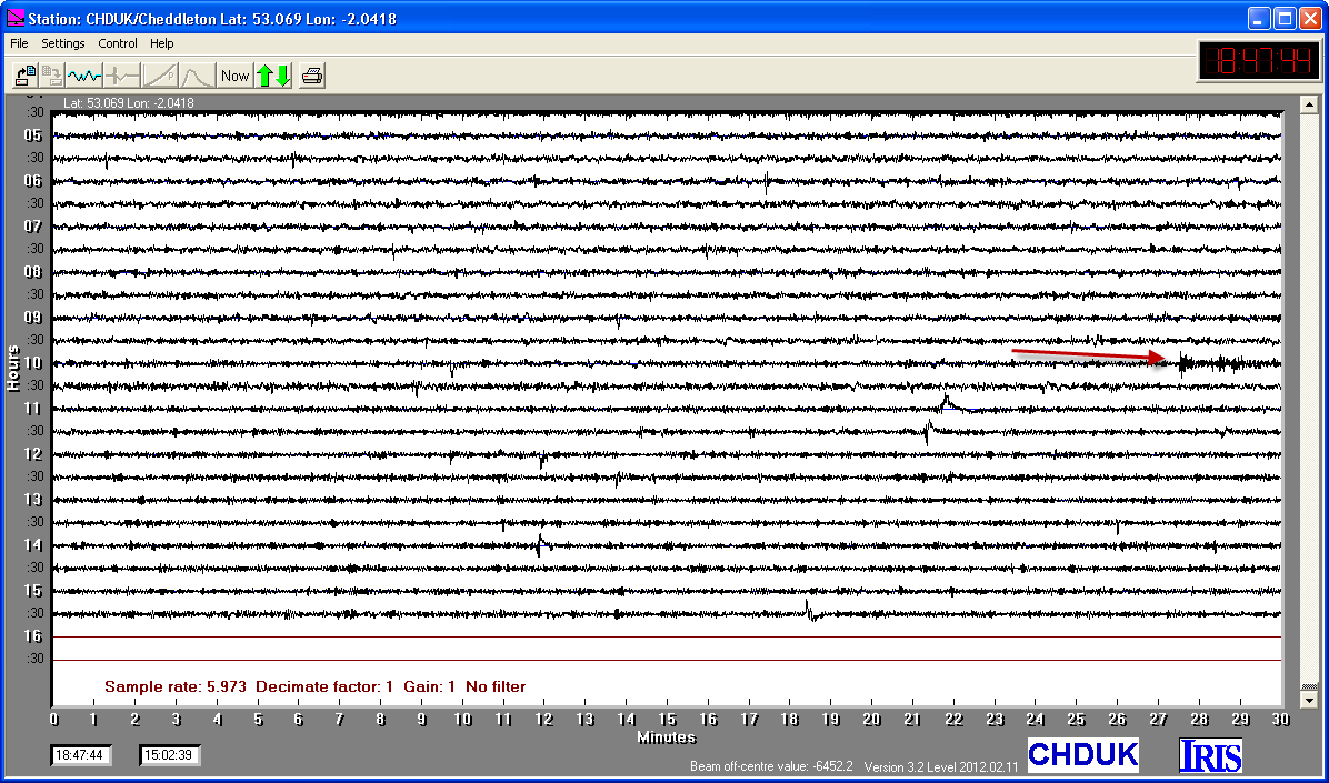
28/04/2012
|
10:08:07
|
6.7
|
129.4
|
Tonga Islands
|
-18.640000°S
|
-174.730000°W
|
|||||||
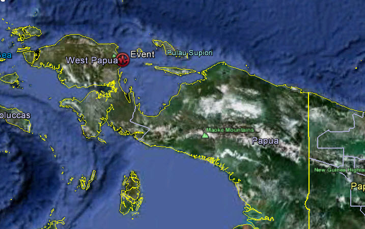
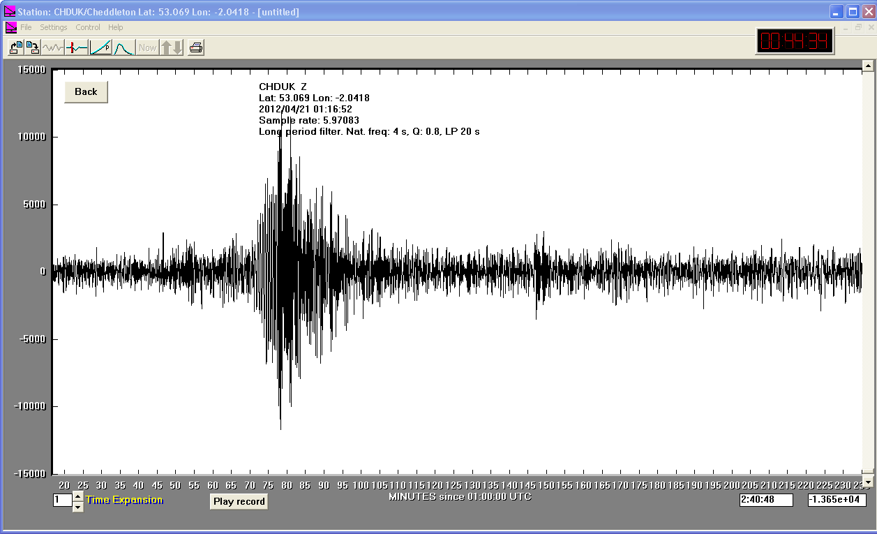
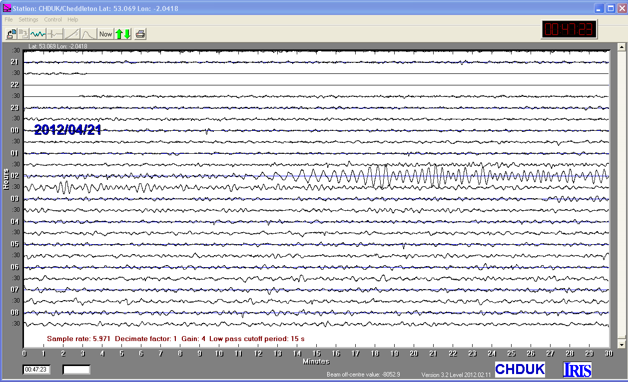
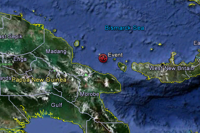
21/04/2012
|
01:16:52
|
6.6
|
16
|
Irian Jaya, Indonesia Region
|
-1.600000°S
|
134.270000°E
|
|||||||
17/04/2012
|
07:13:50
|
6.8
|
208.2
|
Eastern New Guinea, Papua New Guinea Region
|
-5.470000°S
|
147.100000°E
|
|||||||
17/04/2012
|
03:50:16
|
6.7
|
37.0
|
Near Coast of Central Chile
|
-32.700000°S
|
-71.480000°W
|
|||||||
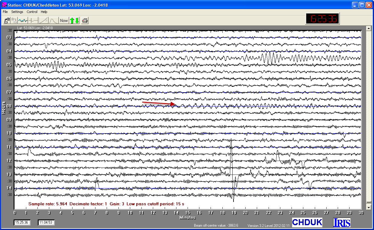
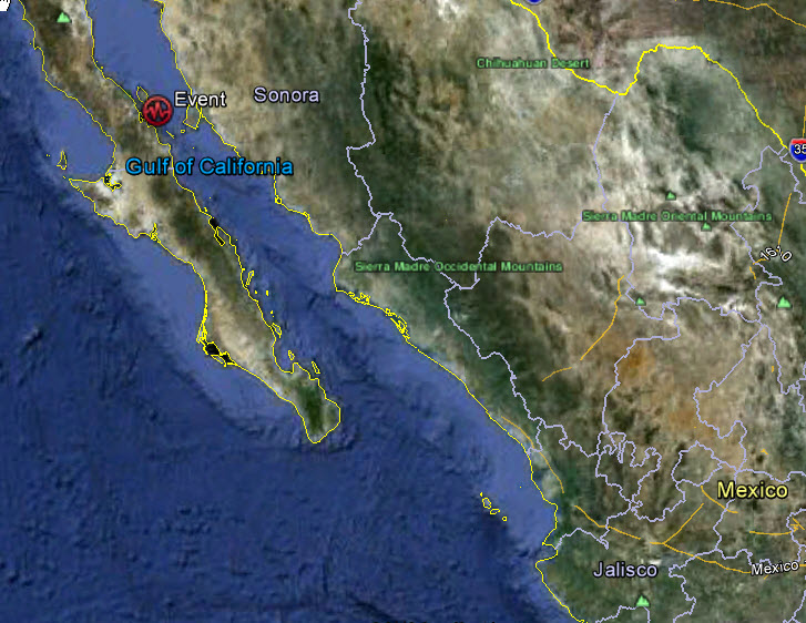
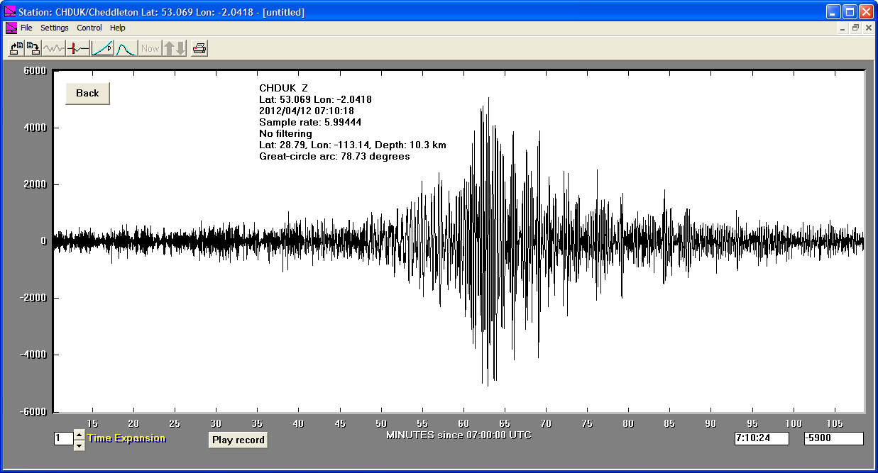
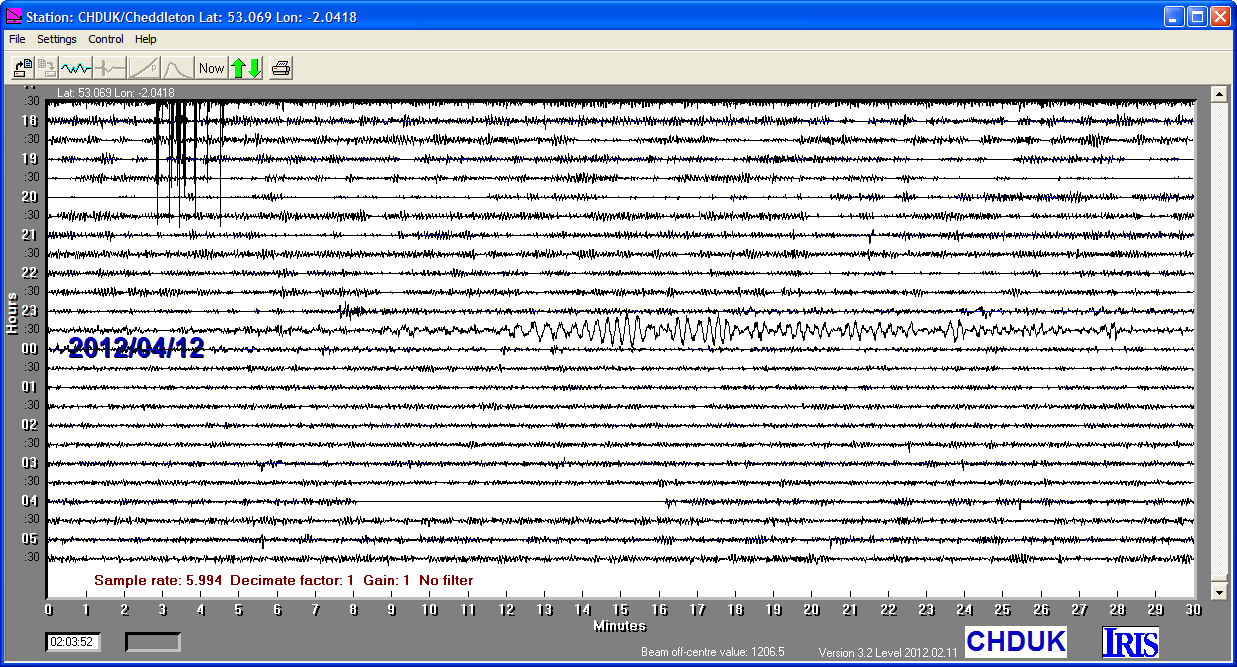
12/04/2012
|
07:15:48
|
6.9
|
10.3
|
Baja California, Mexico
|
28.790000°N
|
-113.140000°W
|
|||||||
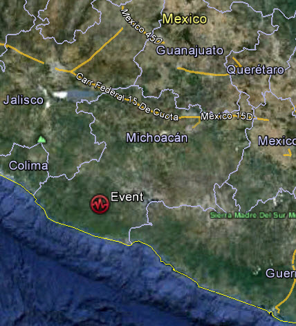
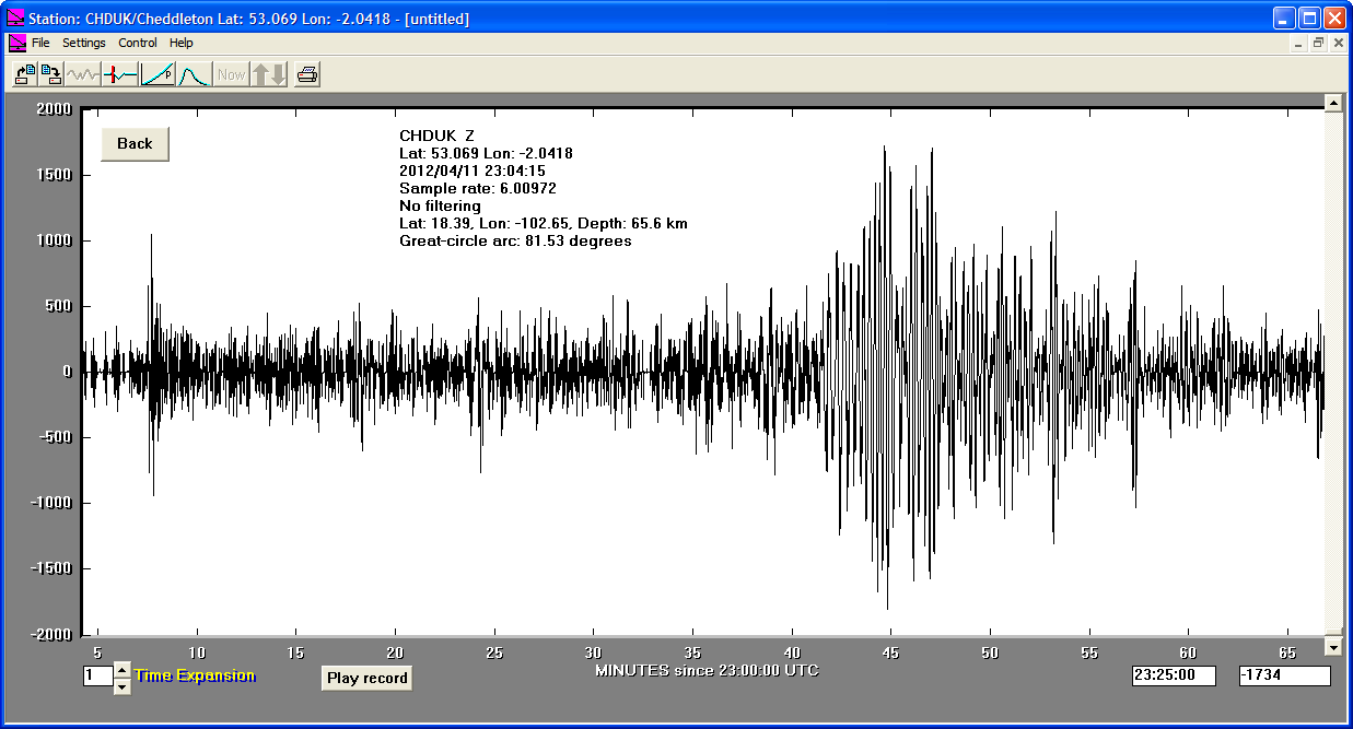
11/04/2012
|
22:55:10
|
6.5
|
20.0
|
Michoacan, Mexico
|
18.390000°N
|
-102.650000°W
|
|||||||
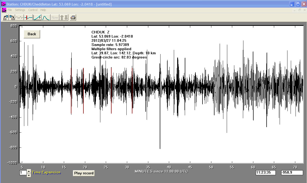
27/03/2012
|
11:00:43
|
6.0
|
10.0
|
Near East Coast of Eastern Honshu, Japan
|
39.870000°N
|
142.120000°E
|
|||||||
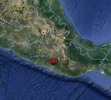
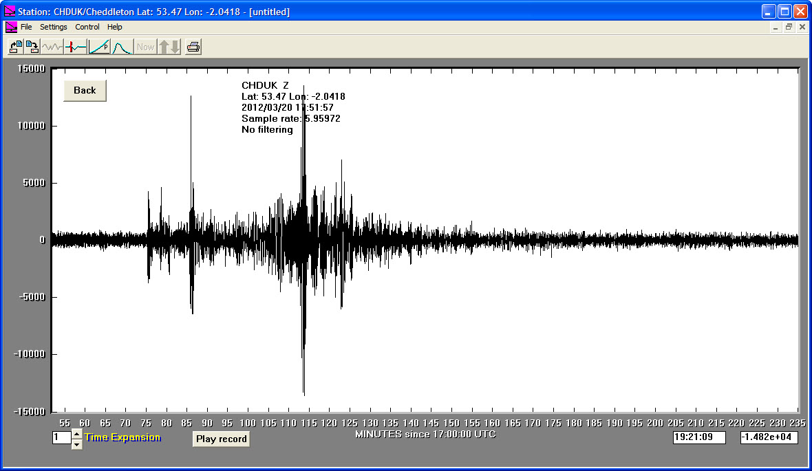
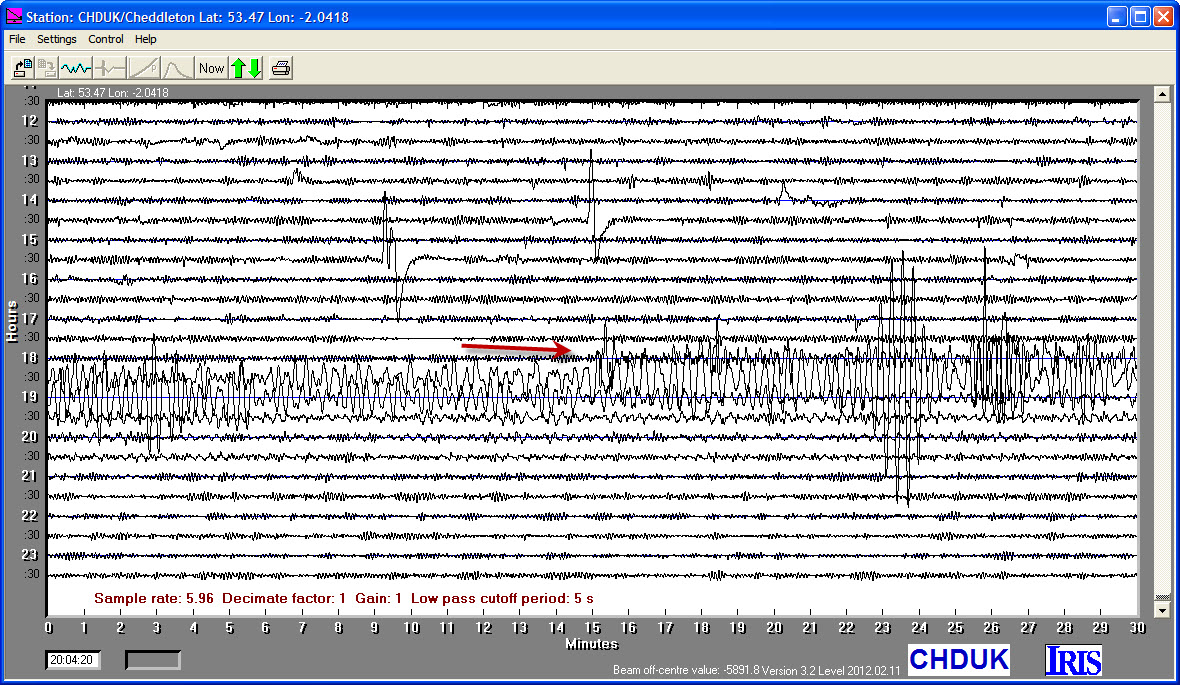
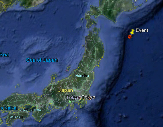
20/03/2012
|
18:02:48
|
7.4
|
20.0
|
Near Coast of Guerrero, Mexico
|
16.660000°N
|
-98.190000°W
|
|||||||
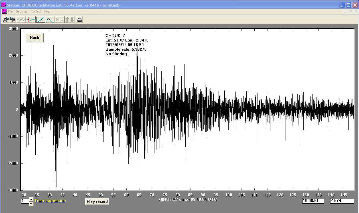
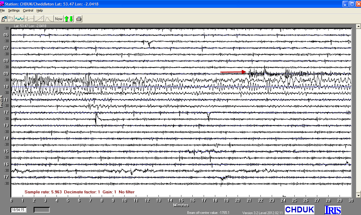
14/03/2012
|
09:08:37
|
6.9
|
26.6
|
East Coast of Honshu, Japan
|
40.900002°N
|
144.919998°E
|
|||||||
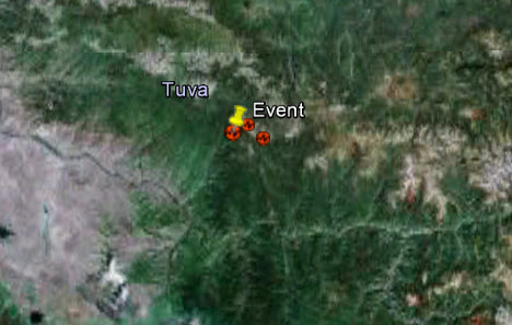
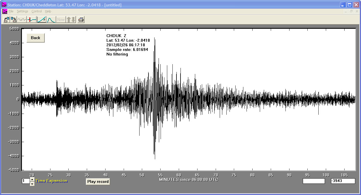
26/02/2012
|
06:17:19
|
6.7
|
11.7
|
Southwestern Siberia, Russia
|
51.731400°N
|
95.920700°E
|
|||||||
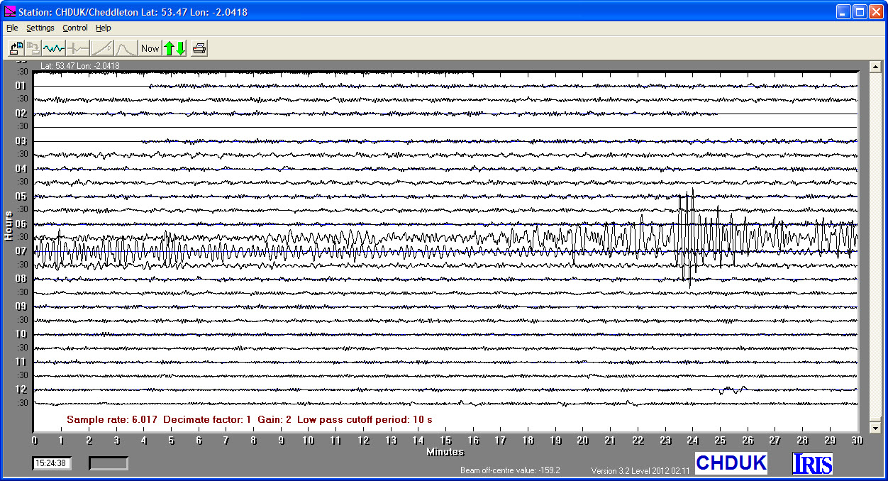
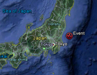
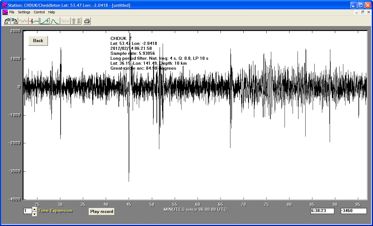
14/02/2012
|
06:21:58
|
6.0
|
10.0
|
Near East Coast of Eastern Honshu, Japan
|
36.150000°N
|
141.490000°E
|
|||||||
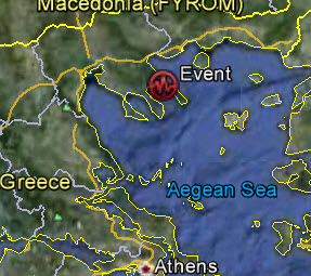
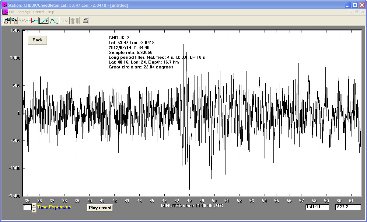
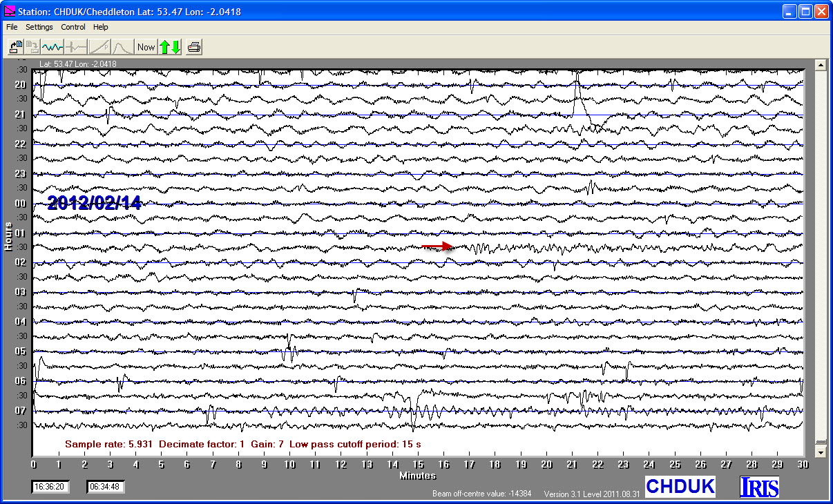
14/02/2012
|
01:34:41
|
5.3
|
16.7
|
Greece,Aegean Sea
|
40.160000°N
|
24.000000°E
|
|||||||
06/02/2012
|
10:10:24
|
6.0
|
15.0
|
Negros, Philippine Islands
|
9.870000°N
|
123.070000°E
|
|||||||
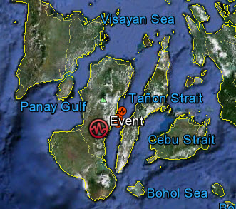
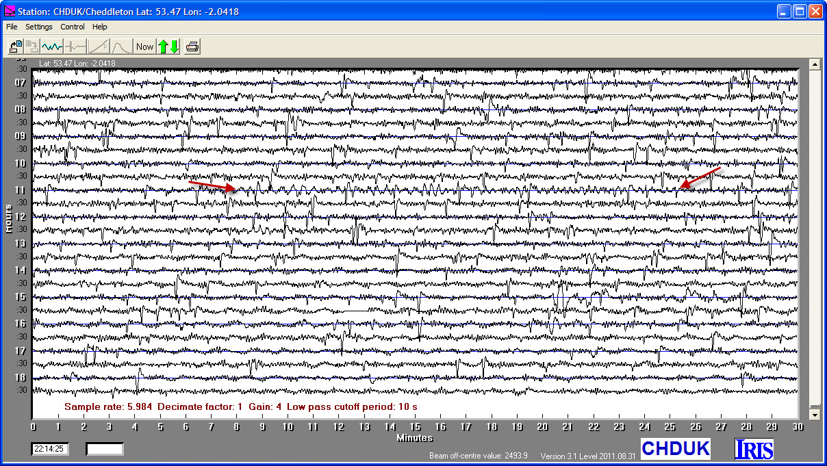
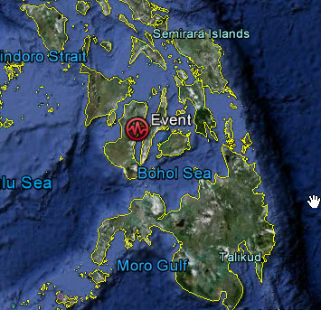
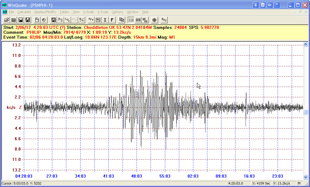
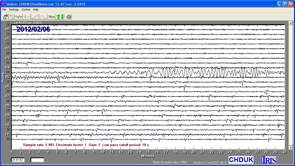
06/02/2012
|
04:20:03
|
5.6
|
15.0
|
Philippine Islands
|
10.060000°N
|
123.170000°E
|
|||||||
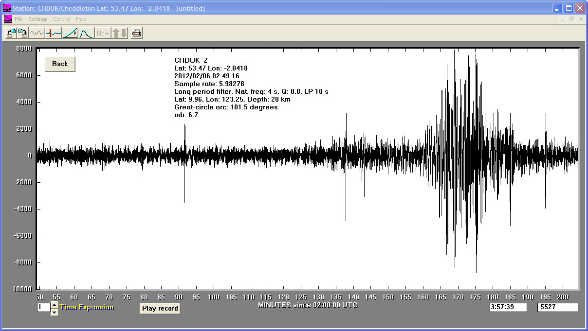
06/02/2012
|
03:49:16
|
6.7
|
20.0
|
Negros, Philippine Islands
|
9.960000°N
|
123.250000°E
|
|||||||
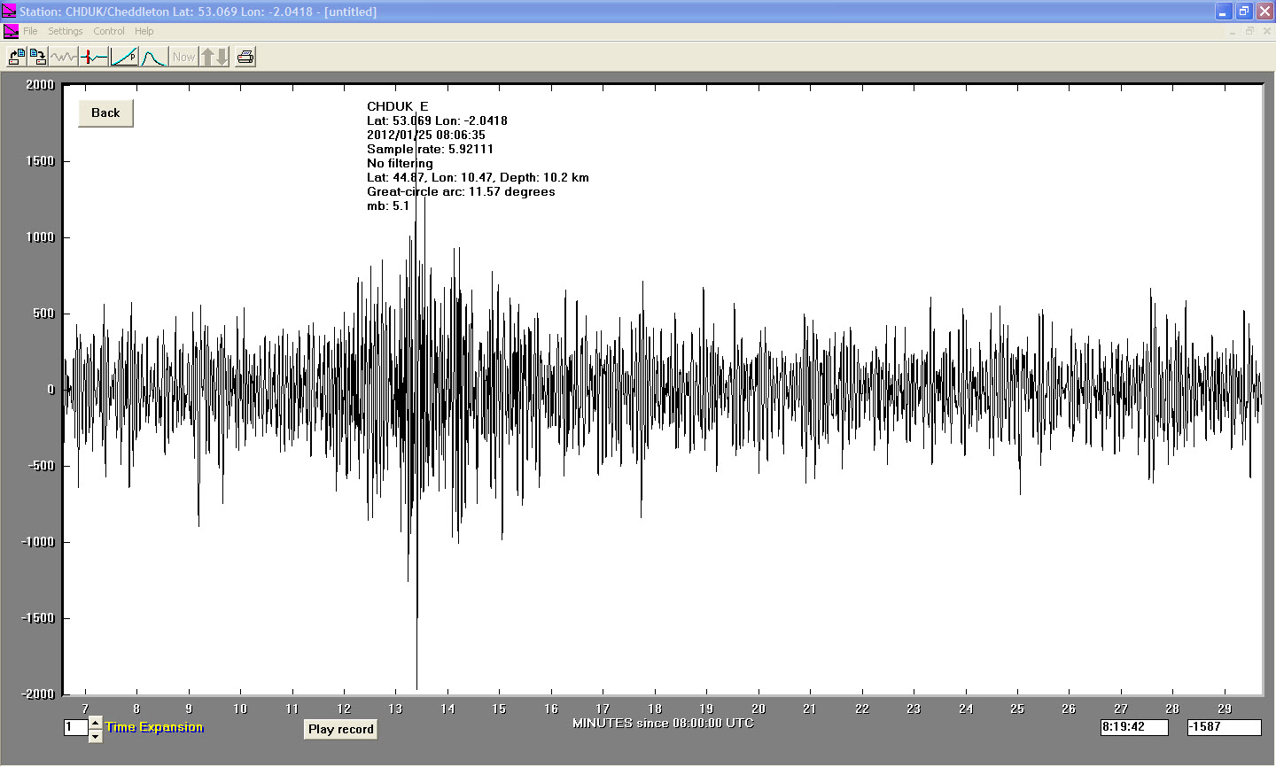
25/01/2012
|
08:06:35
|
5.1
|
10.2
|
Northern Italy
|
44.870000°N
|
10.470000°E
|
|||||||
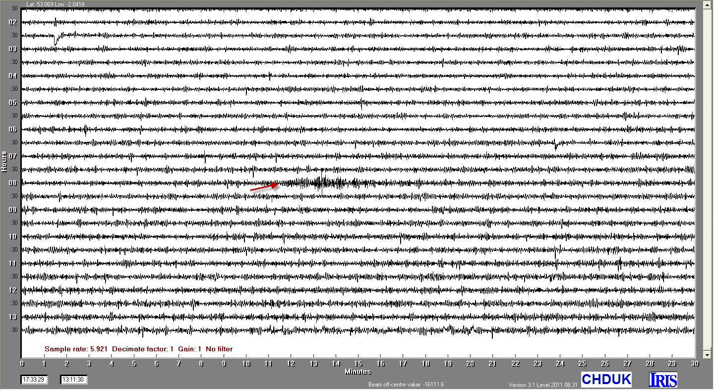
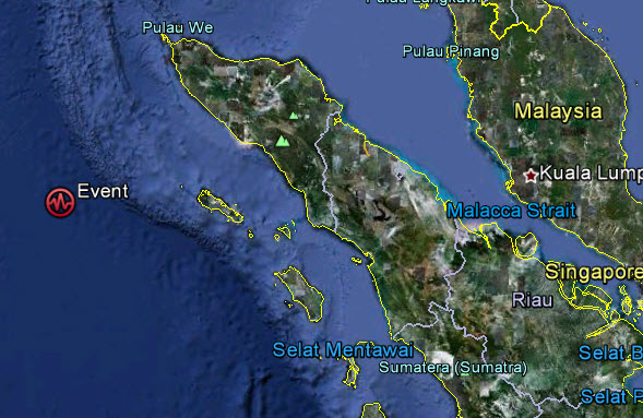
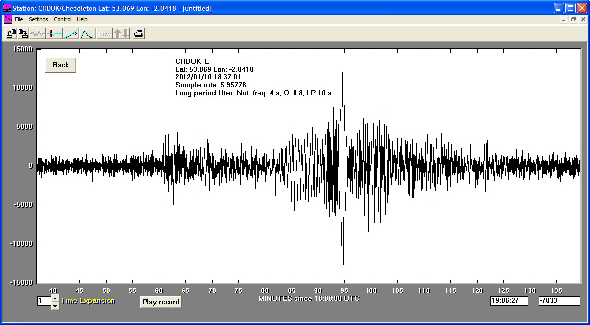
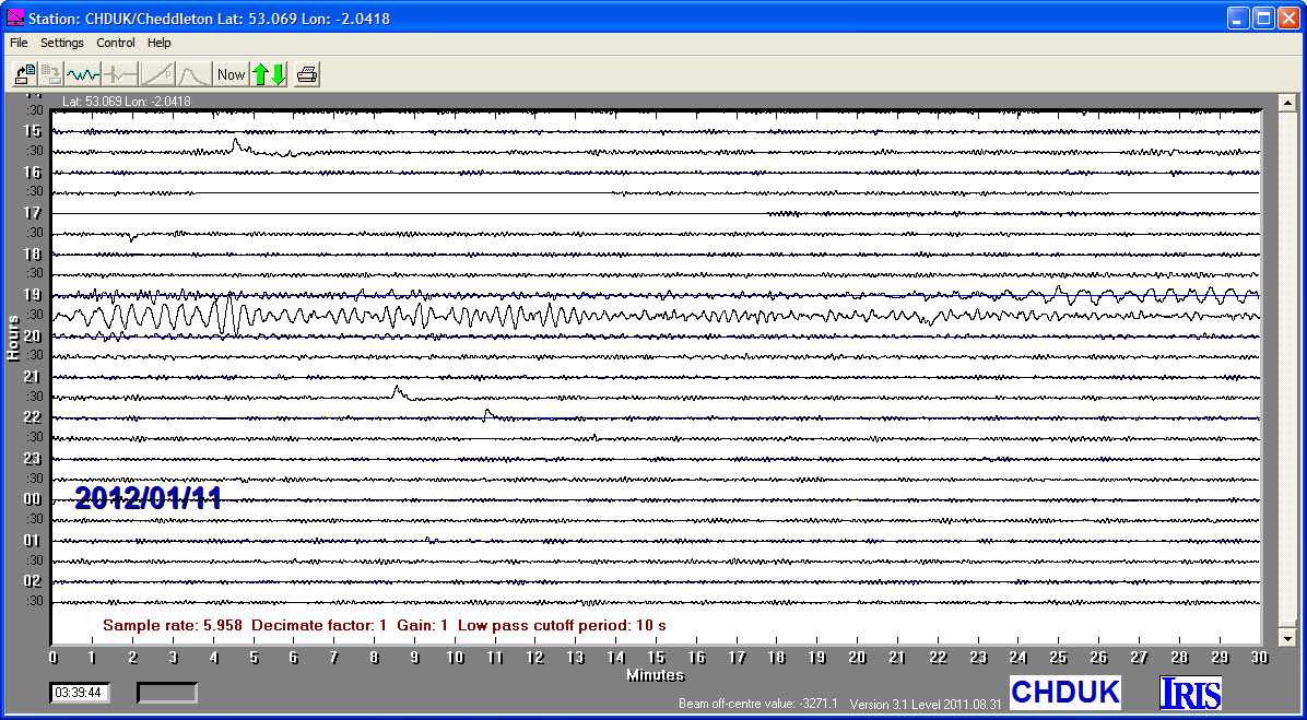
10/01/2012
|
18:37:01
|
7.3
|
29.1
|
Off West Coast of Northern Sumatera, Indonesia
|
2.400000°N
|
93.180000°E
|

