Date
|
Time
UCT
|
MAG
|
Depth km
|
location
|
Lat
|
Long
|
Map
|
PSN
|
AmaSeis
Event
|
Heli
corder
|
Sound
File
|
SCA
|
Notes
|
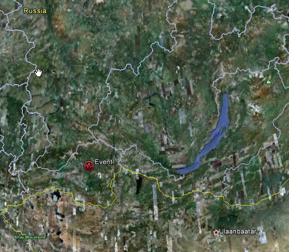
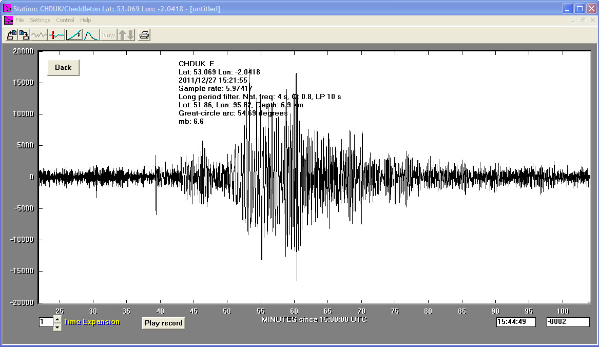
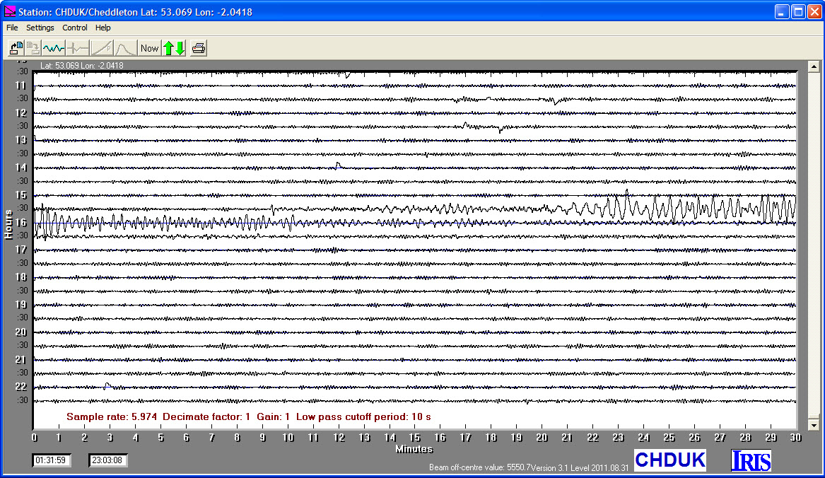
27/12/2011
|
15:21:56
|
6.9
|
6.6
|
Southwestern Siberia, Russia
|
51.860000°N
|
95.820000°E
|
|||||||
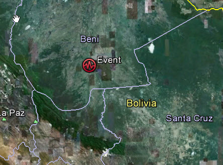
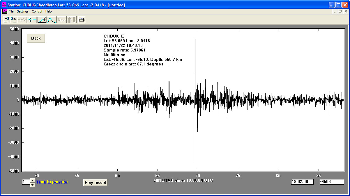
22/11/2011
|
18:48:17
|
6.6
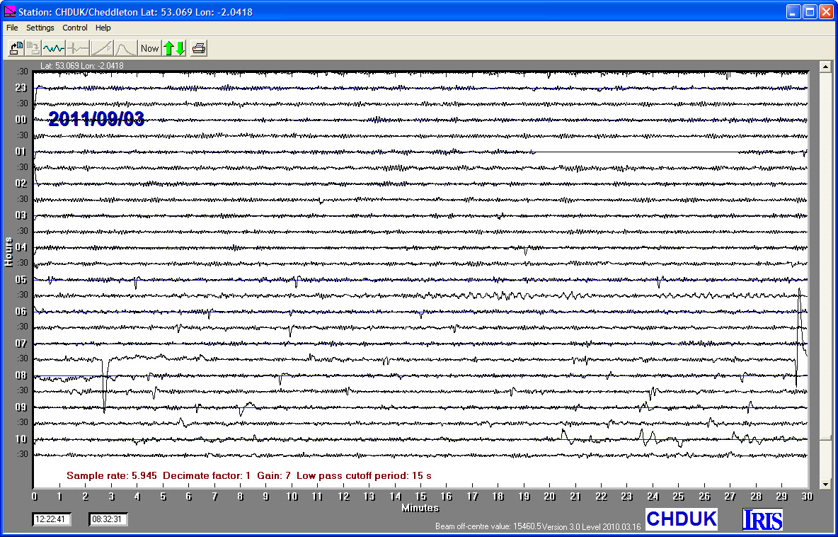
|
556.7
|
Central Bolivia
|
-15.360000°S
|
-65.130000°W
|
|||||||
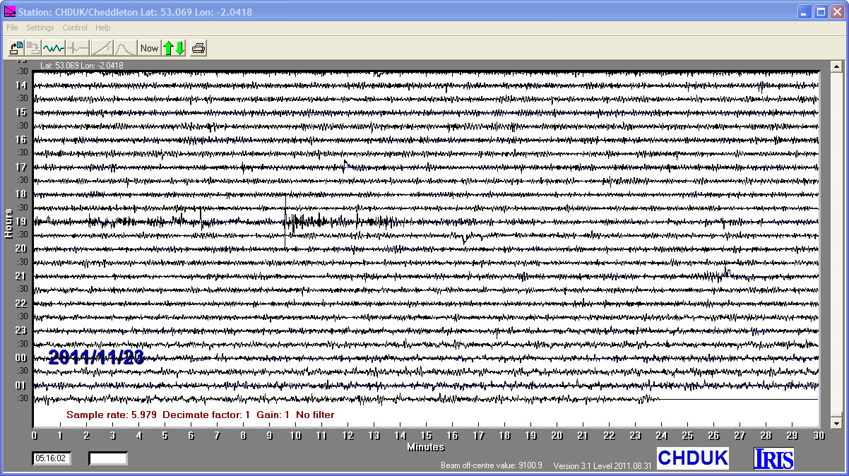
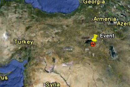
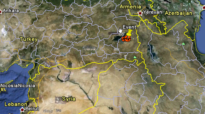
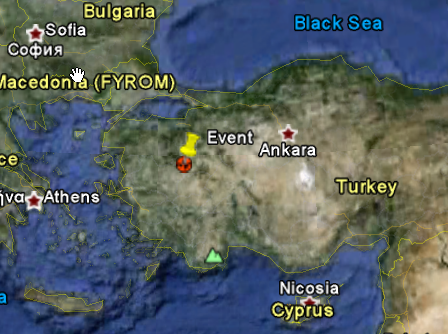
09/11/2011
|
19:23:33
|
5.6
|
5.0
|
Turkey
|
38.430000°N
|
43.230000°E
|
|||||||
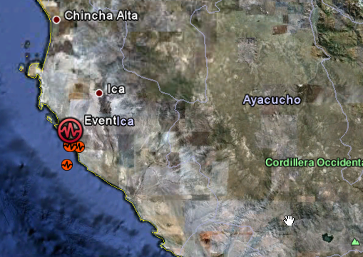
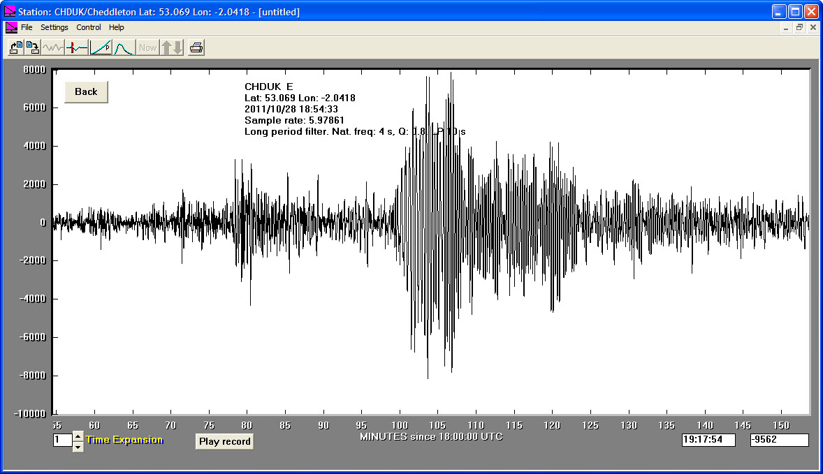
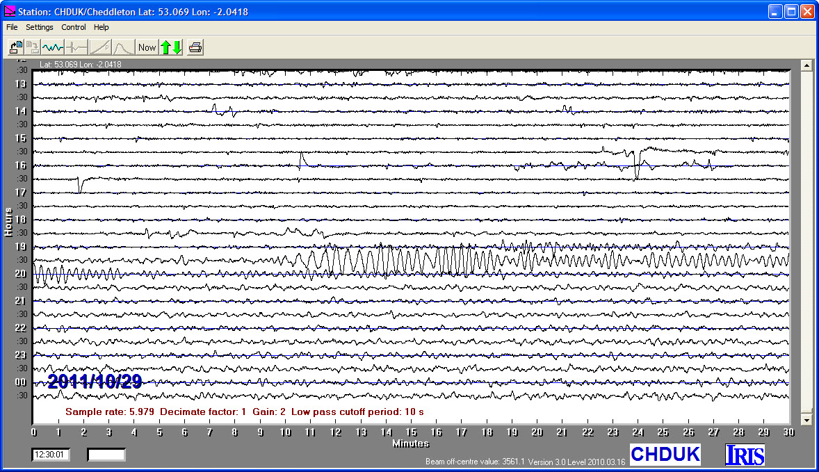
28/10/2011
|
18:54:33
|
6.9
|
23.9
|
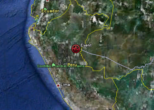
Near Coast of Peru
|
-14.510000°S
|
-76.010000°W
|
|||||||
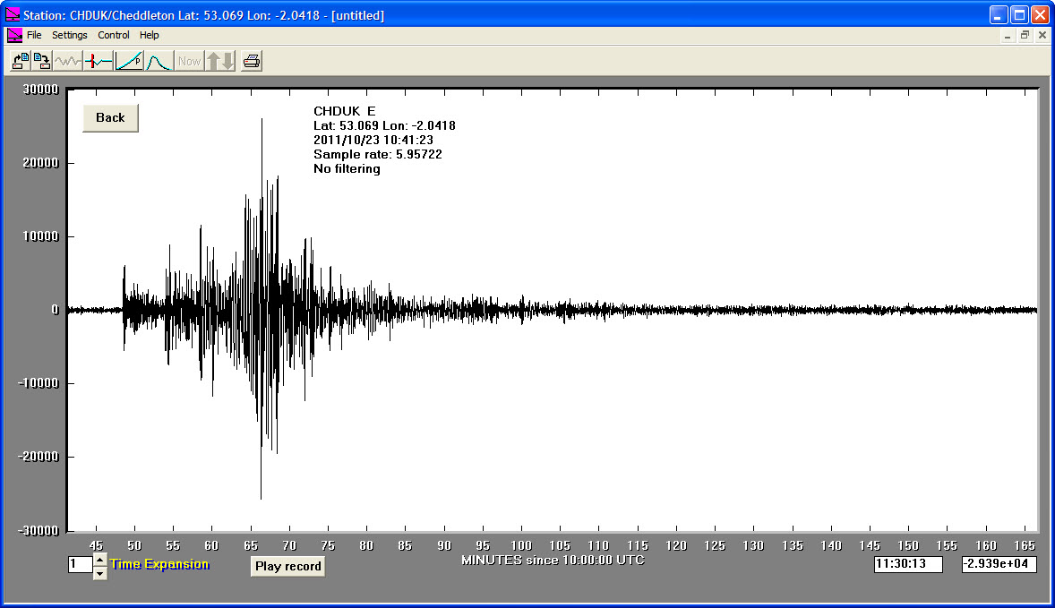
23/10/2011
|
10:41:21
|
7.2
|
20.0
|
Turkey
|
38.630000°N
|
43.490000°E
|
|||||||
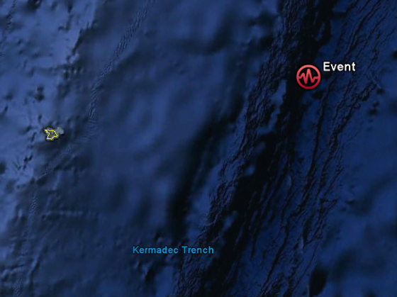
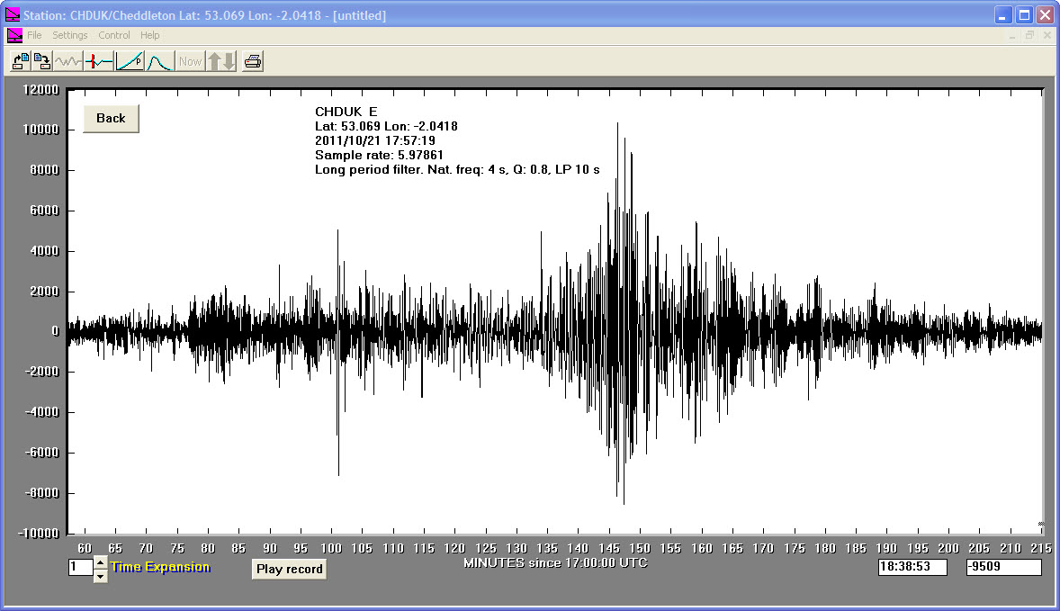
21/10/2011
|
17:57:17
|
7.6
|
39.8
|
Kermadec Islands Region
|
-28.940000°S
|
-176.050000°E
|
|||||||
14/10/2011
|
06:10:15
|
6.1
|
15.3
|
Southeastern Siberia, Russia
|
54.110000°N
|
123.720000°E
|
|||||||
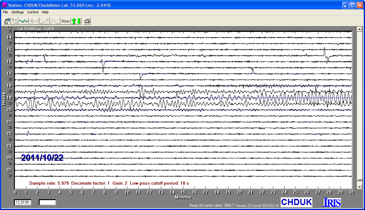
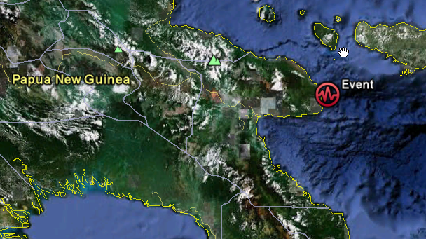
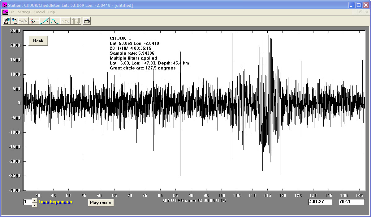
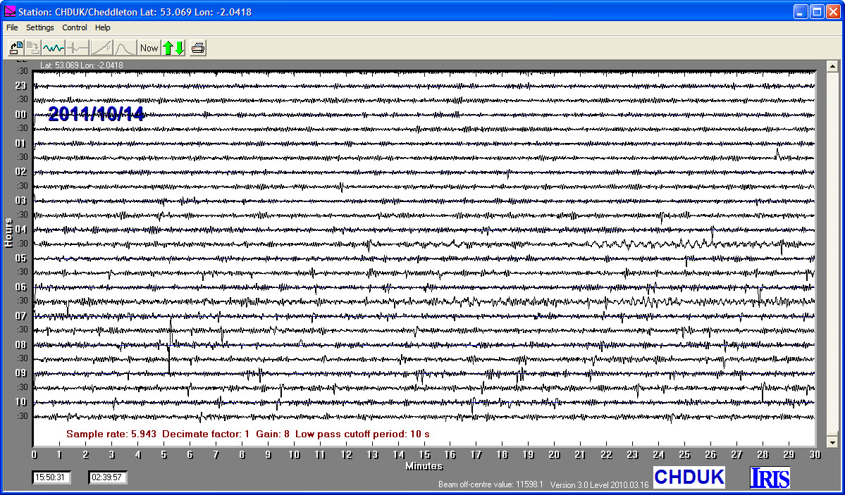
14/10/2011
|
03:35:15
|
6.7
|
45.4
|
Eastern New Guinea, Papua New Guinea Region
|
-6.630000°S
|
147.930000°W
|
|||||||
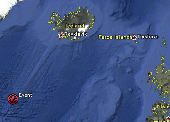
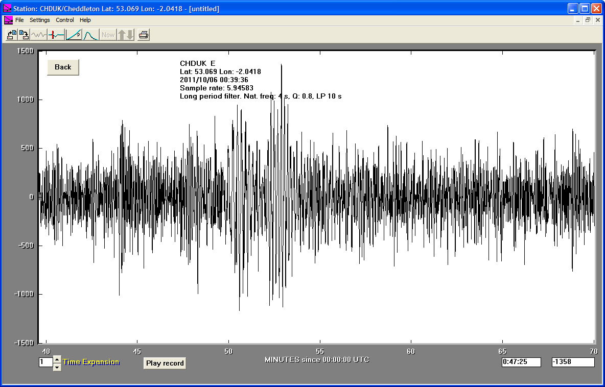
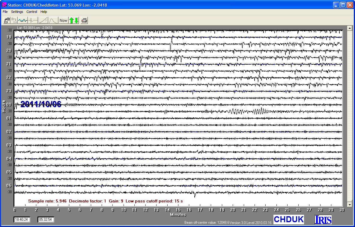
06/10/2011
|
00:39:33
|
5.6
|
10.2
|
Reykjanes Ridge
|
57.880000°N
|
-32.560000°W
|
|||||||
09/09/2011
|
19:26:00
|
5.9
|
10.5
|
Auckland Islands, New Zealand Region
|
-49.670000°S
|
163.990000°E
|
|||||||
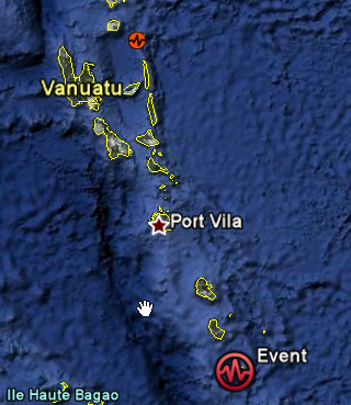
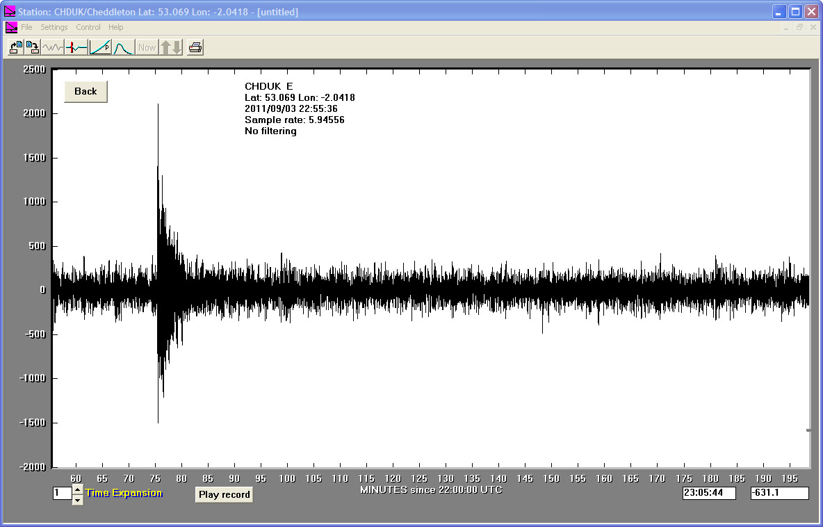
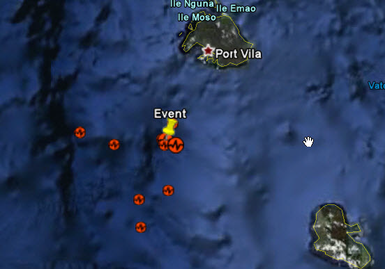
03/09/2011
|
22:55:36
|
7.0
|
132.4
|
Vanuatu Islands
|
-20.580000°S
|
169.700000°E
|
|||||||
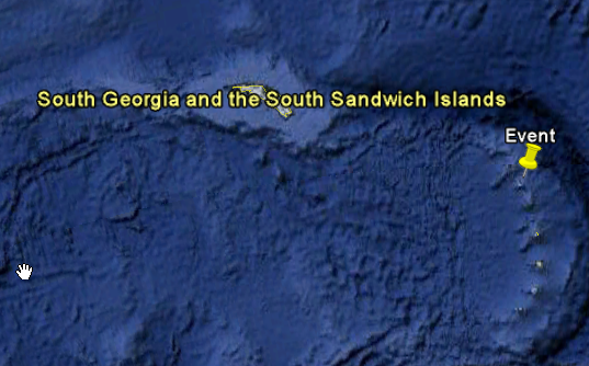
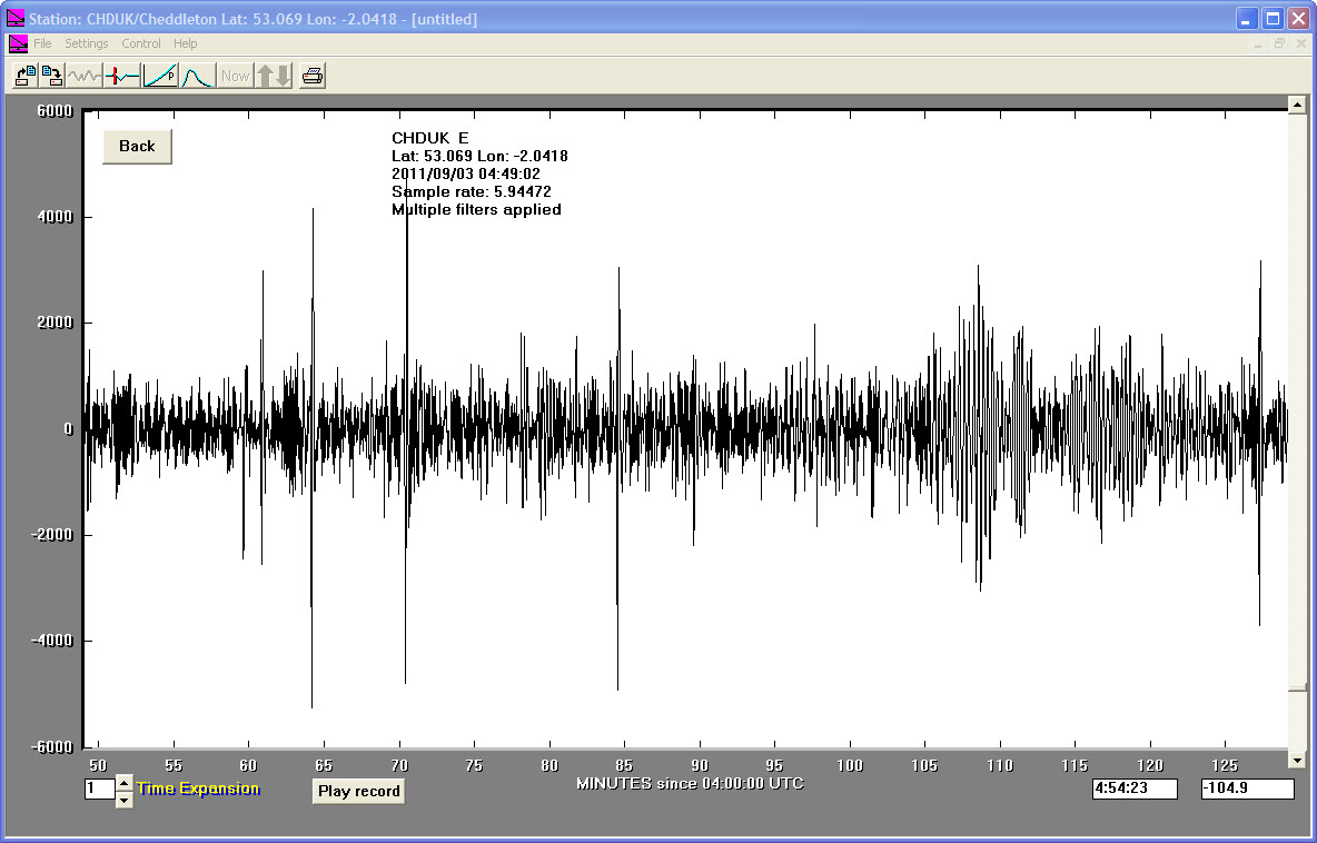
03/09/2011
|
04:49:00
|
6.2
|
106.0
|
South Sandwich Islands Region
|
-56.550000°S
|
-27.040000°W
|
|||||||
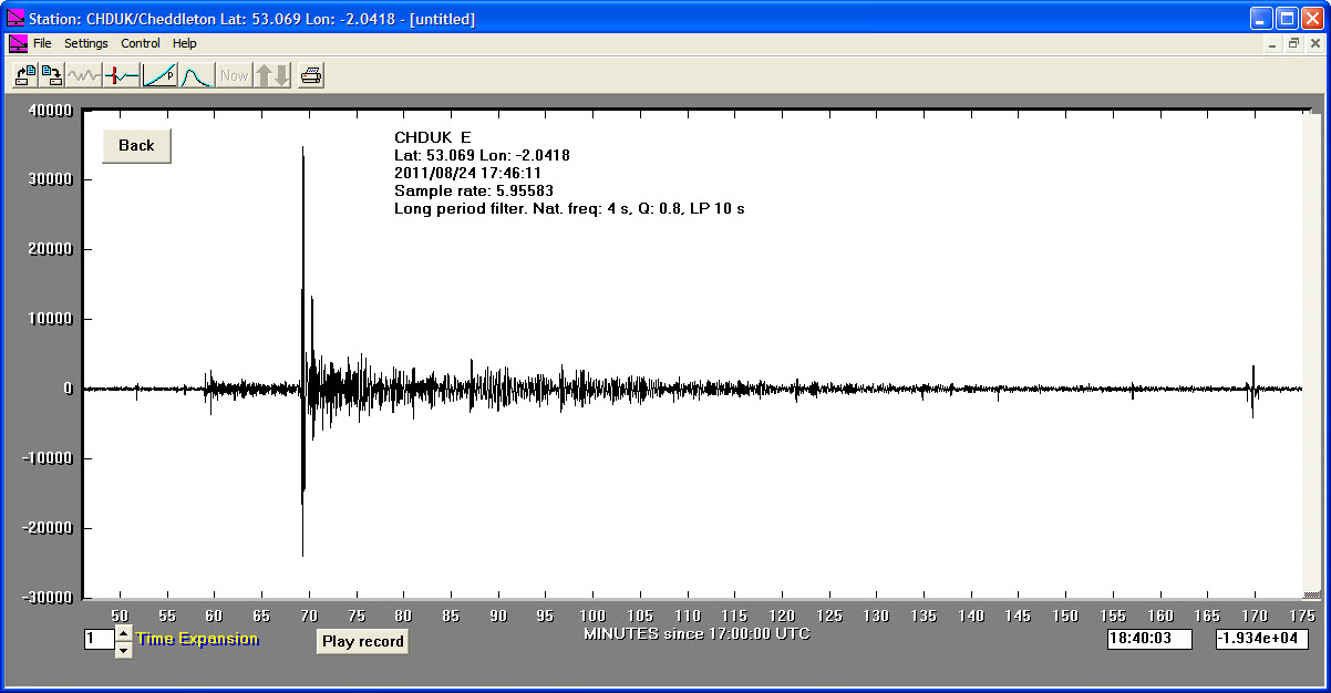
24/08/2011
|
17:46:11
|
7.0
|
145.1
|
Peru-Brazil Border Region
|
-7.640000°S
|
-74.510000°W
|
|||||||
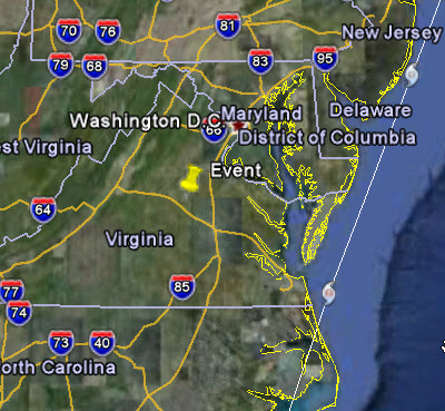
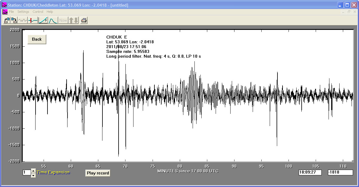
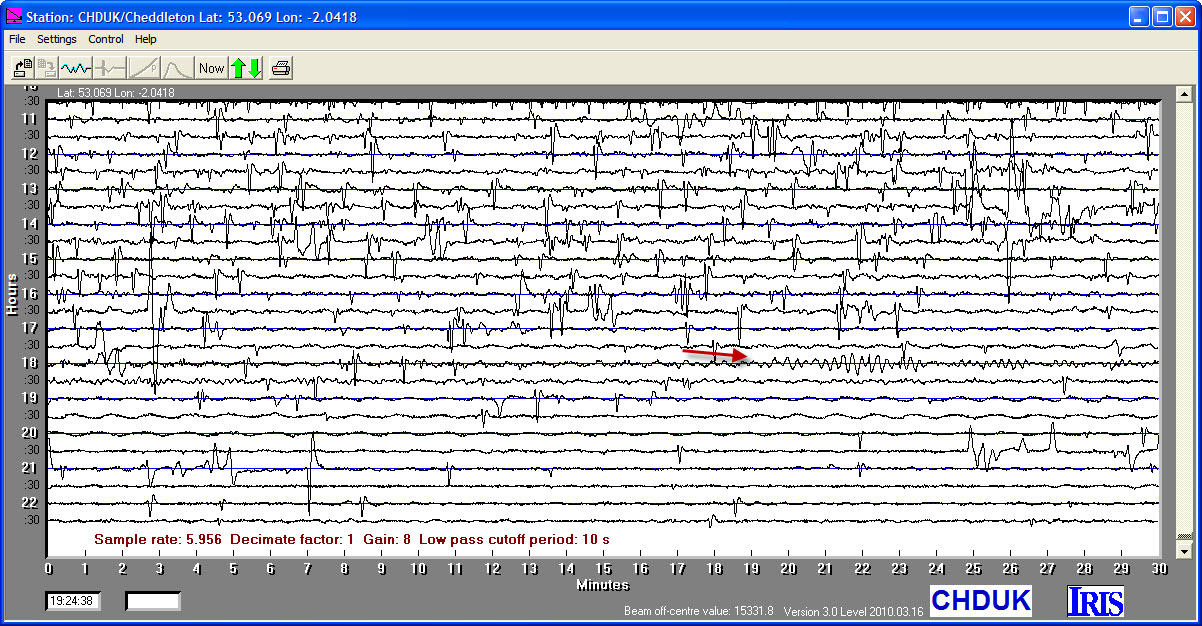
23/08/2011
|
17:51:04
|
5.8
|
6.0
|
Virginia, USA
|
37.940000°N
|
-77.930000°W
|
|||||||
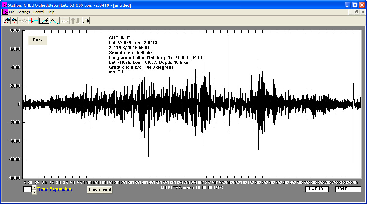
20/08/2011
|
16:55:02
|
7.5
|
40.6
|
Vanuatu Islands
|
-18.260000°S
|
168.070000°E
|
|||||||
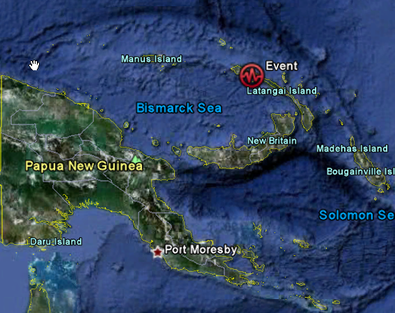
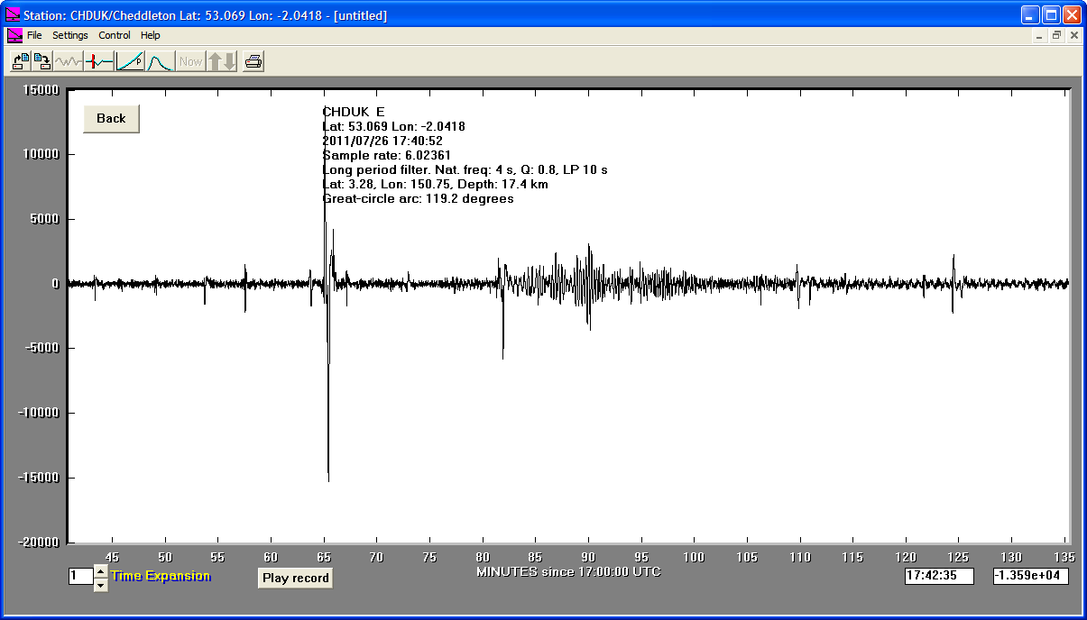
26/07/2011
|
17:40:51
|
5.2
|
17.4
|
New Ireland, Papua New Guinea Region
|
-3.280000°S
|
150.750000°E
|
|||||||
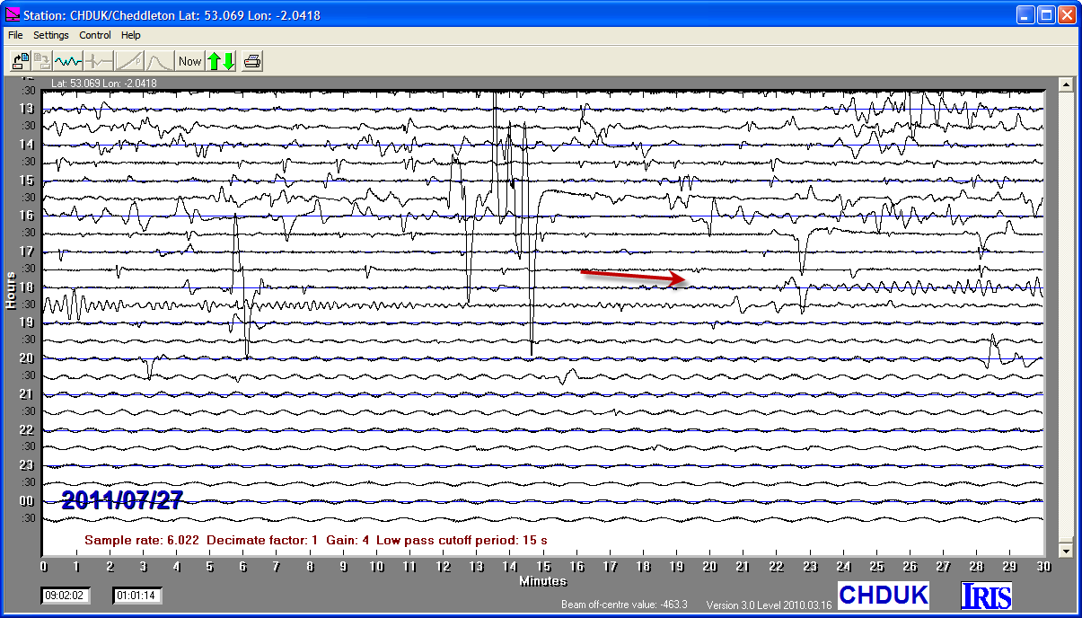
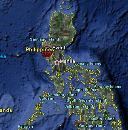
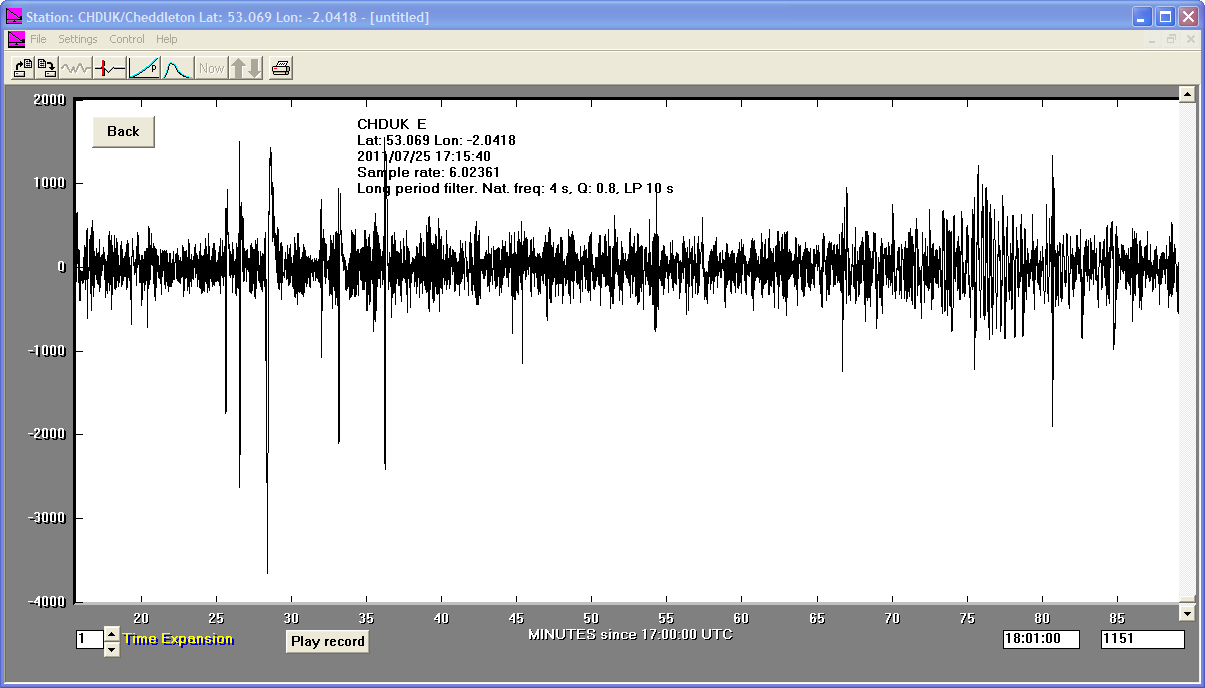
25/07/2011
|
17:15:41
|
5.9
|
35.0
|
Luzon, Philippine Islands
|
14.970000°N
|
120.120000°E
|
|||||||
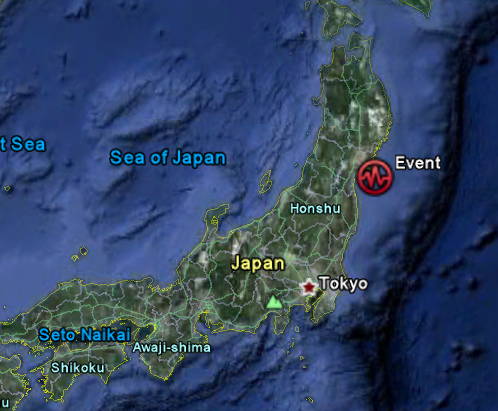
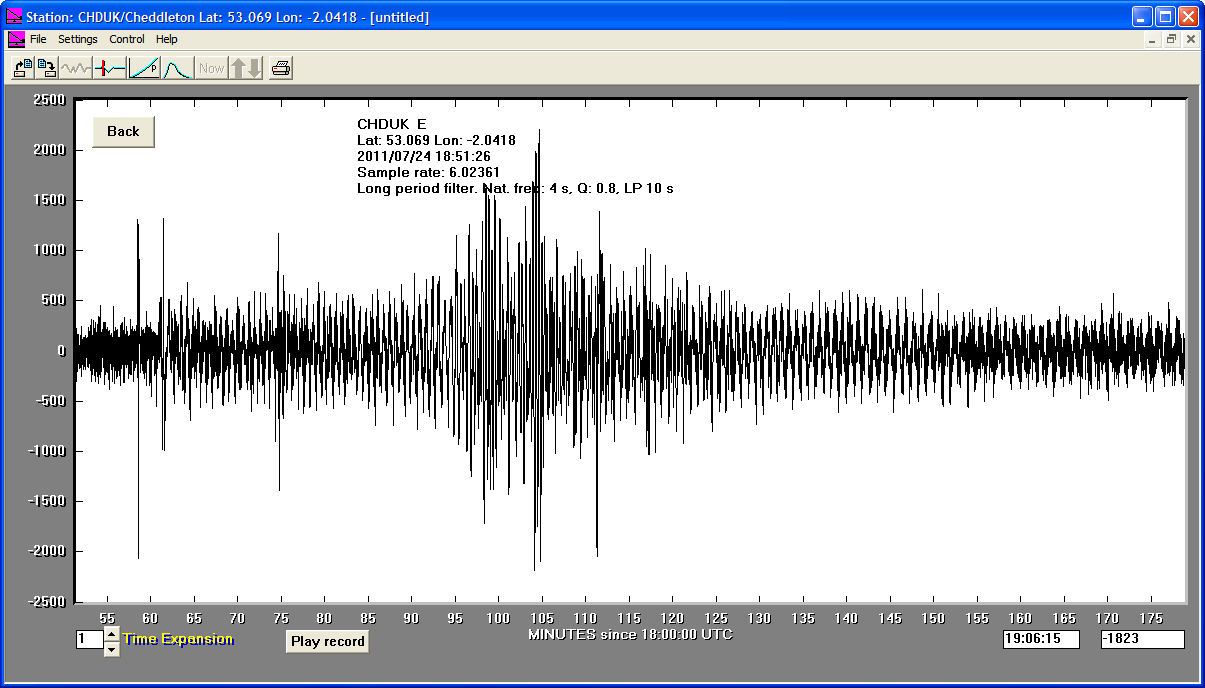
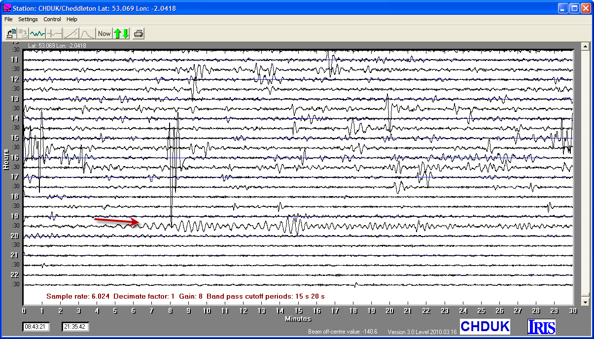
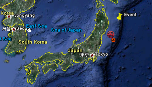
24/07/2011
|
18:51:25
|
6.2
|
35.6
|
Near East Coast of Eastern Honshu, Japan
|
37.760000°N
|
141.540000°E
|
|||||||
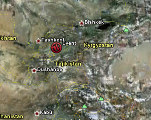
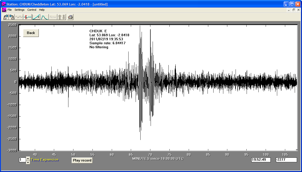
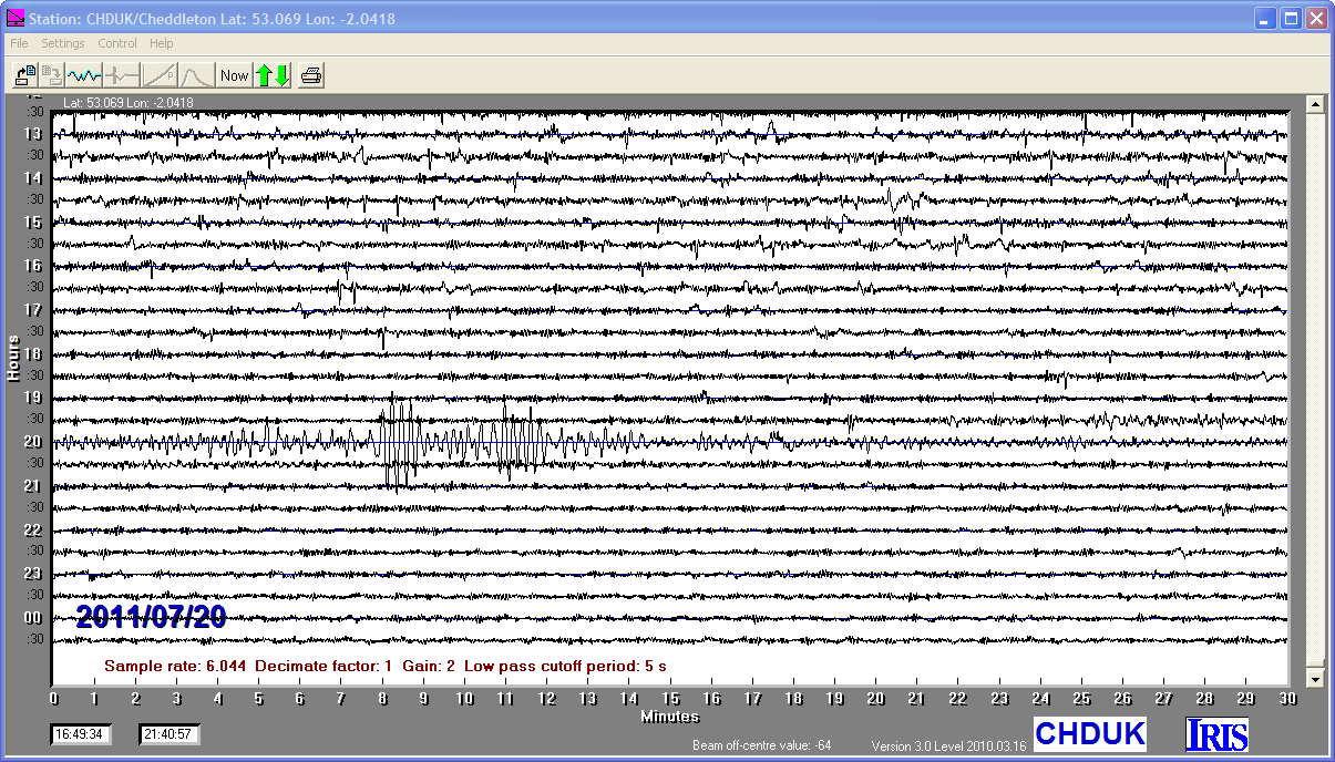
19/07/2011
|
19:35:43
|
6.1
|
16.0
|
Kyrgyzstan
|
40.150000°N
|
71.430000°E
|
|||||||
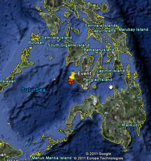
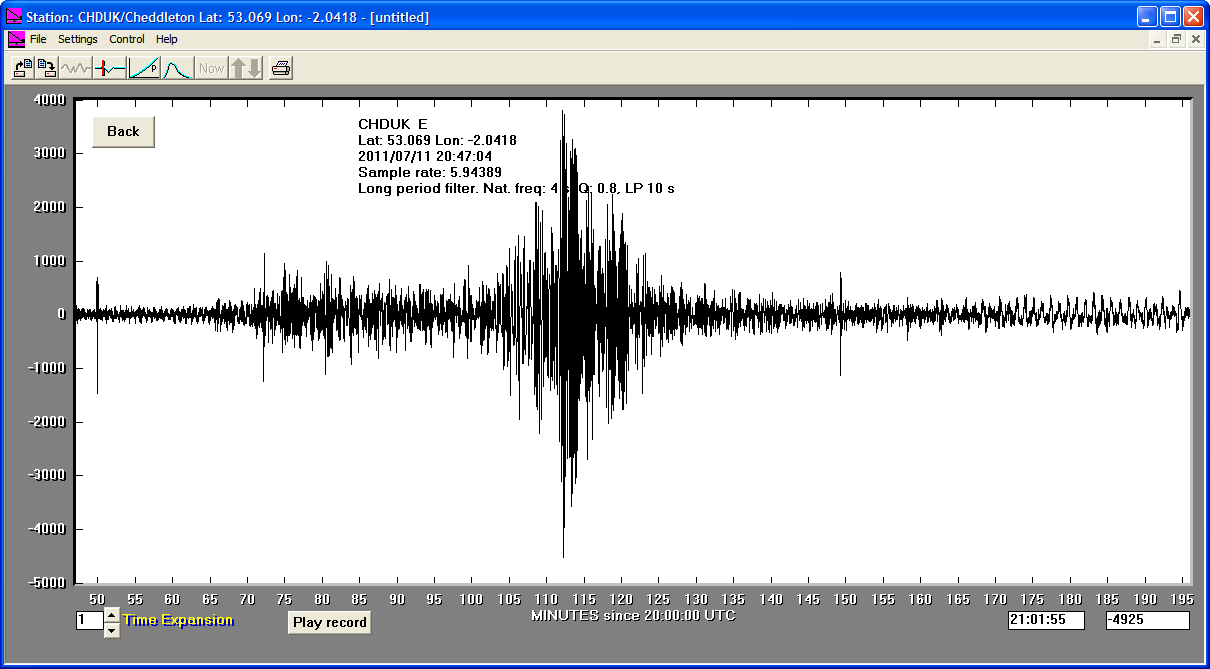
11/07/2011
|
20:47:04
|
6.4
|
20.1
|
Negros, Philippine Islands
|
9.500000°N
|
122.210000°E
|
|||||||
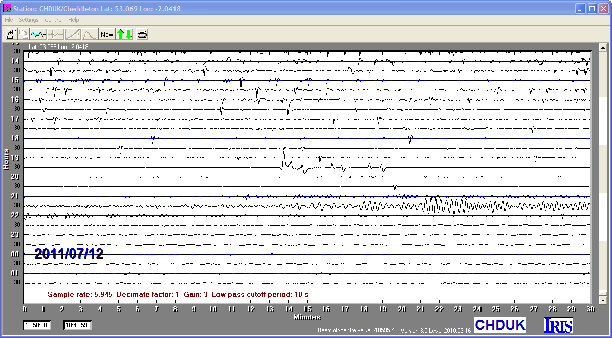
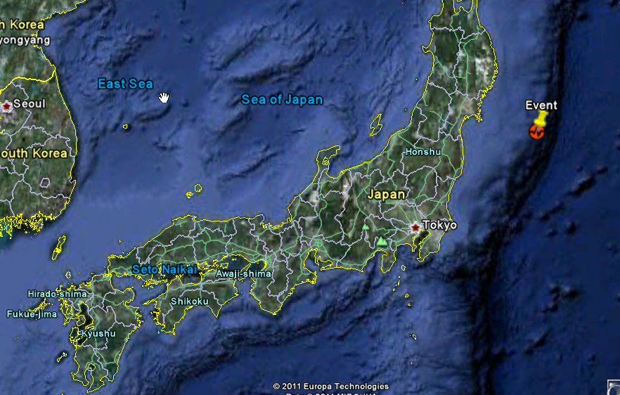
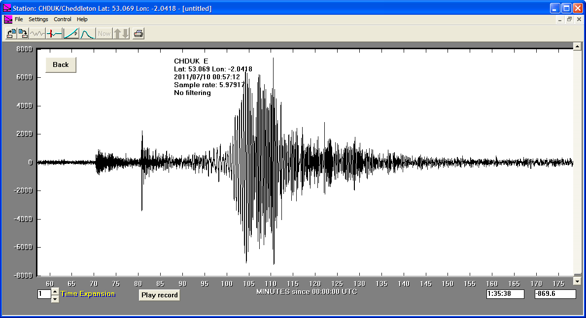
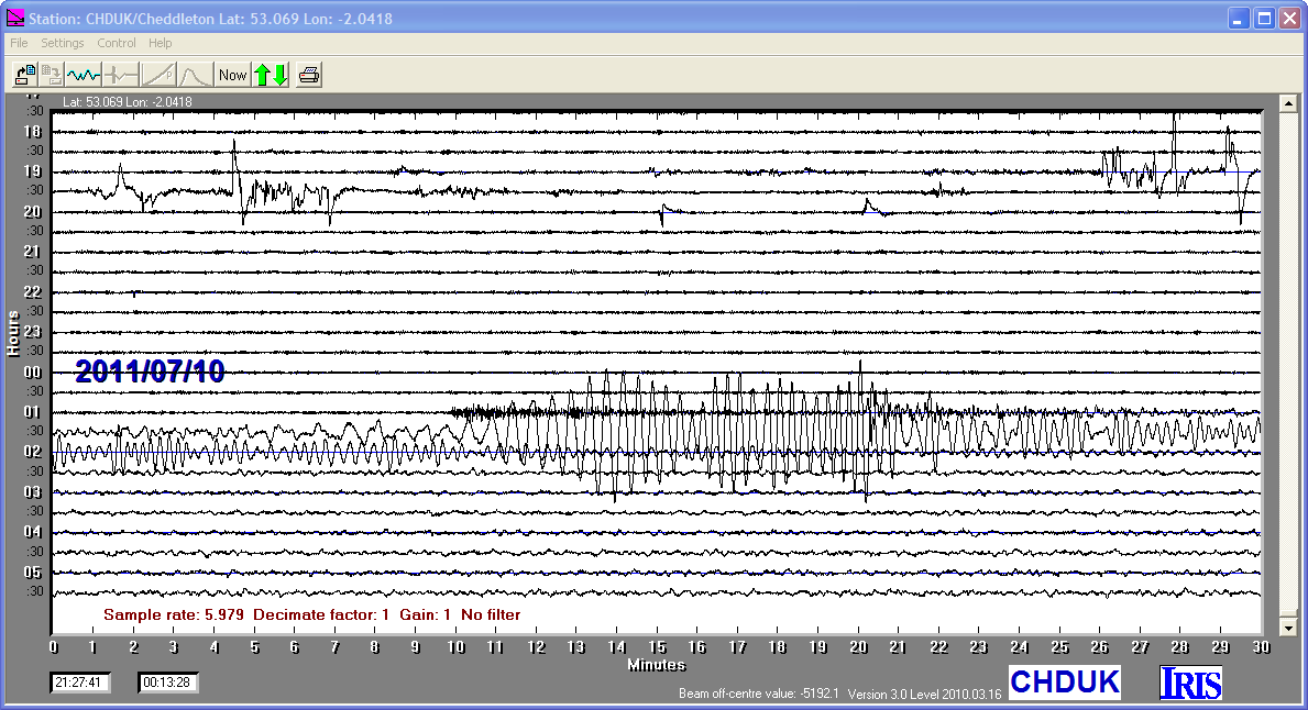
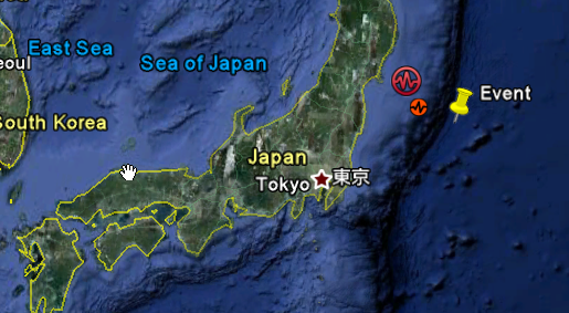
10/07/2011
|
00:57:12
|
7.0
|
18.0
|
Off East Coast of Honshu, Japan
|
38.040000°N
|
143.290000°E
|
|||||||
06/072011
|
19:03:16
|
7.6
|
20.0
|
Kermadec Islands Region
|
-29.310000°S
|
-176.200000°W
|
|||||||
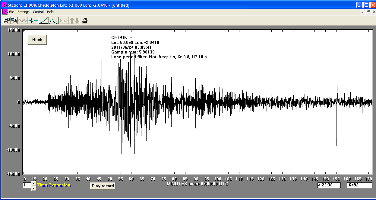
24/06/2011
|
03:09:40
|
7.2
|
62.6
|
Fox Islands, Aleutian Islands USA
|
52.010000°N
|
-171.860000°W
|
|||||||
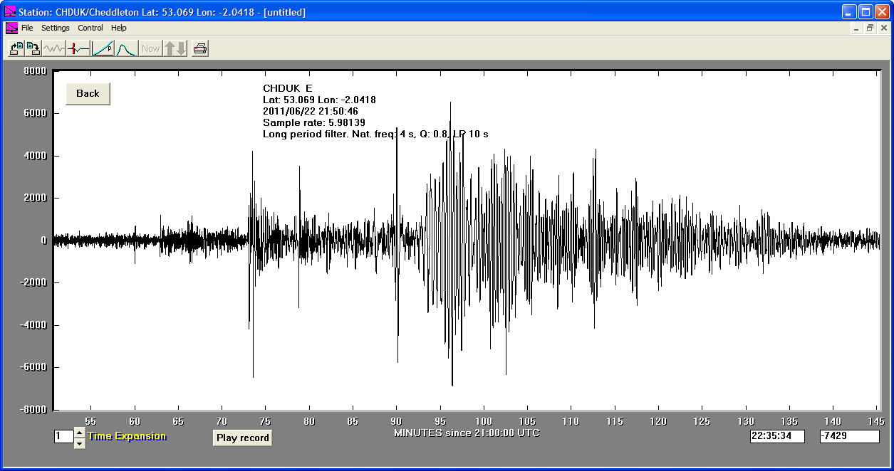
22/06/2011
|
21:50:48
|
6.7
|
32.0
|
Near East Coast of Eastern Honshu, Japan
|
39.980000°N
|
142.250000°E
|
|||||||
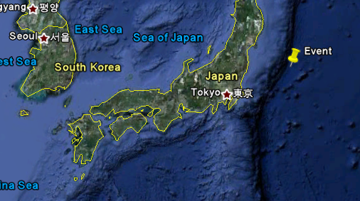
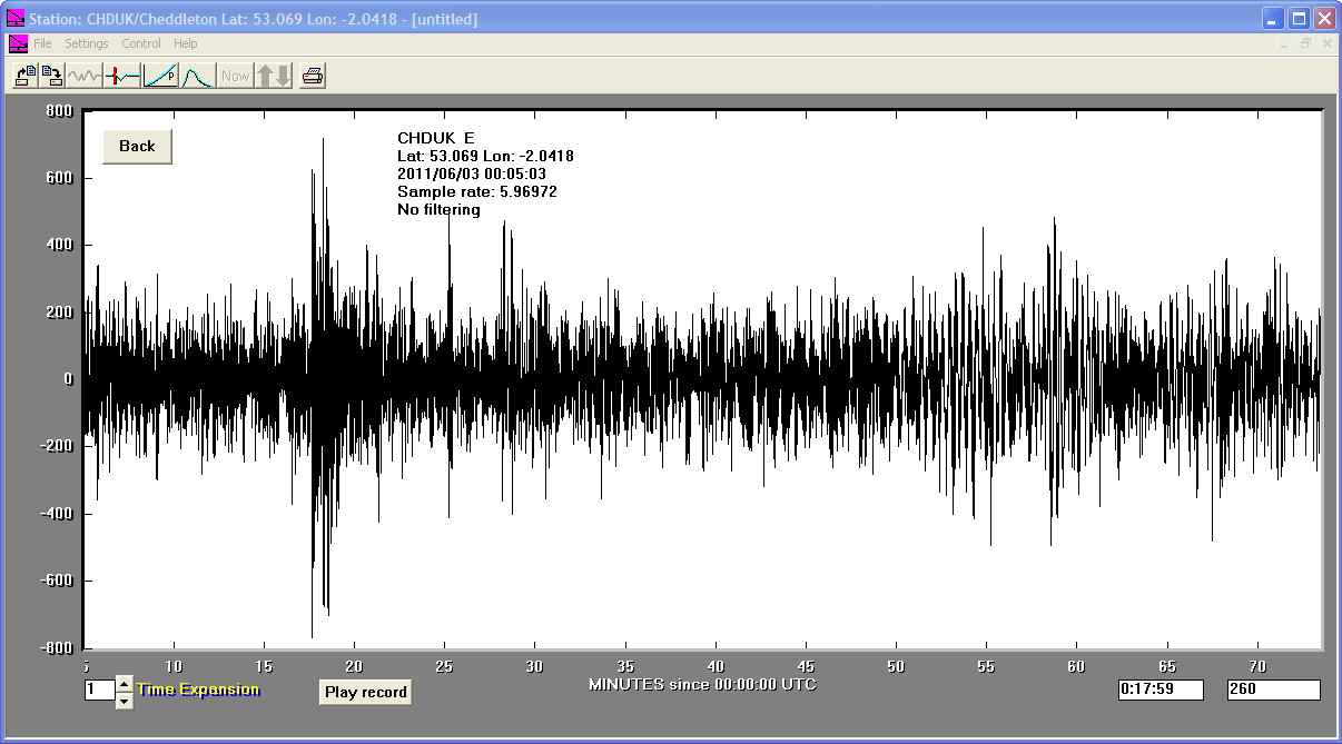
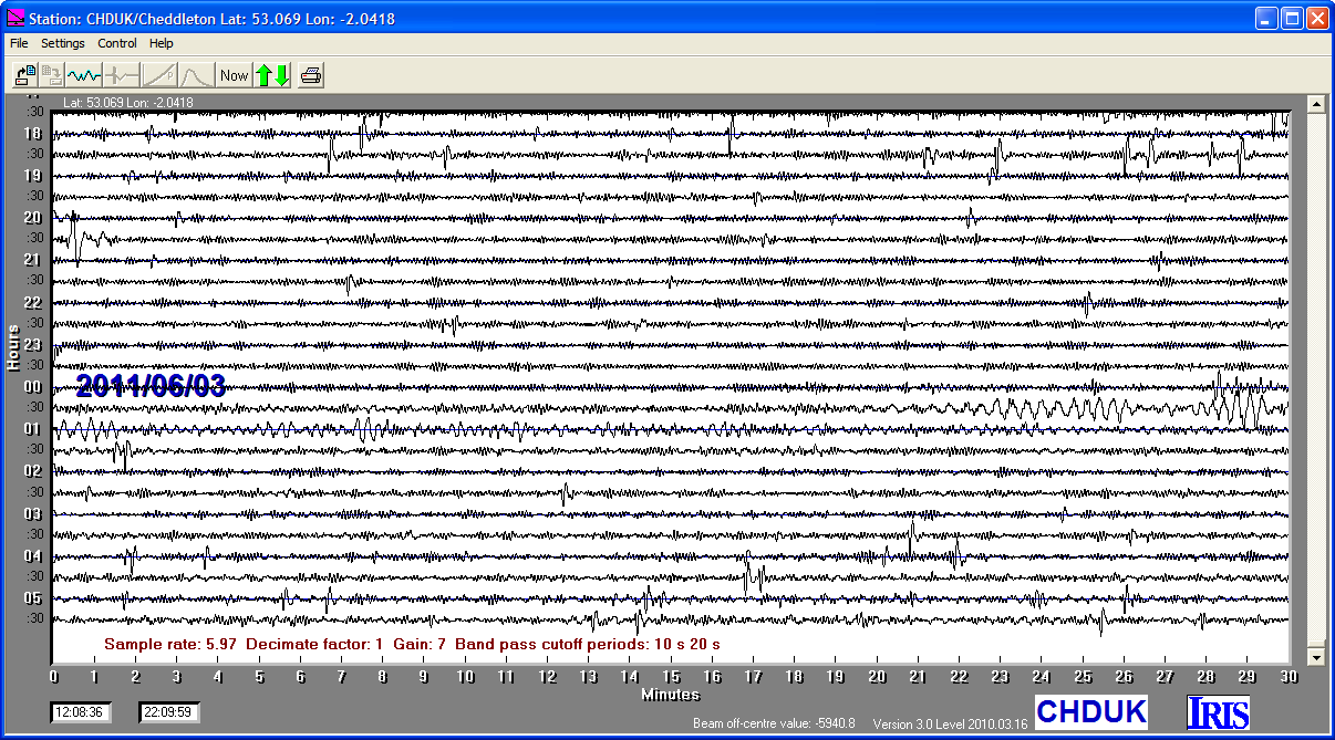
03/06/2011
|
00:05:03
|
6.3
|
31.0
|
Off East Coast of Honshu, Japan
|
37.290000°N
|
143.910000°E
|
|||||||
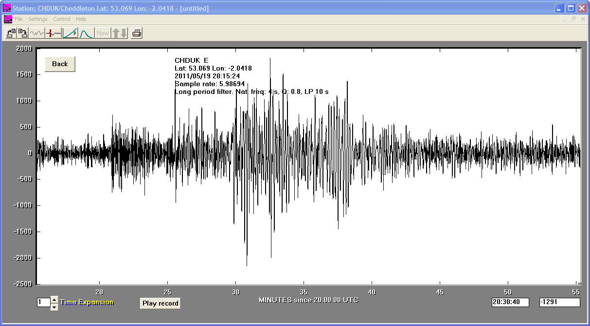
19/05/2011
|
20:15:24
|
5.8
|
9.1
|
Turkey
|
39.140000°N
|
39.140000°E
|
|||||||
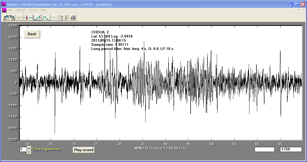
15/05/2011
|
13:08:12
|
6.0
|
10.0
|
Central Mid-Atlantic Ridge
|
0.460000°N
|
-25.600000°W
|
|||||||
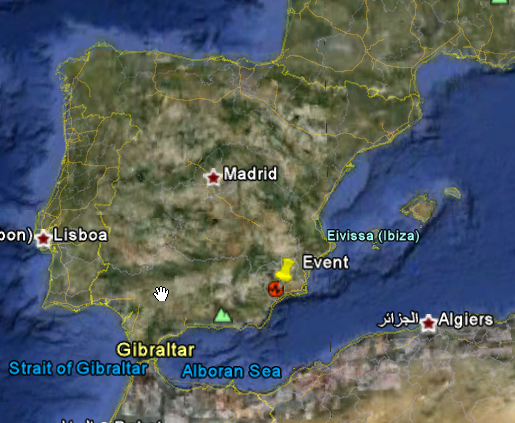
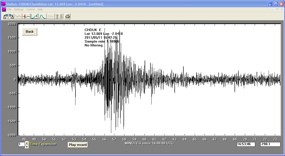
11/05/2011
|
16:47:26
|
5.3
|
1.0
|
Spain
|
37.700001°N
|
-1.560000°W
|
|||||||
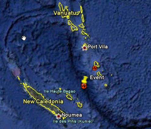
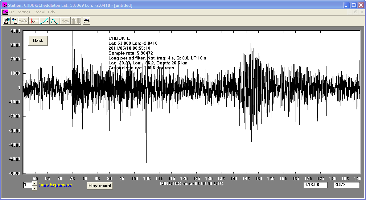
10/05/2011
|
08:55:11
|
7.1
|
26.5
|
Loyalty Islands
|
-20.230000°S
|
168.200000°E
|


This icon will download a file in a pns format , Standard for the Exchange of Earthquake Data This file is the same data in a sac format .


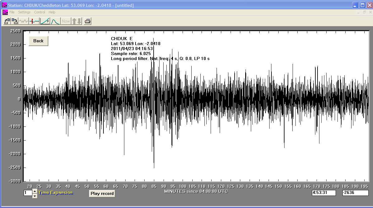
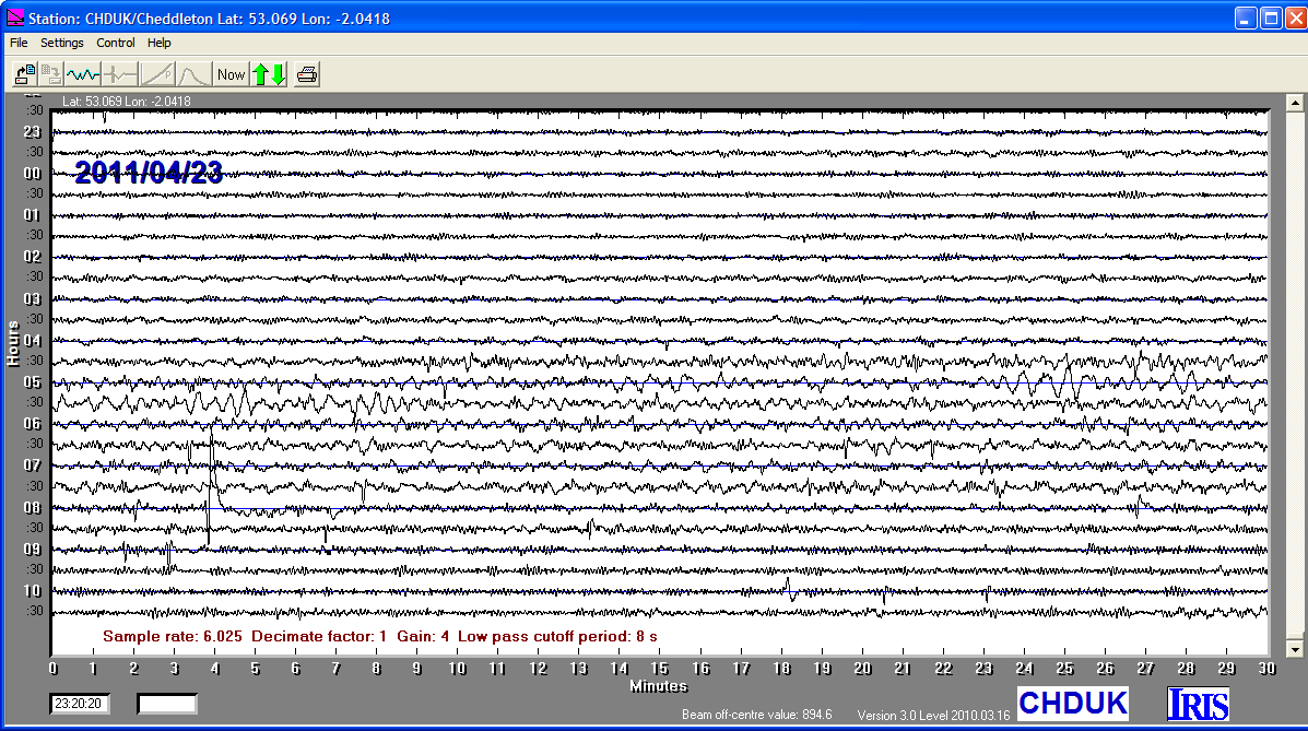
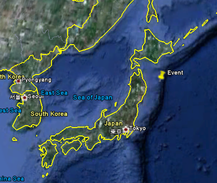
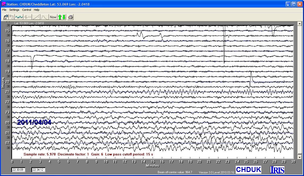
23/04/2011
|
04:16:55
|
6.9
|
81.6
|
Bougainville-Solomon Islands Region
|
-10.350000°S
|
161.230000°E
|
|||||||
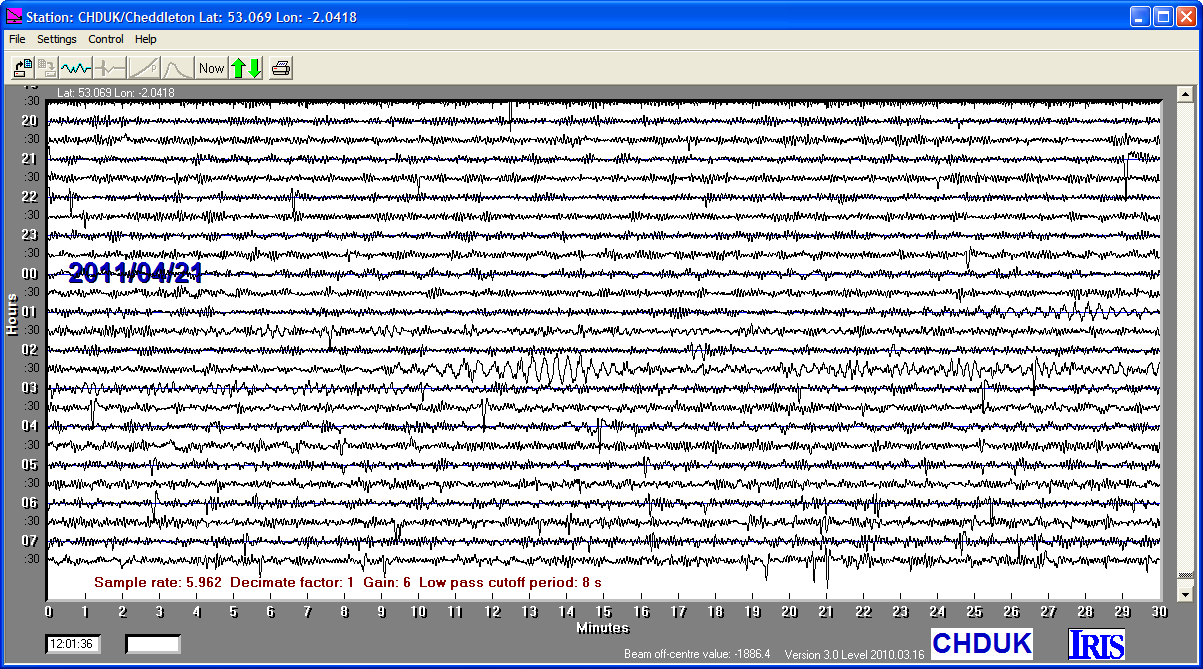
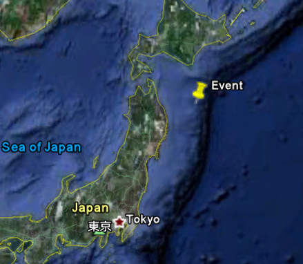
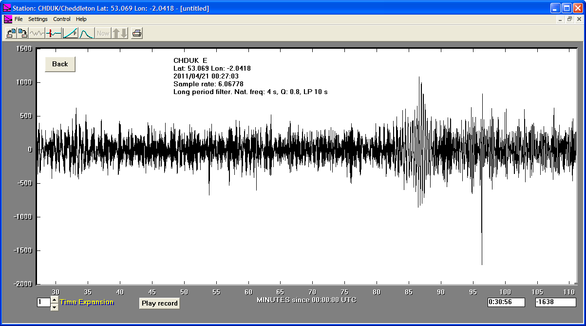
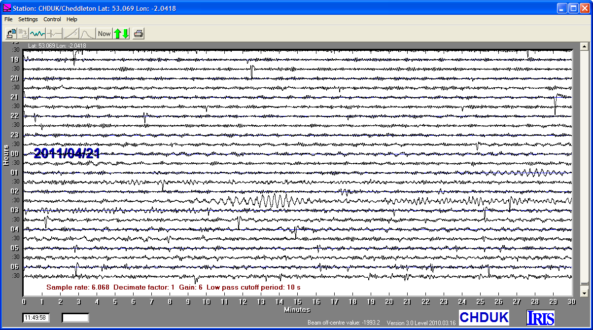
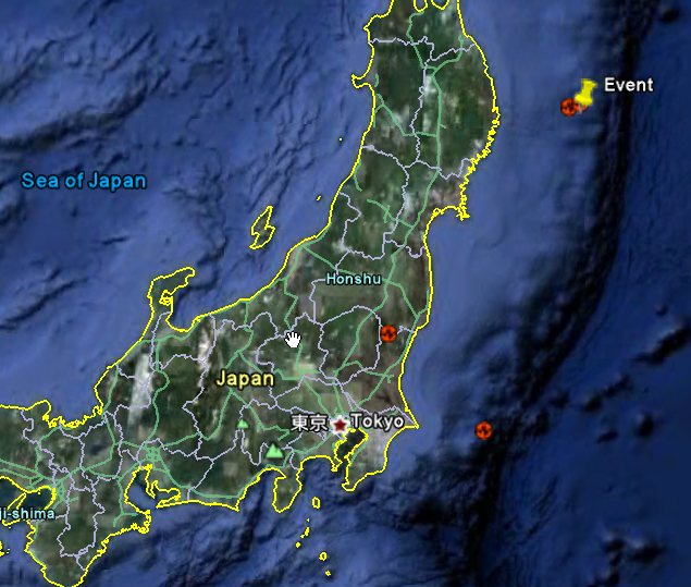
21/04/2011
|
01:54:41
|
6.0
|
7.0
|
Off East Coast of Honshu, Japan
|
40.310000°N
|
143.630000°E
|
|||||||
21/04/2011
|
00:39:04
|
5.8
|
15.0
|
Off East Coast of Honshu, Japan
|
40.500000°N
|
143.480000°E
|
|||||||
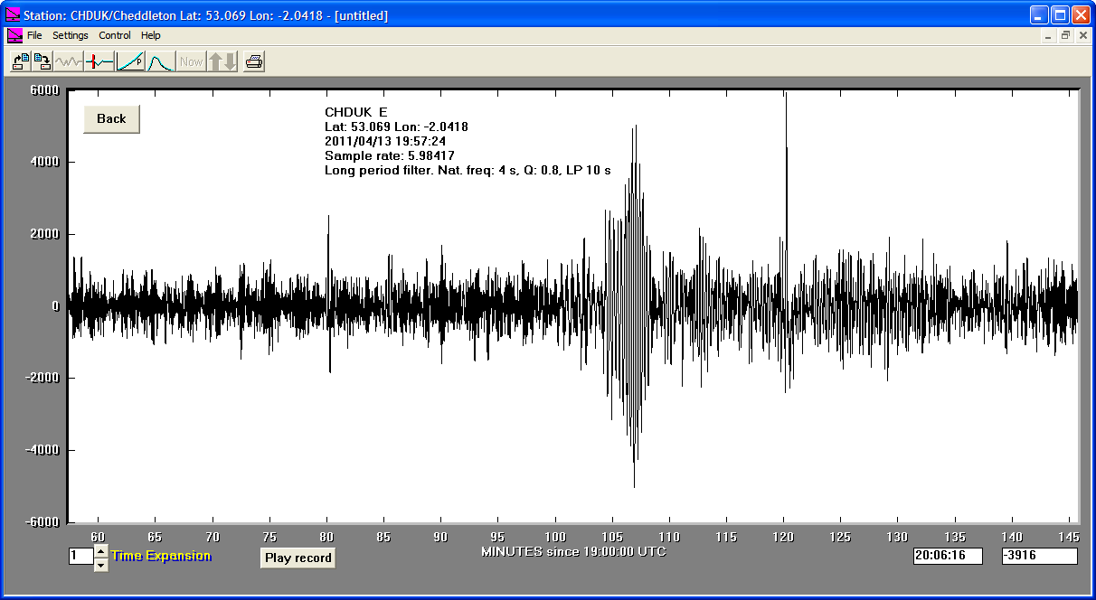
13/04/2011
|
19:57:23
|
6.1
|
11.2
|
Off East Coast of Honshu, Japan
|
39.590000°N
|
143.360000°E
|
|||||||
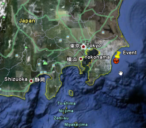
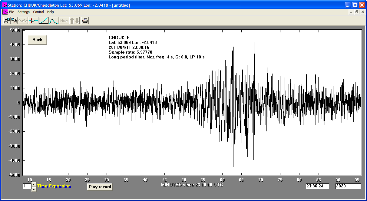
11/04/2011
|
23:08:16
|
6.2
|
13.1
|
Near East Coast of Eastern Honshu, Japan
|
35.410000°N
|
140.540000°E
|
|||||||
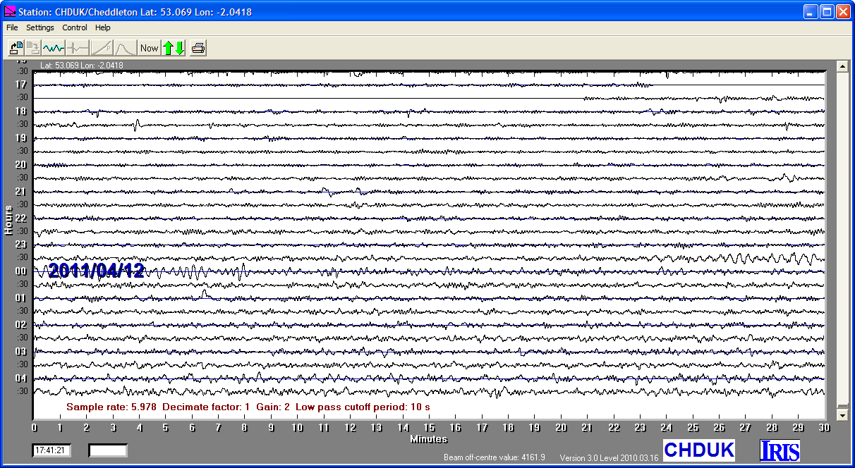
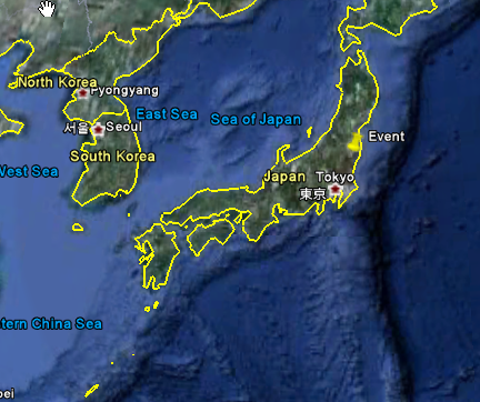
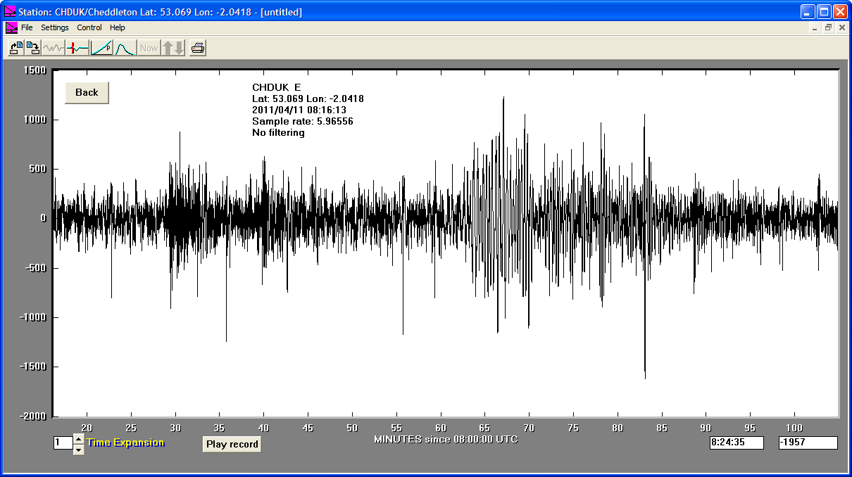
11/04/2011
|
08:16:13
|
6.6
|
10.0
|
Eastern Honshu, Japan
|
37.010000°N
|
140.480000°E
|
|||||||
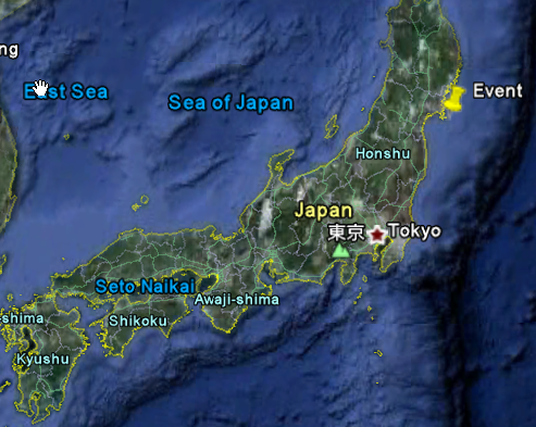
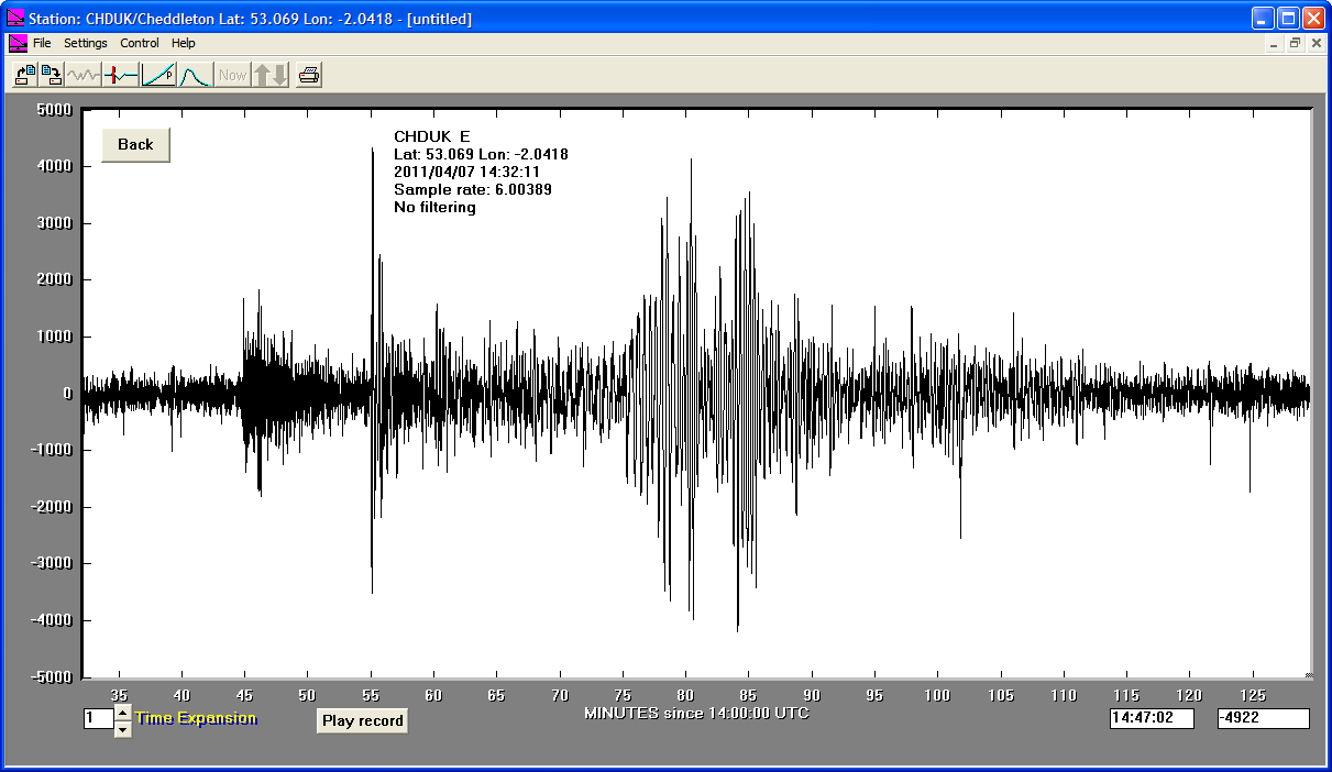
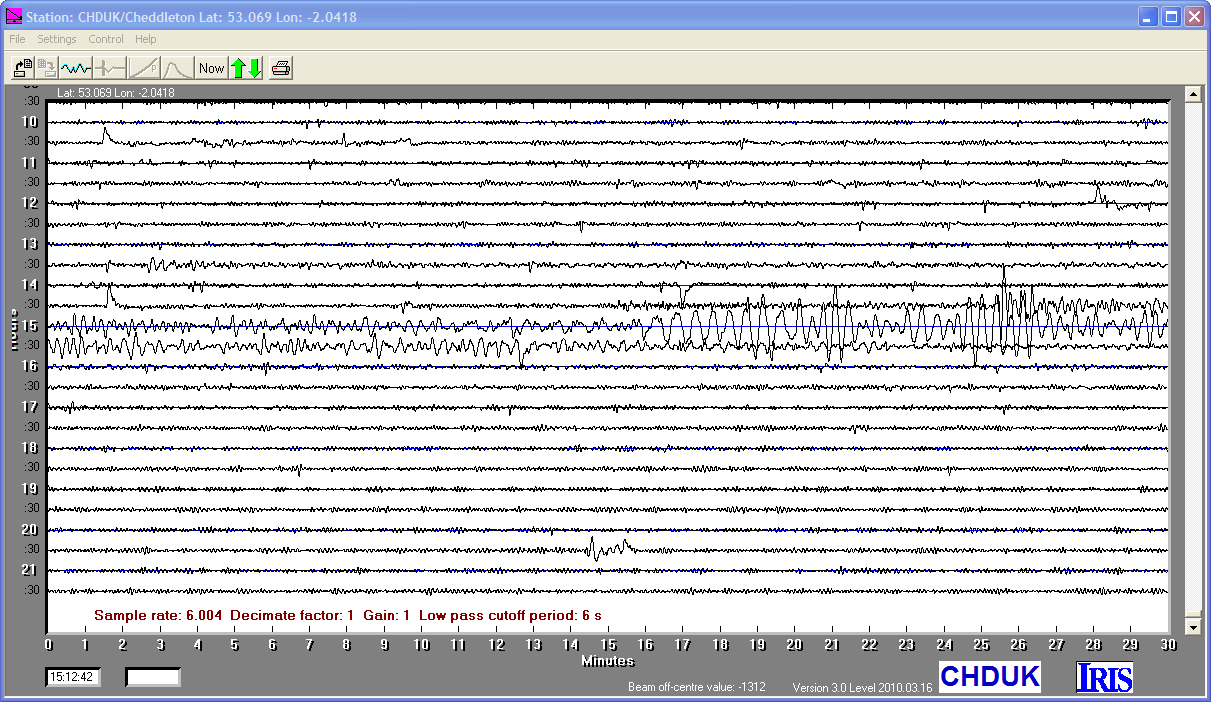
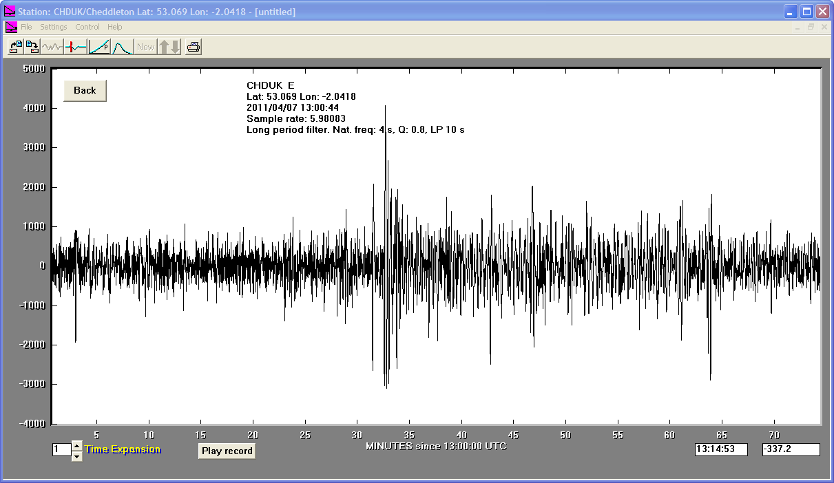
07/04/2011
|
14:32:41
|
7.1
|
49.0
|
Near East Coast of Eastern Honshu, Japan
|
38.250000°N
|
141.640000°E
|
|||||||
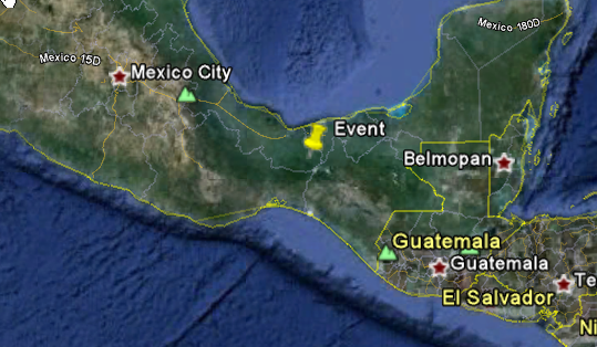
07/04/2011
|
13:11:24
|
6.5
|
167.4
|
Chiapas, Mexico
|
17.430000°N
|
-93.980000°W
|
|||||||
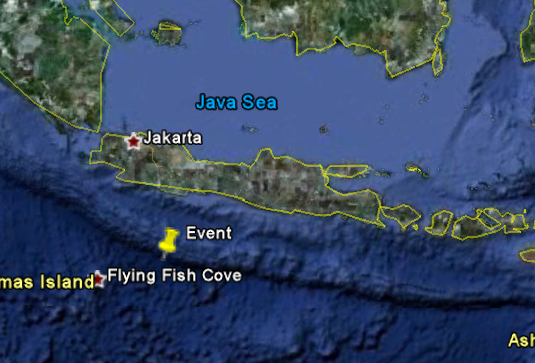
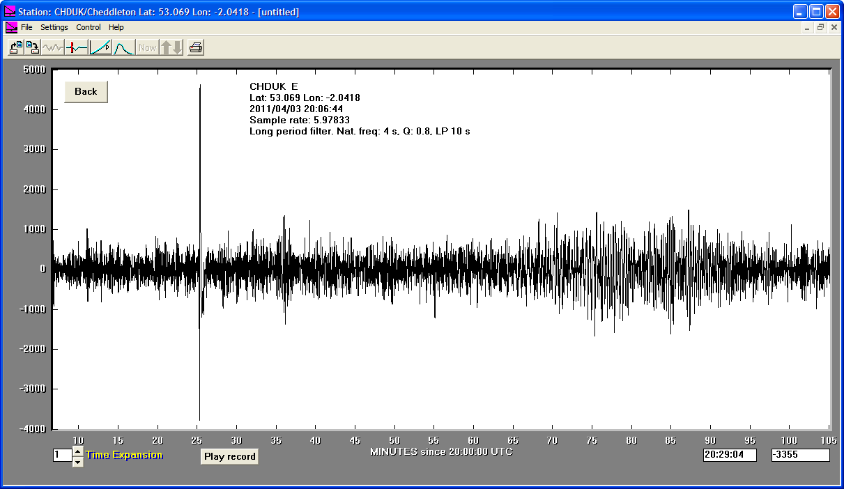
03/04/2011
|
20:06:42
|
6.7
|
24.0
|
South of Jawa, Indonesia
|
-9.790000°S
|
107.750000°E
|
|||||||
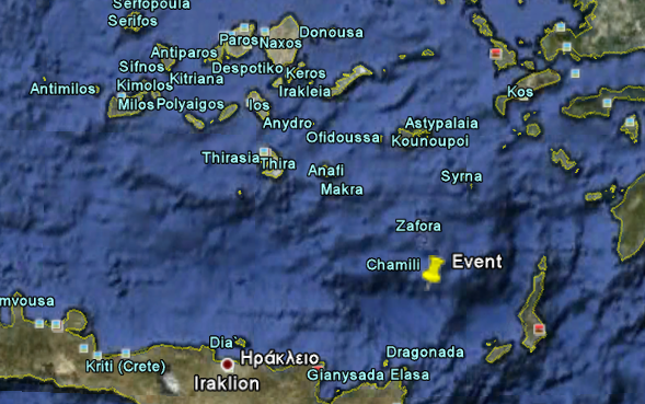
01/04/2011
|
13:29:12
|
5.9
|
77.9
|
Crete, Greece
|
35.730000°N
|
26.450000°E
|
|||||||
30/03/2011
|
05:29:55
|
6.0
|
30.3
|
Off East Coast of Honshu, Japan
|
36.130000°N
|
142.430000°E
|
|||||||
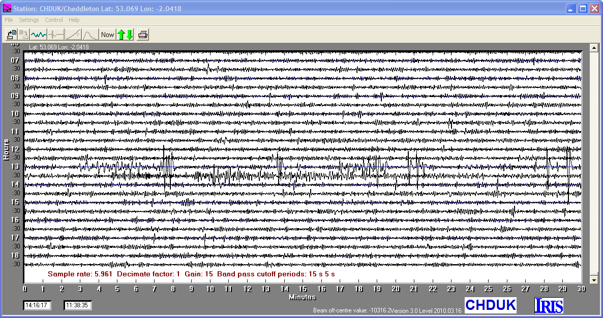
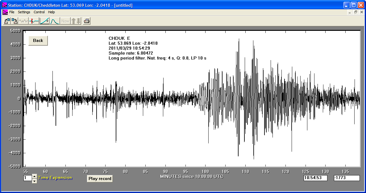
29/03/2011
|
10:54:33
|
6.1
|
13.8
|
Off East Coast of Honshu, Japan
|
37.420000°N
|
142.270000°E
|
|||||||
27/03/2011
|
22:23:58
|
6.1
|
17.1
|
Near East Coast of Eastern Honshu, Japan
|
38.400000°N
|
142.100000°E
|
|||||||
25/03/2011
|
11:36:24
|
6.4
|
39.2
|
Near East Coast of Eastern Honshu, Japan
|
38.760000°N
|
141.940000°E
|
|||||||
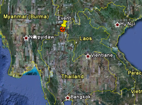
24/03/2011
|
13:55:12
|
6.8
|
10.0
|
Myanmar
|
20.700000°N
|
99.950000°E
|
|||||||
22/03/2011
|
09:44:29
|
6.6
|
15.5
|
Off East Coast of Honshu, Japan
|
39.860000°N
|
143.440000°E
|
|||||||
22/03/2011
|
07:18:47
|
6.6
|
26.5
|
Off East Coast of Honshu, Japan
|
37.250000°N
|
143.960000°E
|
|||||||
16/03/2011
|
04:14:32
|
5.3
|
24.7
|
Near East Coast of Eastern Honshu, Japan
|
37.560000°N
|
141.410000°E
|
|||||||
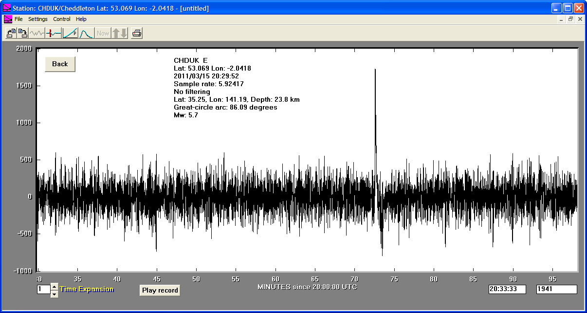
15/03/2011
|
20:30:00
|
5.7
|
23.8
|
Near East Coast of Eastern Honshu, Japan
|
35.250000°N
|
141.190000°E
|
|||||||
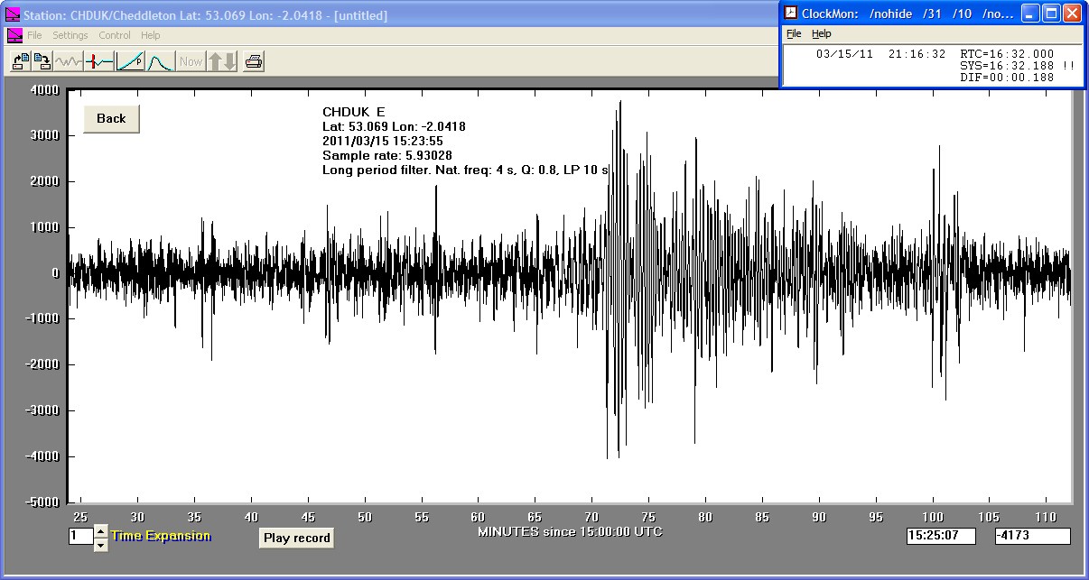
15/03/2011
|
15:23:54
|
6.1
|
19.4
|
Off East Coast of Honshu, Japan
|
40.330000°N
|
143.270000°E
|
|||||||
15/03/2011
|
13:31:46
|
6.2
|
10.0
|
Eastern Honshu, Japan
|
35.300000°N
|
138.700000°E
|
|||||||
15/03/2011
|
09:49:54
|
6.0
|
15.3
|
Off East Coast of Honshu, Japan
|
37.350000°N
|
142.410000°E
|
|||||||
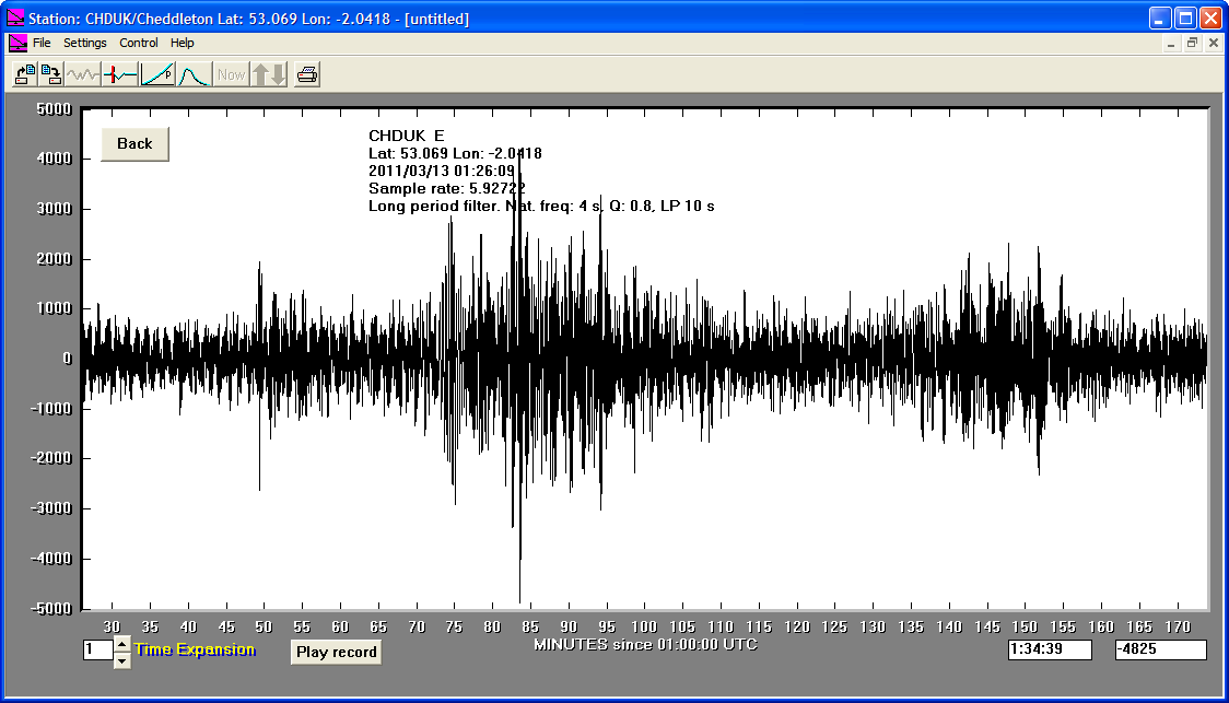
13/03/2011
|
01:26:07
|
6.2
|
24.5
|
Near East Coast of Eastern Honshu, Japan
|
35.740000°N
|
141.730000°E
|
|||||||
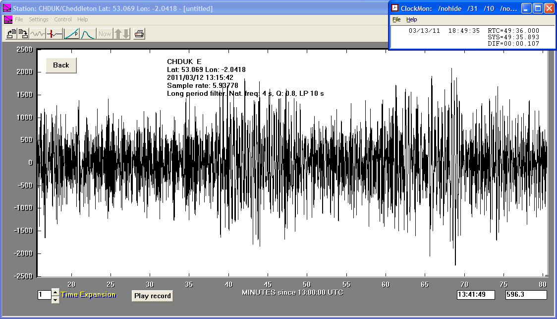
12/03/2011
|
13:15:44
|
6.4
|
38.0
|
Near East Coast of Eastern Honshu, Japan
|
35.800000°N
|
141.000000°E
|
|||||||
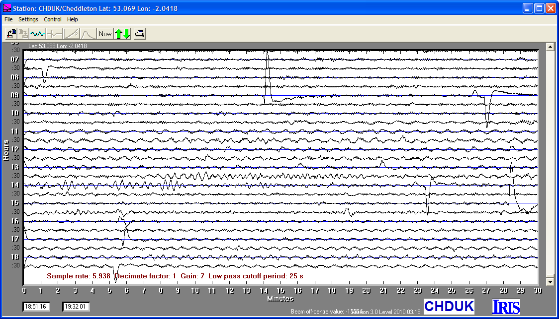
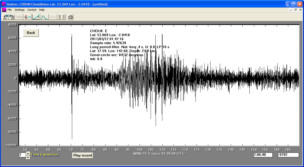
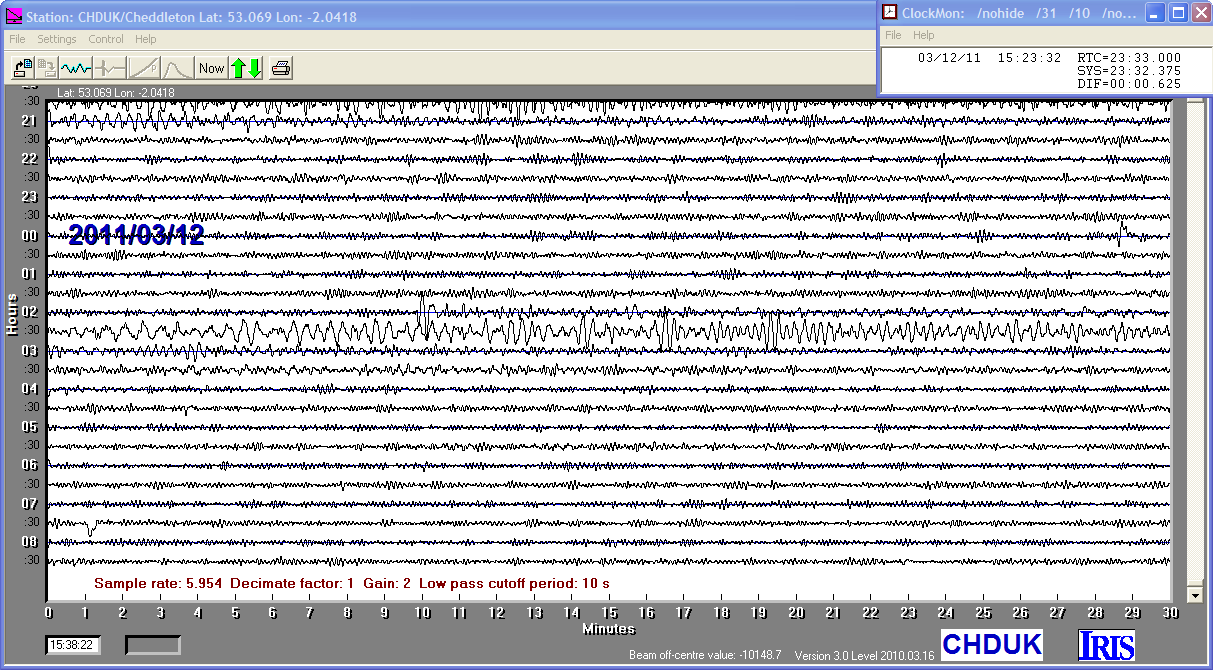
12/03/2011
|
01:47:16
|
6.8
|
24.8
|
Off East Coast of Honshu, Japan
|
37.590000°N
|
142.680000°E
|
|||||||
11/03/2011
|
19:24:28
|
5.5
|
24.9
|
Near East Coast of Eastern Honshu, Japan
|
35.770000°N
|
140.640000°E
|
|||||||
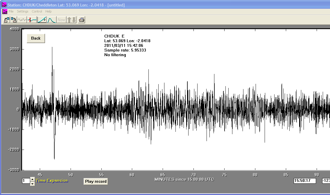
11/03/2011
|
15:42:05
|
5.4
|
15.8
|
Near East Coast of Eastern Honshu, Japan
|
36.070000°N
|
141.520000°E
|
|||||||
11/03/2011
|
11:44:28
|
5.8
|
31.0
|
Off East Coast of Honshu, Japan
|
36.710000°N
|
142.230000°E
|
|||||||
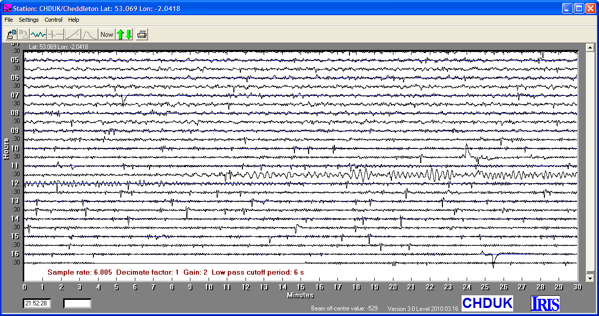
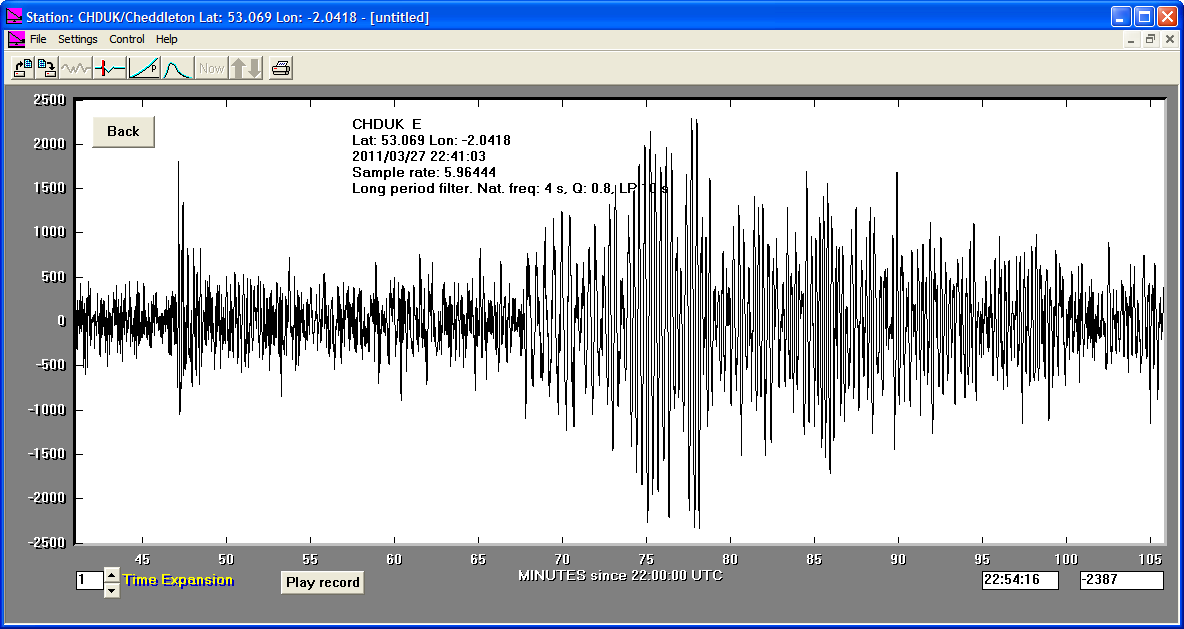
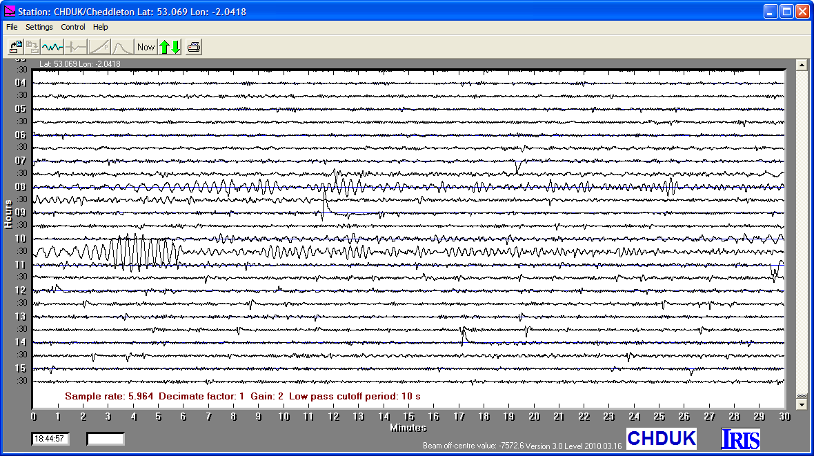
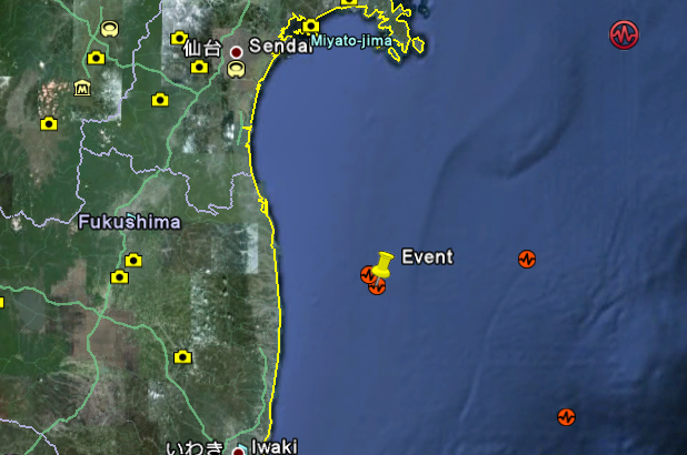
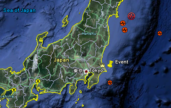
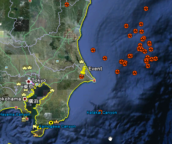
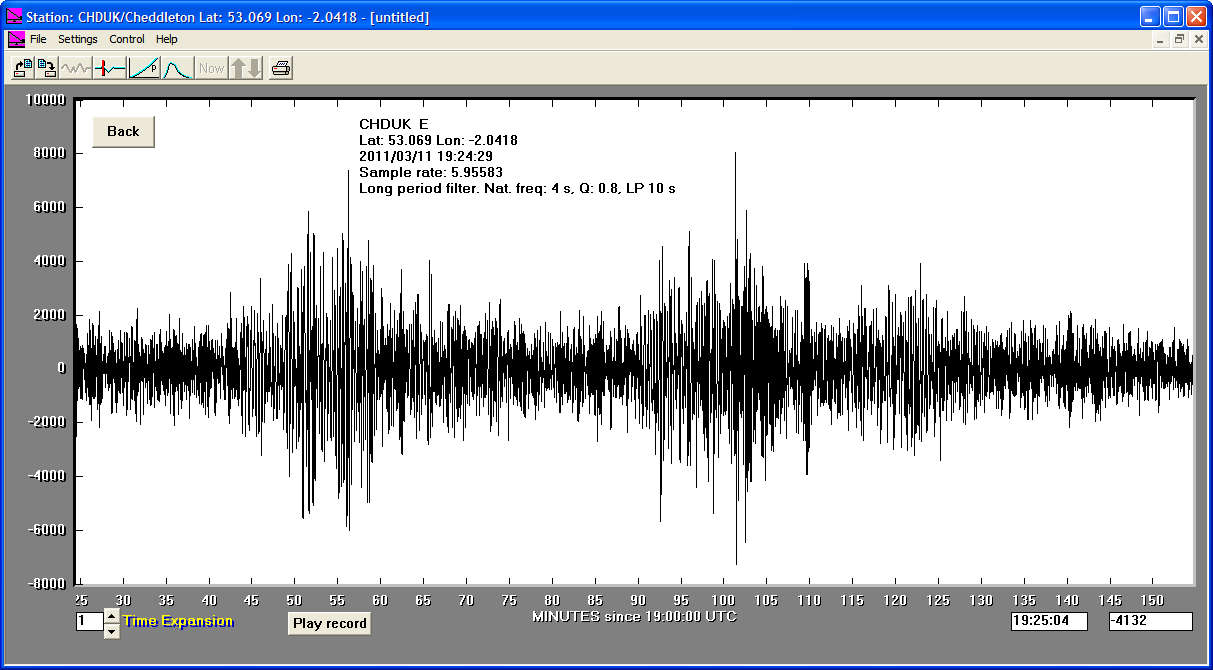
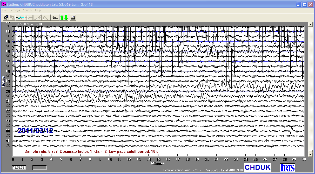
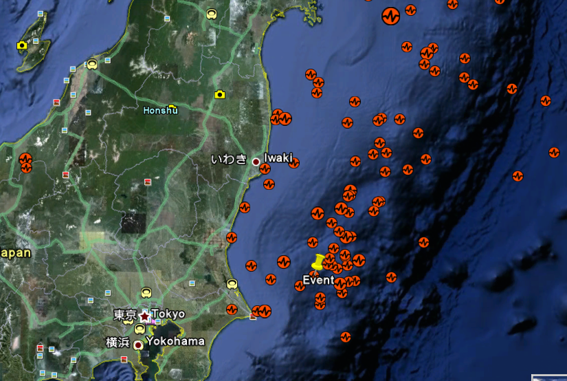
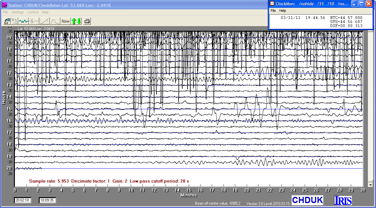
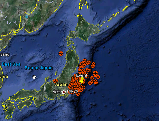
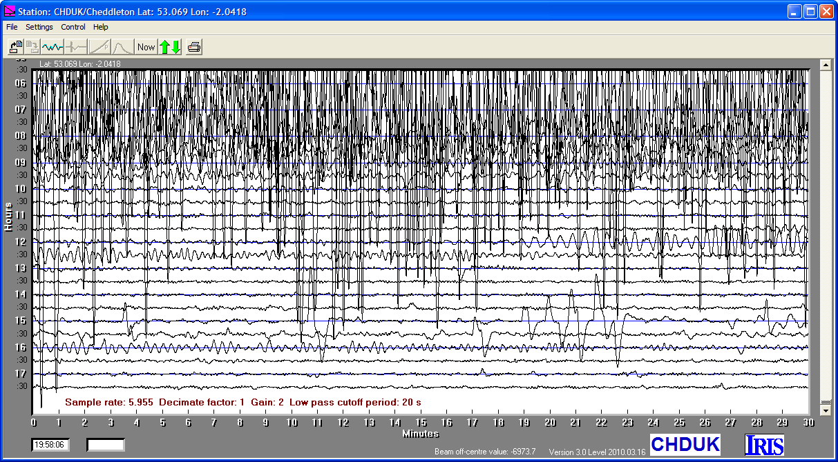
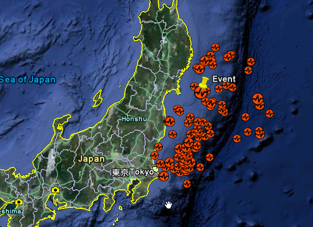
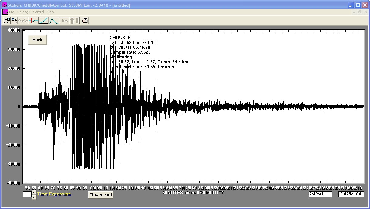
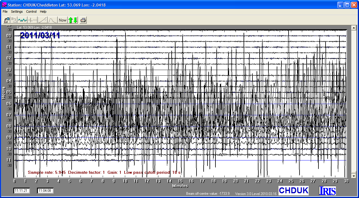
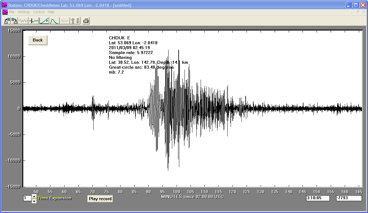
11/03/2011
|
05:46:23
|
9.0
|
24.4
|
Near East Coast of Eastern Honshu, Japan
|
38.320000°N
|
142.370000°E
|
|||||||
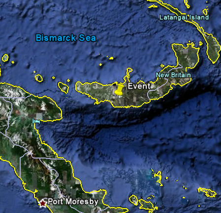
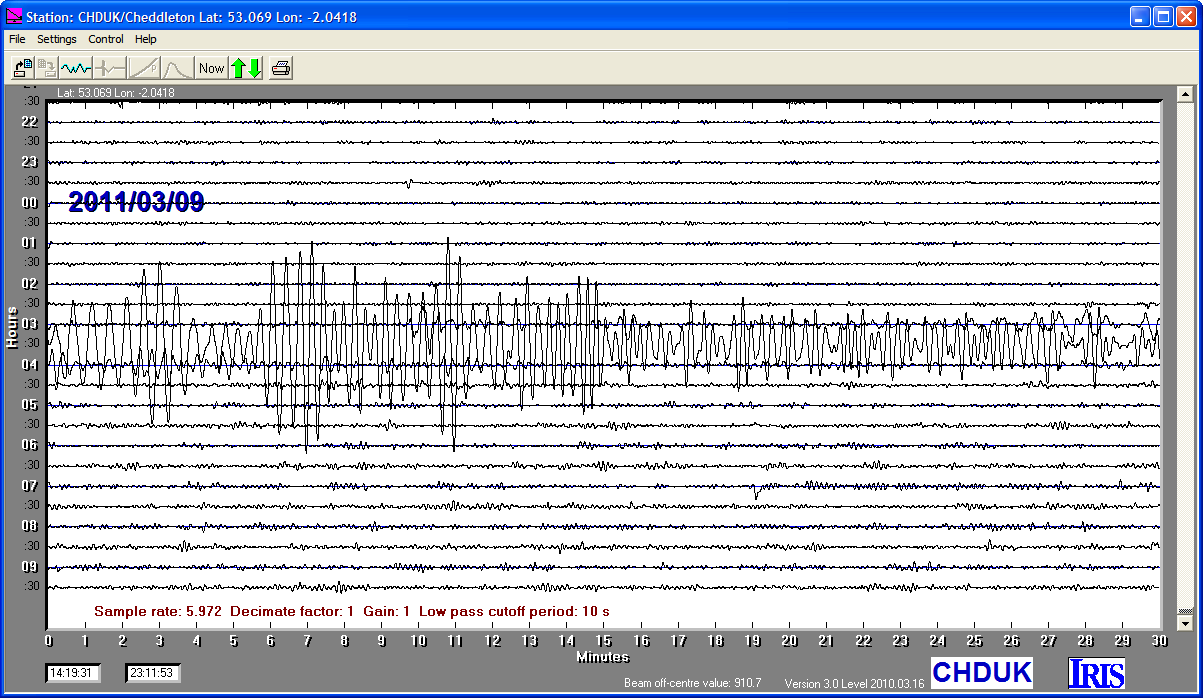
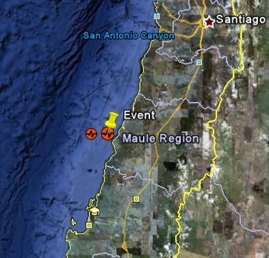
09/03/2011
|
21:24:51
|
6.5
|
29.0
|
New Britain, Papua New Guinea Region
|
-6.020000°S
|
149.660000°E
|
|||||||
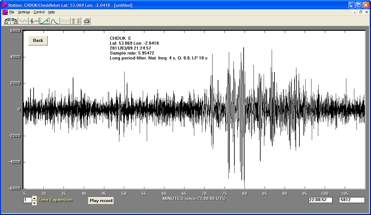
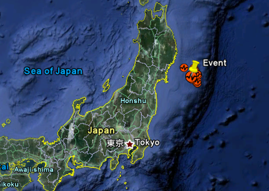
09/03/2011
|
02:45:18
|
7.2
|
14.1
|
Near East Coast of Eastern Honshu, Japan
|
38.520000°N
|
142.790000°E
|
|||||||
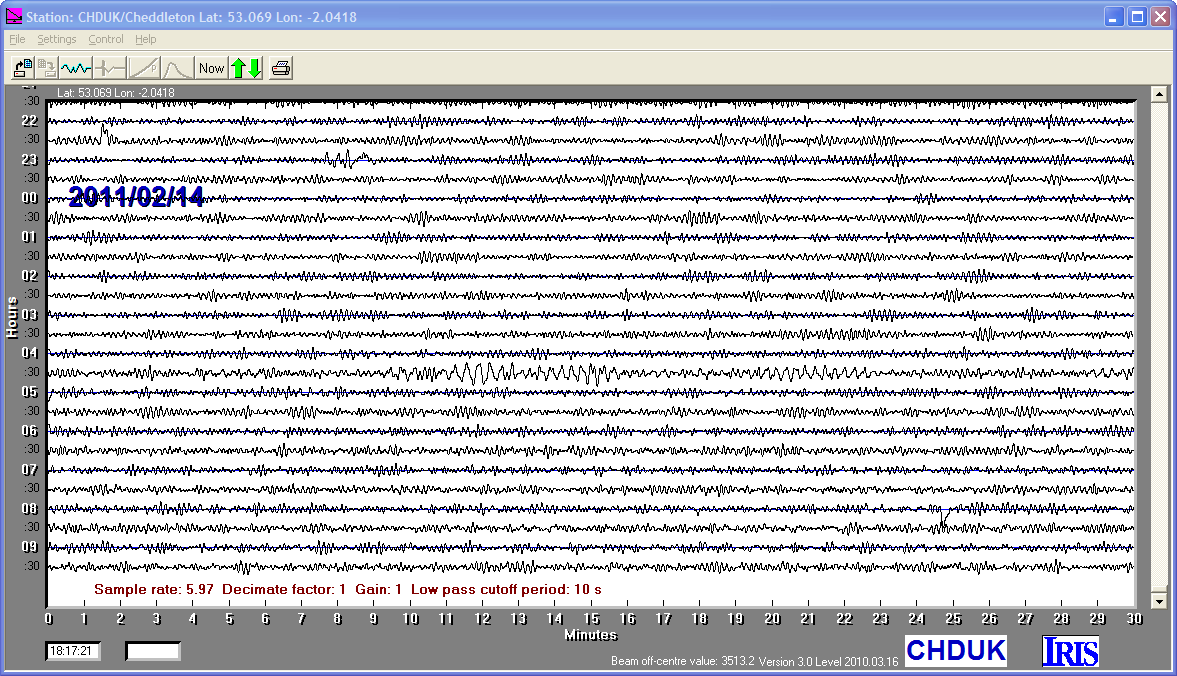
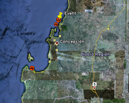
14/02/2011
|
03:40:10
|
6.6
|
25.4
|
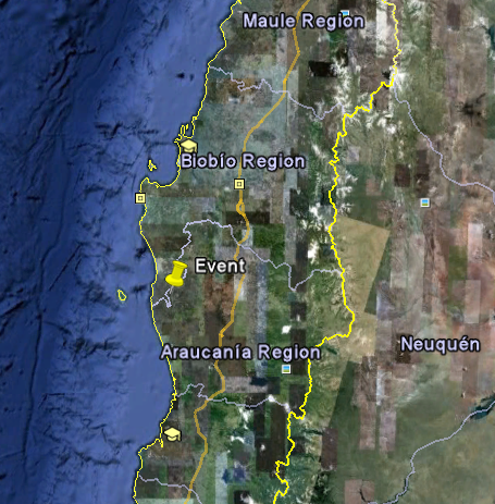
Near Coast of Central Chile
|
-35.430000°S
|
-72.740000°W
|
|||||||
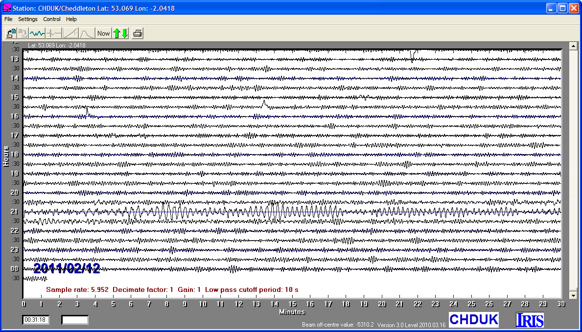
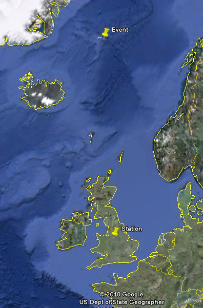
11/02/2011
|
20:05:31
|
6.8
|
28.0
|
Near Coast of Central Chile
|
-36.480000°S
|
-73.000000°W
|
|||||||
29/01/2011
|
06:55:26
|
6.1
|
9.5
|
Jan Mayen Island Region
|
70.960000°N
|
-6.780000°W
|
|||||||
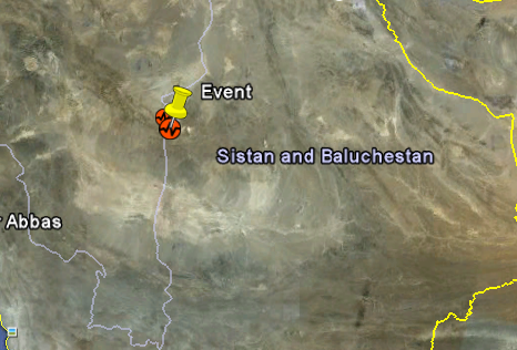
27/01/2011
|
08:38:28
|
6.0
|
10.7
|
Southern Iran
|
28.190000°N
|
58.970000°E
|
|||||||
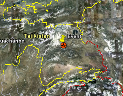
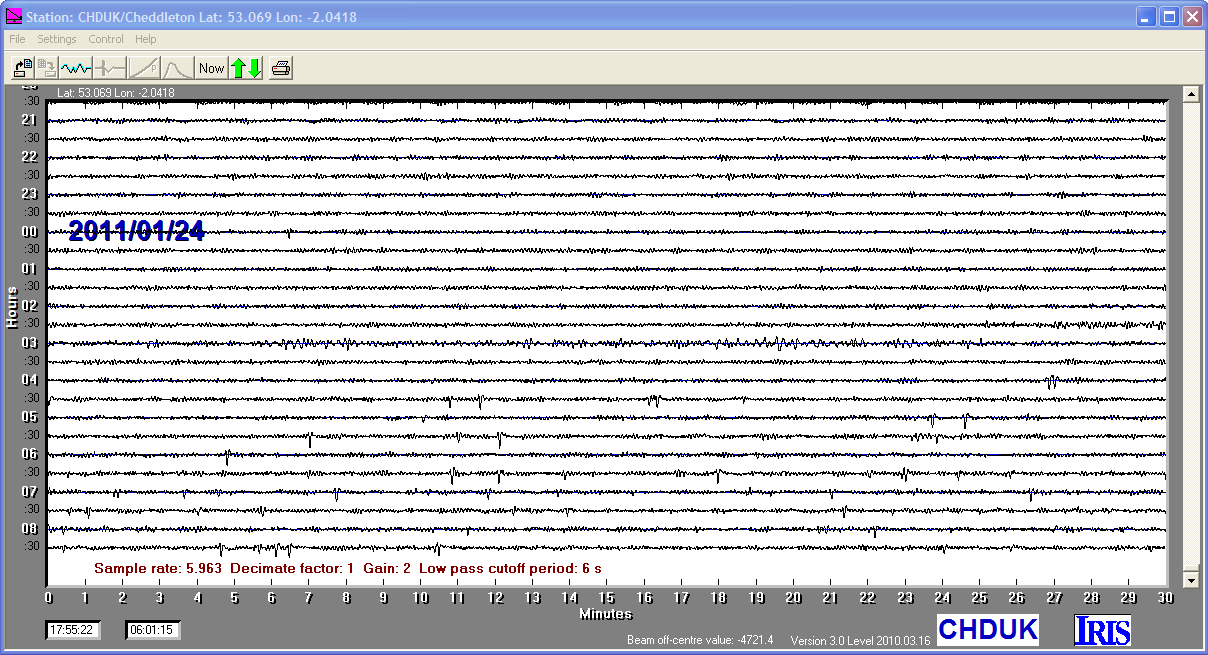
24/01/2011
|
02:45:28
|
6.1
|
86.0
|
Tajikistan
|
38.500000°N
|
72.600000°E
|
|||||||
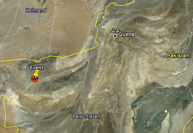
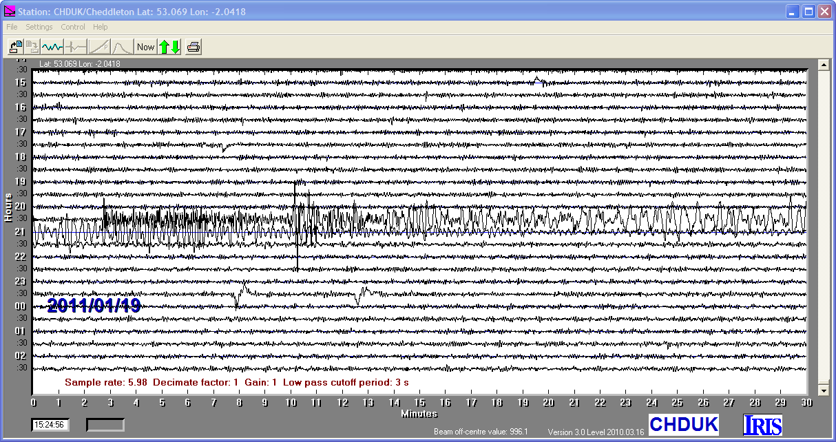
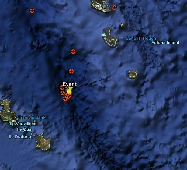
18/01/2011
|
20:23:26
|
7.2
|
84.0
|
Southwestern Pakistan
|
28.840000°N
|
63.950000°E
|
|||||||
13/01/2011
|
16:16:41
|
7.0
|
5.9
|
Loyalty Islands
|
-20.620000°S
|
168.490000°E
|
|||||||
02/01/2011
|
20:20:16
|
7.1
|
16.9
|
Near Coast of Central Chile
|
-38.360000°S
|
-73.280000°W
|

Welcome to Weather-Above
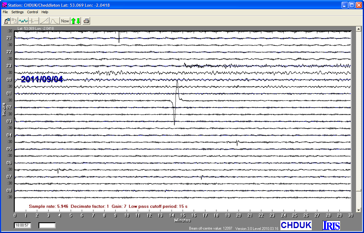
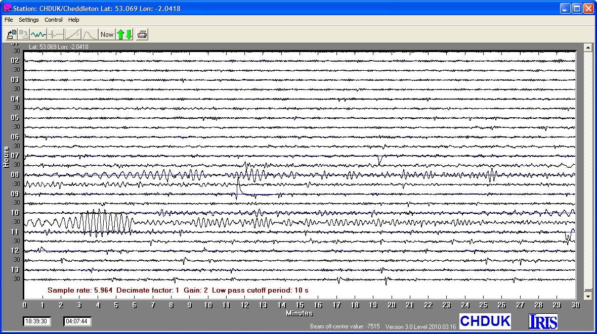
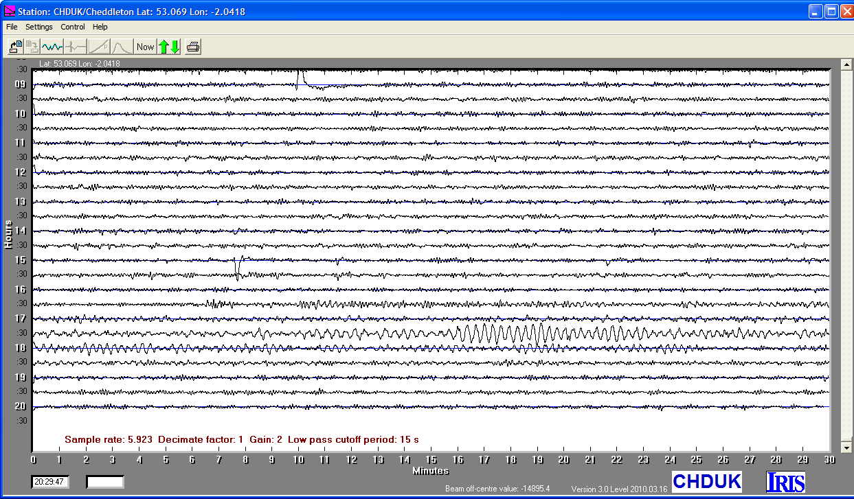
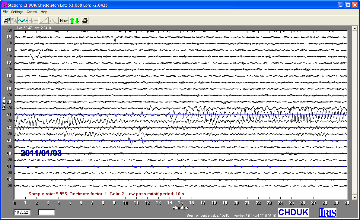
Cheddleton Station Earthquake LOG 2011


